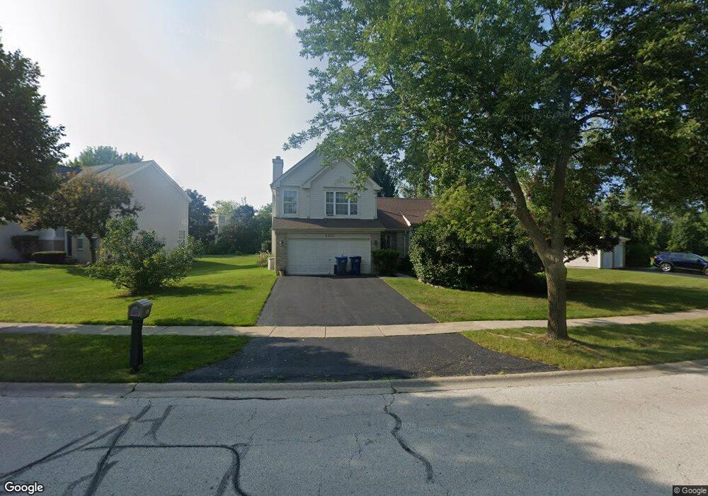
6350 Crossland Blvd Gurnee, IL 60031
Estimated Value: $419,000 - $445,000
3
Beds
3
Baths
2,009
Sq Ft
$214/Sq Ft
Est. Value
About This Home
This home is located at 6350 Crossland Blvd, Gurnee, IL 60031 and is currently estimated at $429,401, approximately $213 per square foot. 6350 Crossland Blvd is a home located in Lake County with nearby schools including Woodland Primary School, Woodland Elementary School, and Woodland Intermediate School.
Ownership History
Date
Name
Owned For
Owner Type
Purchase Details
Closed on
Feb 6, 1995
Sold by
Northern Tr Bank Lake Forest Natl Assn
Bought by
Moran Joseph and Moran Helen
Current Estimated Value
Home Financials for this Owner
Home Financials are based on the most recent Mortgage that was taken out on this home.
Original Mortgage
$108,875
Interest Rate
8.75%
Create a Home Valuation Report for This Property
The Home Valuation Report is an in-depth analysis detailing your home's value as well as a comparison with similar homes in the area
Home Values in the Area
Average Home Value in this Area
Purchase History
| Date | Buyer | Sale Price | Title Company |
|---|---|---|---|
| Moran Joseph | $212,000 | Chicago Title Insurance Co |
Source: Public Records
Mortgage History
| Date | Status | Borrower | Loan Amount |
|---|---|---|---|
| Closed | Moran Joseph | $108,875 |
Source: Public Records
Tax History Compared to Growth
Tax History
| Year | Tax Paid | Tax Assessment Tax Assessment Total Assessment is a certain percentage of the fair market value that is determined by local assessors to be the total taxable value of land and additions on the property. | Land | Improvement |
|---|---|---|---|---|
| 2024 | $8,601 | $119,422 | $17,676 | $101,746 |
| 2023 | $8,601 | $103,524 | $15,323 | $88,201 |
| 2022 | $7,648 | $97,102 | $15,328 | $81,774 |
| 2021 | $7,218 | $93,206 | $14,713 | $78,493 |
| 2020 | $7,171 | $90,915 | $14,351 | $76,564 |
| 2019 | $7,087 | $88,275 | $13,934 | $74,341 |
| 2018 | $7,190 | $90,564 | $17,176 | $73,388 |
| 2017 | $7,105 | $87,969 | $16,684 | $71,285 |
| 2016 | $7,022 | $84,052 | $15,941 | $68,111 |
| 2015 | $6,807 | $79,716 | $15,119 | $64,597 |
| 2014 | $6,801 | $80,102 | $14,931 | $65,171 |
| 2012 | $6,756 | $80,715 | $15,045 | $65,670 |
Source: Public Records
Map
Nearby Homes
- 6141 Crossland Blvd
- 920 Vose Dr Unit 304
- 920 Vose Dr Unit 106
- 920 Vose Dr Unit 105
- 914 Vose Dr
- 917 Vose Dr Unit 304
- 6121 Brookstone Place
- 776 Chandler Rd
- 32956 N Ashley Dr
- 6359 Doral Dr
- 6296 Doral Dr
- 741 Colby Ct Unit U42
- 690 Chandler Rd Unit 102
- 690 Chandler Rd Unit 207
- 690 Chandler Rd Unit 305
- 17474 W Hickory Ln
- 650 Whitney Ct Unit 108
- 650 Whitney Ct Unit 203
- 17119 W Prairieview Ln
- 6191 Oakmont Ln
- 6328 Crossland Blvd
- 6364 Crossland Blvd
- 6367 Andover Dr
- 6372 Crossland Blvd
- 6359 Andover Dr
- 6357 Crossland Blvd
- 6375 Andover Dr
- 6349 Braxton Ct
- 6365 Crossland Blvd
- 6309 Braxton Ct
- 6380 Crossland Blvd
- 6373 Crossland Blvd
- 6341 Braxton Ct
- 6354 Andover Dr
- 6383 Andover Dr
- 6317 Braxton Ct
- 6301 Crossland Blvd
- 6381 Crossland Blvd
- 6325 Braxton Ct
- 6388 Crossland Blvd