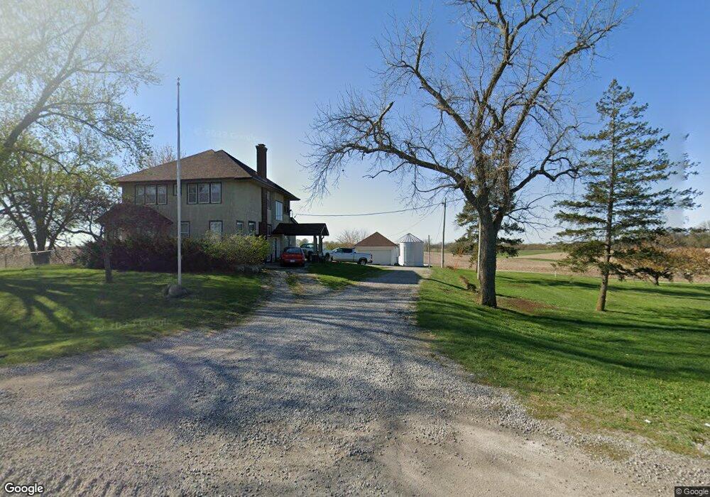
6353 Highway F48 W Newton, IA 50208
Estimated Value: $293,395 - $434,000
4
Beds
3
Baths
2,075
Sq Ft
$180/Sq Ft
Est. Value
About This Home
This home is located at 6353 Highway F48 W, Newton, IA 50208 and is currently estimated at $373,849, approximately $180 per square foot. 6353 Highway F48 W is a home located in Jasper County with nearby schools including Thomas Jefferson Elementary School, Woodrow Wilson Elementary School, and Berg Middle School.
Ownership History
Date
Name
Owned For
Owner Type
Purchase Details
Closed on
Jul 16, 2021
Sold by
Amended Betty E Snook and Revoc Restated
Bought by
Isely Anthony M and Isely Jenna Marie
Current Estimated Value
Purchase Details
Closed on
Dec 5, 2008
Sold by
Pierce Carmen and Pierce Michael Todd
Bought by
Pierce Michael Todd and Pierce Carmen
Create a Home Valuation Report for This Property
The Home Valuation Report is an in-depth analysis detailing your home's value as well as a comparison with similar homes in the area
Home Values in the Area
Average Home Value in this Area
Purchase History
| Date | Buyer | Sale Price | Title Company |
|---|---|---|---|
| Isely Anthony M | $180,000 | None Listed On Document | |
| Pierce Michael Todd | -- | None Available |
Source: Public Records
Tax History Compared to Growth
Tax History
| Year | Tax Paid | Tax Assessment Tax Assessment Total Assessment is a certain percentage of the fair market value that is determined by local assessors to be the total taxable value of land and additions on the property. | Land | Improvement |
|---|---|---|---|---|
| 2025 | $3,070 | $275,290 | $53,000 | $222,290 |
| 2024 | $3,070 | $246,220 | $37,190 | $209,030 |
| 2023 | $2,974 | $246,220 | $37,190 | $209,030 |
| 2022 | $2,542 | $193,060 | $37,190 | $155,870 |
| 2021 | $2,720 | $180,630 | $37,190 | $143,440 |
| 2020 | $2,720 | $183,270 | $28,520 | $154,750 |
| 2019 | $2,476 | $157,080 | $0 | $0 |
| 2018 | $2,476 | $157,080 | $0 | $0 |
| 2017 | $2,482 | $157,080 | $0 | $0 |
| 2016 | $2,482 | $157,080 | $0 | $0 |
| 2015 | $2,416 | $157,080 | $0 | $0 |
| 2014 | $2,368 | $157,080 | $0 | $0 |
Source: Public Records
Map
Nearby Homes
- 6911 Highway F48 W
- 3390 W 62nd St S
- 3205 W 66th St S
- 2214 Highway F48 W
- 3729 W 56th St N
- 299 Hickory St
- 1149 W 28th St S
- 860 W 28th St S
- TBD W 28th St S
- 1650 W 28th St N
- 124 Emerson Hough Dr
- 6911-10 Highway F 48 W
- 913 W 18th St S
- 5323 Highway F36 W
- 1401 W 16th St S Unit 2
- 1506 W 17th St S
- 606 W 16th St N
- 1431 Cardinal Ridge Dr
- 1503 S 16th Ave W
- 4848 W 48th St N
- 0 Highway F48 W
- 6431 Highway F48 W
- 6446 Highway F48 W
- 6446 Highway F48 W
- 429 W 62nd St S
- 387 W 62nd St S
- 514 W 62nd St S
- 6168 Highway F48 W
- 6613 Highway F48 W
- 6707 Highway F48 W
- 6707 Highway F 48 W
- 6014 Highway F48 W
- 5957 Highway F48 W
- 229 W 62nd St N
- 1223 W 62nd St S
- 1252 W 62nd St S
- 555 W 68th St S
- 6828 Highway F48 W
- 1212 W 62nd St S
- 1305 W 62nd St S