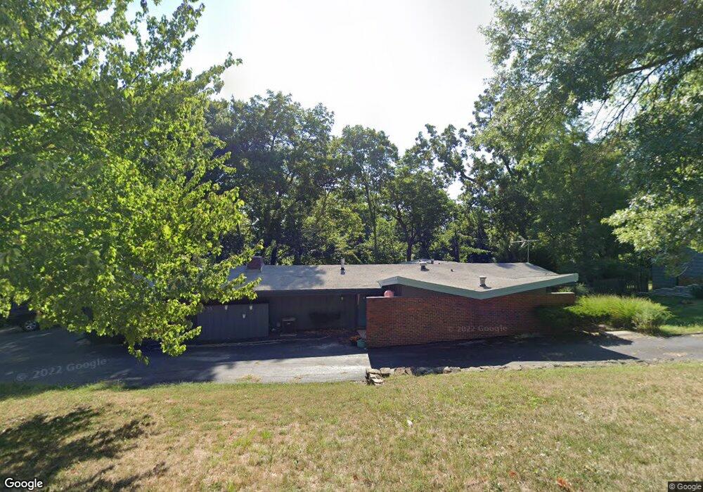
6355 Robinhood Ln Shawnee, KS 66203
Estimated Value: $371,000 - $396,259
3
Beds
2
Baths
2,160
Sq Ft
$178/Sq Ft
Est. Value
About This Home
This home is located at 6355 Robinhood Ln, Shawnee, KS 66203 and is currently estimated at $385,315, approximately $178 per square foot. 6355 Robinhood Ln is a home located in Johnson County with nearby schools including Merriam Park Elementary School, Hocker Grove Middle School, and Shawnee Mission North High School.
Ownership History
Date
Name
Owned For
Owner Type
Purchase Details
Closed on
Mar 24, 2015
Sold by
Rohman Allan and Rohman Janis
Bought by
Rohman Janis I and Janis I Rohman Trust
Current Estimated Value
Purchase Details
Closed on
Feb 6, 2012
Sold by
Young Rodney Lee and Young David Michael
Bought by
Rohman Allan and Rohman Janis
Home Financials for this Owner
Home Financials are based on the most recent Mortgage that was taken out on this home.
Original Mortgage
$114,000
Outstanding Balance
$78,230
Interest Rate
4%
Mortgage Type
New Conventional
Estimated Equity
$307,085
Create a Home Valuation Report for This Property
The Home Valuation Report is an in-depth analysis detailing your home's value as well as a comparison with similar homes in the area
Home Values in the Area
Average Home Value in this Area
Purchase History
| Date | Buyer | Sale Price | Title Company |
|---|---|---|---|
| Rohman Janis I | -- | None Available | |
| Rohman Allan | -- | Kansas City Title Inc |
Source: Public Records
Mortgage History
| Date | Status | Borrower | Loan Amount |
|---|---|---|---|
| Open | Rohman Allan | $114,000 |
Source: Public Records
Tax History Compared to Growth
Tax History
| Year | Tax Paid | Tax Assessment Tax Assessment Total Assessment is a certain percentage of the fair market value that is determined by local assessors to be the total taxable value of land and additions on the property. | Land | Improvement |
|---|---|---|---|---|
| 2024 | $3,969 | $36,605 | $7,434 | $29,171 |
| 2023 | $3,290 | $31,016 | $7,434 | $23,582 |
| 2022 | $3,378 | $30,613 | $6,761 | $23,852 |
| 2021 | $3,378 | $27,623 | $5,868 | $21,755 |
| 2020 | $2,771 | $23,839 | $5,868 | $17,971 |
| 2019 | $2,773 | $23,839 | $5,107 | $18,732 |
| 2018 | $2,518 | $21,586 | $4,651 | $16,935 |
| 2017 | $2,462 | $20,700 | $4,651 | $16,049 |
| 2016 | $2,281 | $19,067 | $4,651 | $14,416 |
| 2015 | $2,123 | $17,883 | $4,651 | $13,232 |
| 2013 | -- | $17,446 | $4,651 | $12,795 |
Source: Public Records
Map
Nearby Homes
- 10120 W 65th St
- 5933 Knox Ave
- 6420 Ballentine St
- 10924 W 67th St
- 10235 W 70th St
- 6213 Terrydale St
- 10024 W 70th Terrace
- 6901 Grandview St
- 8510 W 61st St
- 6724 Mackey St
- 9906 Edelweiss Cir
- Ashwood Plan at Bristol Highlands - North
- The Fleetwood Plan at Bristol Highlands - The Villas
- Cypress II Plan at Bristol Highlands - North
- The Fleetwood Plan at Bristol Highlands - The Manors
- The Brentwood Plan at Bristol Highlands - The Villas
- Yorkshire V Plan at Bristol Highlands - North
- The Kirkwood Plan at Bristol Highlands - The Villas
- 8013 Payne St
- The Rockwood Plan at Bristol Highlands - The Villas
- 6355 Robin Hood Dr
- 6353 Robinhood Ln
- 6353 Robinhood Dr
- 6301 Robinhood Ln
- 6351 Robinhood Ln
- 6302 Robin Hood Dr
- 6302 Robinhood Ln
- 6349 Robinhood Ln
- 6349 Robin Hood Dr
- 6303 Robinhood Ln
- 6350 Robinhood Ln
- 6347 Robinhood Ln
- 6306 Robinhood Ln
- 6305 Robinhood Dr
- 6305 Robinhood Ln
- 6302 Sherwood Ln
- 6305 Sherwood Ln
- 6345 Robin Hood Dr
- 6345 Robinhood Dr
- 6310 Robin Hood Dr