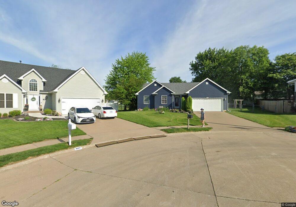
6358 High Point Ct Davenport, IA 52806
North Side NeighborhoodEstimated Value: $244,000 - $309,000
4
Beds
2
Baths
1,451
Sq Ft
$192/Sq Ft
Est. Value
About This Home
This home is located at 6358 High Point Ct, Davenport, IA 52806 and is currently estimated at $278,494, approximately $191 per square foot. 6358 High Point Ct is a home located in Scott County with nearby schools including Fillmore Elementary School, Wood Intermediate School, and North High School.
Ownership History
Date
Name
Owned For
Owner Type
Purchase Details
Closed on
Jun 16, 2010
Sold by
Kietzman Howard W and Kietzman Kimberly M
Bought by
Ross Adam D and Ross Brittany R
Current Estimated Value
Home Financials for this Owner
Home Financials are based on the most recent Mortgage that was taken out on this home.
Original Mortgage
$185,896
Outstanding Balance
$124,588
Interest Rate
4.97%
Mortgage Type
FHA
Estimated Equity
$153,906
Create a Home Valuation Report for This Property
The Home Valuation Report is an in-depth analysis detailing your home's value as well as a comparison with similar homes in the area
Home Values in the Area
Average Home Value in this Area
Purchase History
| Date | Buyer | Sale Price | Title Company |
|---|---|---|---|
| Ross Adam D | $188,500 | None Available |
Source: Public Records
Mortgage History
| Date | Status | Borrower | Loan Amount |
|---|---|---|---|
| Open | Ross Adam D | $185,896 |
Source: Public Records
Tax History Compared to Growth
Tax History
| Year | Tax Paid | Tax Assessment Tax Assessment Total Assessment is a certain percentage of the fair market value that is determined by local assessors to be the total taxable value of land and additions on the property. | Land | Improvement |
|---|---|---|---|---|
| 2025 | $4,300 | $284,760 | $38,940 | $245,820 |
| 2024 | $4,192 | $250,850 | $38,940 | $211,910 |
| 2023 | $5,240 | $250,850 | $38,940 | $211,910 |
| 2022 | $4,918 | $243,580 | $30,090 | $213,490 |
| 2021 | $4,918 | $238,110 | $30,090 | $208,020 |
| 2020 | $4,426 | $212,560 | $30,090 | $182,470 |
| 2019 | $4,374 | $203,440 | $30,090 | $173,350 |
| 2018 | $277 | $203,440 | $30,090 | $173,350 |
| 2017 | $1,132 | $203,440 | $30,090 | $173,350 |
| 2016 | $4,278 | $204,020 | $0 | $0 |
| 2015 | $4,278 | $193,550 | $0 | $0 |
| 2014 | $4,106 | $193,550 | $0 | $0 |
| 2013 | $4,030 | $0 | $0 | $0 |
| 2012 | -- | $188,420 | $30,480 | $157,940 |
Source: Public Records
Map
Nearby Homes
- 2822 High Point Dr
- 6354 High Point Ct
- 2521 W 63rd St
- 3101 Fieldcrest Dr
- 2714 W 66th St
- 2611 W 69th St
- 2434 W 59th St
- 5904 Hillandale Rd
- 5824 Hillandale Rd
- 5556 N Thornwood Ave
- 2203 W 59th St
- Lot 55 Franklin
- 000 W 73rd St
- 5406 Hillandale Rd
- 2008 W 70th St
- 7402 N Pine St
- Lot 65 W 66th St
- 2620 W 54th St
- 5335 Hillandale Rd
- 000 Pacific St
- 6357 High Point Ct
- 2913 W 65th St
- 2925 W 65th St
- 6351 High Point Ct
- 2905 W 65th St
- 2906 High Point Dr
- 6345 N Hazelwood Ave
- 2829 W 65th St
- 2832 High Point Dr
- 2914 High Point Dr
- 3011 W 65th St
- 6415 N Hazelwood Ave
- 6339 N Hazelwood Ave
- 2914 High Point Dr
- 6331 N Hazelwood Ave
- 6425 N Hazelwood Ave
- 2918 W 65th St
- 2816 High Point Dr
- 2924 W 65th St
- 2912 W 65th St