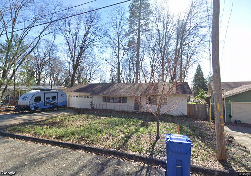
6358 Simonson Ct Magalia, CA 95954
Magalia NeighborhoodEstimated Value: $216,000 - $294,000
2
Beds
2
Baths
1,092
Sq Ft
$227/Sq Ft
Est. Value
About This Home
This home is located at 6358 Simonson Ct, Magalia, CA 95954 and is currently estimated at $248,207, approximately $227 per square foot. 6358 Simonson Ct is a home located in Butte County with nearby schools including Pine Ridge, Paradise Senior High School, and Children's Community Charter School.
Ownership History
Date
Name
Owned For
Owner Type
Purchase Details
Closed on
Aug 5, 2020
Sold by
Forsyth Blackmon Nola F
Bought by
Ashton Michael Forsyth
Current Estimated Value
Purchase Details
Closed on
Oct 22, 2003
Sold by
Blackmon Paul D
Bought by
Forsyth Blackmon Nola F
Purchase Details
Closed on
Sep 27, 2001
Sold by
Collins Armand J
Bought by
Blackmon Paul D and Forsyth Blackmon Nola F
Home Financials for this Owner
Home Financials are based on the most recent Mortgage that was taken out on this home.
Original Mortgage
$77,000
Interest Rate
6.9%
Mortgage Type
Stand Alone First
Create a Home Valuation Report for This Property
The Home Valuation Report is an in-depth analysis detailing your home's value as well as a comparison with similar homes in the area
Home Values in the Area
Average Home Value in this Area
Purchase History
| Date | Buyer | Sale Price | Title Company |
|---|---|---|---|
| Ashton Michael Forsyth | -- | None Available | |
| Forsyth Blackmon Nola F | -- | -- | |
| Blackmon Paul D | $115,000 | Fidelity National Title Co |
Source: Public Records
Mortgage History
| Date | Status | Borrower | Loan Amount |
|---|---|---|---|
| Previous Owner | Blackmon Paul D | $77,000 |
Source: Public Records
Tax History
| Year | Tax Paid | Tax Assessment Tax Assessment Total Assessment is a certain percentage of the fair market value that is determined by local assessors to be the total taxable value of land and additions on the property. | Land | Improvement |
|---|---|---|---|---|
| 2025 | $1,718 | $169,864 | $36,921 | $132,943 |
| 2024 | $1,718 | $166,535 | $36,198 | $130,337 |
| 2023 | $1,716 | $163,271 | $35,489 | $127,782 |
| 2022 | $1,696 | $160,071 | $34,794 | $125,277 |
| 2021 | $1,658 | $156,933 | $34,112 | $122,821 |
| 2020 | $1,633 | $155,325 | $33,763 | $121,562 |
| 2019 | $1,601 | $152,280 | $33,101 | $119,179 |
| 2018 | $1,571 | $149,295 | $32,452 | $116,843 |
| 2017 | $1,547 | $146,368 | $31,816 | $114,552 |
| 2016 | $1,393 | $135,000 | $40,000 | $95,000 |
| 2015 | $1,291 | $125,000 | $40,000 | $85,000 |
| 2014 | $1,189 | $115,000 | $35,000 | $80,000 |
Source: Public Records
Map
Nearby Homes
- 6367 Simonson Ct
- 6377 Simonson Ct
- 6379 Zuckerman Ct
- 13605 S Park Dr
- 13620 S Park Dr
- 13576 S Park Dr
- 13630 S Park Dr
- 6451 Ranger Ct
- 6394 Glendale Ct
- 6292 Dimitri Ct
- 13579 Wichita Dr
- 13553 Witchita Dr
- 13557 Wichita Dr
- 6366 Glendale Ct
- 13630 Einstoss Ct
- 6487 Ridgeside Ct
- 13460 Adrian Dr
- 0 Adrian Dr Unit SN25128482
- 6385 Glendale Dr
- 6262 Woodbury Dr
- 6362 Simonson Ct
- 6352 Simonson Ct
- 0 Simonson Ct
- 13545 Andover Dr
- 13541 Andover Dr
- 13549 Andover Dr
- 6370 Simonson Ct
- 6355 Simonson Ct
- 13594 S Park Dr
- 13535 Andover Dr
- 6361 Simonson Ct
- 13553 Andover Dr
- 13606 S Park Dr
- 6371 Simonson Ct
- 13546 Andover Dr
- 6360 Scripps Ct
- 13540 Andover Dr
- 13548 Andover Dr
- 13610 S Park Dr
- 13536 Andover Dr
Your Personal Tour Guide
Ask me questions while you tour the home.