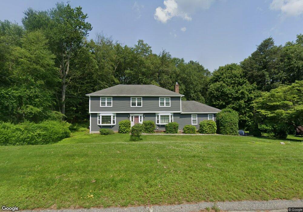
636 Cedar Grove Orange, CT 06477
Estimated Value: $737,000 - $859,000
4
Beds
3
Baths
2,795
Sq Ft
$285/Sq Ft
Est. Value
About This Home
This home is located at 636 Cedar Grove, Orange, CT 06477 and is currently estimated at $795,629, approximately $284 per square foot. 636 Cedar Grove is a home located in New Haven County with nearby schools including Mary L. Tracy School, Turkey Hill School, and Amity Middle School: Orange.
Ownership History
Date
Name
Owned For
Owner Type
Purchase Details
Closed on
Dec 28, 1998
Sold by
Goldberg Richard M and Goldberg Robin E
Bought by
Guarino Vincent J and Guarino Vanna R
Current Estimated Value
Home Financials for this Owner
Home Financials are based on the most recent Mortgage that was taken out on this home.
Original Mortgage
$225,000
Outstanding Balance
$64,711
Interest Rate
6.89%
Estimated Equity
$730,918
Purchase Details
Closed on
Jun 28, 1994
Sold by
Kohut Ronald and Kohut Rosemary D
Bought by
Goldberg Richard M and Goldberg Robin E
Purchase Details
Closed on
Jun 22, 1990
Sold by
Nusky Kenneth D
Bought by
Kohut Ronald
Create a Home Valuation Report for This Property
The Home Valuation Report is an in-depth analysis detailing your home's value as well as a comparison with similar homes in the area
Home Values in the Area
Average Home Value in this Area
Purchase History
| Date | Buyer | Sale Price | Title Company |
|---|---|---|---|
| Guarino Vincent J | $342,000 | -- | |
| Guarino Vincent J | $342,000 | -- | |
| Goldberg Richard M | $330,000 | -- | |
| Goldberg Richard M | $330,000 | -- | |
| Kohut Ronald | $330,000 | -- |
Source: Public Records
Mortgage History
| Date | Status | Borrower | Loan Amount |
|---|---|---|---|
| Open | Kohut Ronald | $225,000 | |
| Closed | Kohut Ronald | $225,000 | |
| Previous Owner | Kohut Ronald | $255,000 |
Source: Public Records
Tax History
| Year | Tax Paid | Tax Assessment Tax Assessment Total Assessment is a certain percentage of the fair market value that is determined by local assessors to be the total taxable value of land and additions on the property. | Land | Improvement |
|---|---|---|---|---|
| 2025 | $14,384 | $494,300 | $193,400 | $300,900 |
| 2024 | $15,323 | $494,300 | $193,400 | $300,900 |
| 2023 | $11,402 | $352,900 | $141,200 | $211,700 |
| 2022 | $11,543 | $352,900 | $141,200 | $211,700 |
| 2021 | $11,734 | $352,900 | $141,200 | $211,700 |
| 2020 | $11,554 | $352,900 | $141,200 | $211,700 |
| 2019 | $11,501 | $352,900 | $141,200 | $211,700 |
| 2018 | $11,293 | $352,900 | $141,200 | $211,700 |
| 2017 | $11,502 | $345,600 | $154,900 | $190,700 |
| 2016 | $11,128 | $345,600 | $154,900 | $190,700 |
| 2015 | $10,852 | $345,600 | $154,900 | $190,700 |
| 2014 | $10,541 | $345,600 | $154,900 | $190,700 |
Source: Public Records
Map
Nearby Homes
- 74 Victory St
- 500 River Rd Unit 3
- 20 3rd Ave
- 249 Coram Rd
- 11A Derby-Milford Rd
- 4 Rivendell Dr
- 847 Glenbrook Rd
- 223 River Rd
- 88 Rocky Rest Rd
- 133 Rocky Rest Rd
- 26 Bunker Hill Cir
- 489 Derby Milford Rd
- 444 Asbury Ridge
- 112 River Rd
- 1 Windward Way Unit 1
- 2 Windward Way Unit 2
- 830 Bayberry Ln
- 11 Westminster Ave
- 941 Garden Rd
- 22 Jenyfer Ct
- 628 Cedar Grove
- 651 Broadview Rd
- 639 Cedar Grove
- 663 Broadview Rd
- 622 Cedar Grove
- 623 Cedar Grove
- 652 Cedar Grove
- 639 Broadview Rd
- 655 Cedar Grove
- 670 Broadview Rd
- 607 Aspen Ln
- 601 Aspen Ln
- 616 Cedar Grove
- 660 Broadview Rd
- 627 Broadview Rd
- 672 Cedar Grove
- 650 Broadview Rd
- 615 Aspen Ln
- 615 Broadview Rd
- 636 Broadview Rd
Your Personal Tour Guide
Ask me questions while you tour the home.