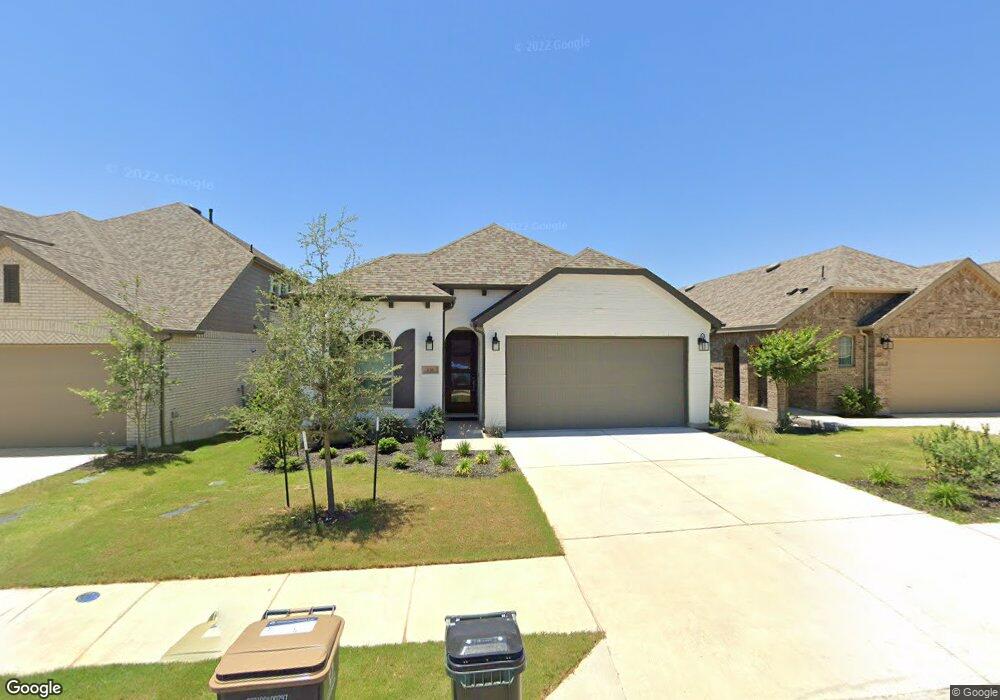
636 Pecan Bottom Trail Georgetown, TX 78628
Estimated Value: $447,122 - $500,000
3
Beds
3
Baths
2,018
Sq Ft
$233/Sq Ft
Est. Value
About This Home
This home is located at 636 Pecan Bottom Trail, Georgetown, TX 78628 and is currently estimated at $469,531, approximately $232 per square foot. 636 Pecan Bottom Trail is a home located in Williamson County with nearby schools including Dell Pickett Elementary School, James Tippit Middle School, and East View High School.
Ownership History
Date
Name
Owned For
Owner Type
Purchase Details
Closed on
Jul 26, 2021
Sold by
Highland Homes Austin Llc
Bought by
Devore Bruce A and Devore Patricia M
Current Estimated Value
Purchase Details
Closed on
Oct 21, 2020
Sold by
H4wr Phase 4 Llc
Bought by
Highland Homes Austin Llc
Home Financials for this Owner
Home Financials are based on the most recent Mortgage that was taken out on this home.
Original Mortgage
$80,000,000
Interest Rate
2.8%
Mortgage Type
Construction
Create a Home Valuation Report for This Property
The Home Valuation Report is an in-depth analysis detailing your home's value as well as a comparison with similar homes in the area
Home Values in the Area
Average Home Value in this Area
Purchase History
| Date | Buyer | Sale Price | Title Company |
|---|---|---|---|
| Devore Bruce A | -- | None Listed On Document | |
| Highland Homes Austin Llc | -- | None Available |
Source: Public Records
Mortgage History
| Date | Status | Borrower | Loan Amount |
|---|---|---|---|
| Previous Owner | Highland Homes Austin Llc | $80,000,000 |
Source: Public Records
Tax History Compared to Growth
Tax History
| Year | Tax Paid | Tax Assessment Tax Assessment Total Assessment is a certain percentage of the fair market value that is determined by local assessors to be the total taxable value of land and additions on the property. | Land | Improvement |
|---|---|---|---|---|
| 2025 | $13,055 | $499,791 | $115,000 | $384,791 |
| 2024 | $13,055 | $505,384 | $123,000 | $382,384 |
| 2023 | $13,055 | $538,756 | $110,000 | $428,756 |
| 2022 | $13,002 | $497,548 | $100,000 | $397,548 |
| 2021 | $2,125 | $75,000 | $75,000 | $0 |
| 2020 | $2,043 | $71,250 | $71,250 | $0 |
Source: Public Records
Map
Nearby Homes
- 617 Pecan Bottom Trail
- 237 Arrowhead Mound Rd
- 224 Diamondback Dr
- 261 Arrowhead Mound Rd
- 608 Pecan Bottom Trail
- 236 Diamondback Dr
- 120 Diamondback Dr
- 1122 Silver Dollar Trail
- 1313 Spring Gulch Ln
- 104 Arrowhead Mound Rd
- 1321 Highcrest
- 1225 Highcrest
- 101 Ashmore Ln
- 1232 River Trace
- 129 Three Oaks Ln
- 229 Ashmore Ln
- 1213 River Trace
- Huntley II Plan at West Bend - Wolf Ranch South Fork
- Brady Plan at West Bend - Wolf Ranch South Fork
- Bristol Plan at West Bend - Wolf Ranch South Fork
- 632 Pecan Bottom Trail
- 640 Pecan Bottom Trail
- 628 Pecan Bottom Trail
- 644 Pecan Bottom Trail
- 624 Pecan Bottom Trail
- 245 Arrowhead Mound Rd
- 648 Pecan Bottom Trail
- 625 Pecan Bottom Trail
- 249 Arrowhead Mound Rd
- 629 Pecan Bottom Trail
- 633 Pecan Bottom Trail
- 621 Pecan Bottom Trail
- 620 Pecan Bottom Trail
- 229 Arrowhead Mound Rd
- 253 Arrowhead Mound Rd
- 637 Pecan Bottom Trail
- 652 Pecan Bottom Trail
- 257 Arrowhead Mound Rd
- 225 Arrowhead Mound Rd
- 616 Pecan Bottom Trail