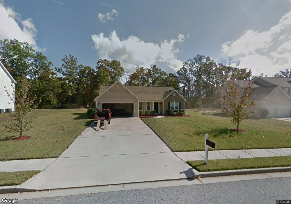
636 Penstock Path Hampton, GA 30228
Estimated Value: $289,000 - $295,722
3
Beds
2
Baths
1,669
Sq Ft
$175/Sq Ft
Est. Value
About This Home
This home is located at 636 Penstock Path, Hampton, GA 30228 and is currently estimated at $292,181, approximately $175 per square foot. 636 Penstock Path is a home located in Henry County with nearby schools including Mount Carmel Elementary School, Hampton Middle School, and Hampton High School.
Ownership History
Date
Name
Owned For
Owner Type
Purchase Details
Closed on
Dec 19, 2018
Sold by
Mccain Robert
Bought by
Holmes Stanley and Holmes Lureon
Current Estimated Value
Home Financials for this Owner
Home Financials are based on the most recent Mortgage that was taken out on this home.
Original Mortgage
$163,778
Outstanding Balance
$146,563
Interest Rate
5.62%
Mortgage Type
FHA
Estimated Equity
$145,618
Purchase Details
Closed on
Aug 7, 2006
Sold by
Mccain Robert
Bought by
Mccain Robert and Mccain Lacole A
Purchase Details
Closed on
Apr 20, 2005
Sold by
Knight Grp Inc
Bought by
Mccain Robert
Home Financials for this Owner
Home Financials are based on the most recent Mortgage that was taken out on this home.
Original Mortgage
$124,952
Interest Rate
6.28%
Mortgage Type
New Conventional
Create a Home Valuation Report for This Property
The Home Valuation Report is an in-depth analysis detailing your home's value as well as a comparison with similar homes in the area
Home Values in the Area
Average Home Value in this Area
Purchase History
| Date | Buyer | Sale Price | Title Company |
|---|---|---|---|
| Holmes Stanley | $166,800 | -- | |
| Mccain Robert | -- | -- | |
| Mccain Robert | $156,200 | -- |
Source: Public Records
Mortgage History
| Date | Status | Borrower | Loan Amount |
|---|---|---|---|
| Open | Holmes Stanley | $163,778 | |
| Previous Owner | Mccain Robert | $31,238 | |
| Previous Owner | Mccain Robert | $124,952 |
Source: Public Records
Tax History Compared to Growth
Tax History
| Year | Tax Paid | Tax Assessment Tax Assessment Total Assessment is a certain percentage of the fair market value that is determined by local assessors to be the total taxable value of land and additions on the property. | Land | Improvement |
|---|---|---|---|---|
| 2025 | $3,444 | $123,280 | $16,000 | $107,280 |
| 2024 | $3,444 | $117,040 | $16,000 | $101,040 |
| 2023 | $2,811 | $113,040 | $14,000 | $99,040 |
| 2022 | $2,693 | $86,840 | $14,000 | $72,840 |
| 2021 | $2,454 | $76,760 | $14,000 | $62,760 |
| 2020 | $2,263 | $68,720 | $10,000 | $58,720 |
| 2019 | $2,020 | $58,520 | $10,000 | $48,520 |
| 2018 | $1,928 | $56,640 | $10,000 | $46,640 |
| 2016 | $1,658 | $48,520 | $8,600 | $39,920 |
| 2015 | $1,524 | $44,120 | $8,600 | $35,520 |
| 2014 | $1,494 | $43,000 | $8,000 | $35,000 |
Source: Public Records
Map
Nearby Homes
- 528 Gristmill Ln
- 1141 Norsworthy Mill
- 441 Windpher Ridge Unit 212
- 1412 Turnbridge Walk
- 1200 Pendley Point
- 230 Creekside Cir
- 101 Crestwood Ct
- 320 Cobb Ct
- 101 Bridgemill Dr
- 260 Sandstone Dr
- 81 Bridgemill Dr Unit 1
- 255 Barnett Rd
- 116 Rolling Meadows Ct
- 120 Bridgemill Dr
- 445 Sawmill Trace
- 446 Sawmill Trace
- 907 Brisley Cir
- 248 Fern Ct
- 231 Norfolk Dr
- 169 Cabin Way
- 640 Penstock Path
- 632 Penstock Path
- 0 Penstock Path Unit 8710477
- 0 Penstock Path Unit 8482248
- 0 Penstock Path Unit 8677522
- 0 Penstock Path Unit 8653284
- 0 Penstock Path Unit 7591574
- 0 Penstock Path Unit 9033302
- 0 Penstock Path Unit 8871022
- 0 Penstock Path Unit 8892674
- 0 Penstock Path Unit 7143284
- 0 Penstock Path Unit 7152271
- 0 Penstock Path Unit 7454913
- 0 Penstock Path Unit 7587986
- 0 Penstock Path Unit 7608315
- 0 Penstock Path
- 644 Penstock Path
- 639 Penstock Path Unit 117
- 639 Penstock Path
- 628 Penstock Path