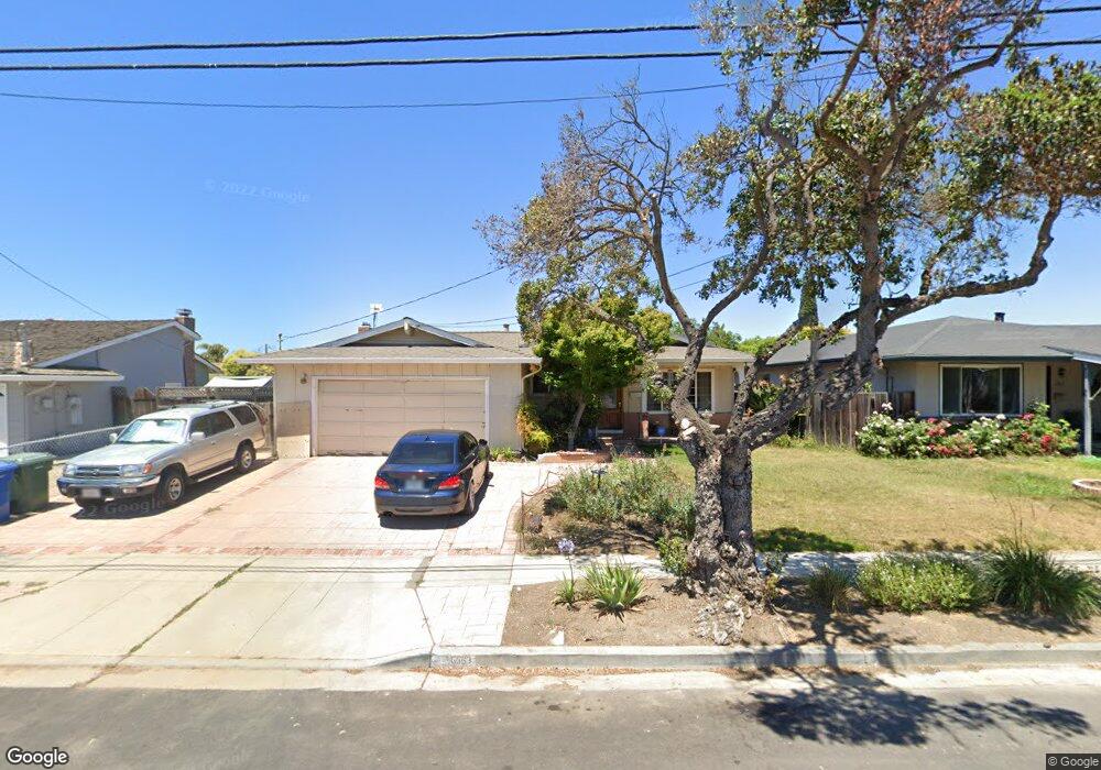
6363 Moores Ave Newark, CA 94560
Birch Grove NeighborhoodEstimated Value: $1,238,000 - $1,353,000
3
Beds
2
Baths
1,315
Sq Ft
$972/Sq Ft
Est. Value
About This Home
This home is located at 6363 Moores Ave, Newark, CA 94560 and is currently estimated at $1,277,620, approximately $971 per square foot. 6363 Moores Ave is a home located in Alameda County with nearby schools including Birch Grove Primary School, Newark Junior High School, and Newark Memorial High School.
Ownership History
Date
Name
Owned For
Owner Type
Purchase Details
Closed on
Sep 10, 1999
Sold by
Ostasiuk Mark S and Ostasiuk Patti M
Bought by
Ostasiuk Mark S and Ostasiuk Patti M
Current Estimated Value
Home Financials for this Owner
Home Financials are based on the most recent Mortgage that was taken out on this home.
Original Mortgage
$30,000
Interest Rate
7.66%
Mortgage Type
Credit Line Revolving
Create a Home Valuation Report for This Property
The Home Valuation Report is an in-depth analysis detailing your home's value as well as a comparison with similar homes in the area
Home Values in the Area
Average Home Value in this Area
Purchase History
| Date | Buyer | Sale Price | Title Company |
|---|---|---|---|
| Ostasiuk Mark S | -- | Old Republic Title Company |
Source: Public Records
Mortgage History
| Date | Status | Borrower | Loan Amount |
|---|---|---|---|
| Closed | Ostasiuk Mark S | $30,000 |
Source: Public Records
Tax History
| Year | Tax Paid | Tax Assessment Tax Assessment Total Assessment is a certain percentage of the fair market value that is determined by local assessors to be the total taxable value of land and additions on the property. | Land | Improvement |
|---|---|---|---|---|
| 2025 | $4,624 | $342,165 | $108,162 | $241,003 |
| 2024 | $4,624 | $335,319 | $106,041 | $236,278 |
| 2023 | $4,486 | $335,608 | $103,963 | $231,645 |
| 2022 | $4,411 | $322,028 | $101,924 | $227,104 |
| 2021 | $4,304 | $315,577 | $99,926 | $222,651 |
| 2020 | $4,198 | $319,271 | $98,902 | $220,369 |
| 2019 | $4,140 | $313,012 | $96,963 | $216,049 |
| 2018 | $4,074 | $306,875 | $95,062 | $211,813 |
| 2017 | $3,969 | $300,859 | $93,198 | $207,661 |
| 2016 | $3,917 | $294,960 | $91,371 | $203,589 |
| 2015 | $3,903 | $290,531 | $89,999 | $200,532 |
| 2014 | $3,792 | $284,840 | $88,236 | $196,604 |
Source: Public Records
Map
Nearby Homes
- 6332 Rockrose Dr
- 39146 Ebbetts St
- 38427 Cedar Blvd
- 6257 Honeysuckle Dr
- 5724 Pandorea Terrace
- 38976 Primula Terrace
- 5604 Pandorea Terrace
- 5550 Higo Way
- 6364 Honeysuckle Dr
- 5659 Daylily St
- 5513 Higo Way
- 5516 Higo Way
- 38539 Amaranto St
- 38515 Amaranto St
- 5502 Higo Way
- 38509 Amaranto St
- 38463 Amaranto St
- 38445 Amaranto St
- 37640 Hyacinth St
- 5859 Central Ave
- 6347 Moores Ave
- 6377 Moores Ave
- 38544 Rockrose Ct
- 6319 Moores Ave
- 6340 Rockrose Dr
- 6393 Moores Ave
- 38586 Rockrose Ct
- 6360 Moores Ave
- 38528 Rockrose Ct
- 6378 Moores Ave
- 6291 Moores Ave
- 6342 Moores Ave
- 38618 Larkspur St
- 6401 Moores Ave
- 6318 Rockrose Dr
- 38599 Rockrose Ct
- 6310 Moores Ave
- 6259 Moores Ave
- 6415 Moores Ave
- 38632 Larkspur St
Your Personal Tour Guide
Ask me questions while you tour the home.