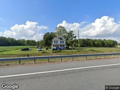
6369 Worcester Hwy Newark, MD 21841
Estimated Value: $173,000 - $410,230
--
Bed
1
Bath
1,776
Sq Ft
$178/Sq Ft
Est. Value
About This Home
This home is located at 6369 Worcester Hwy, Newark, MD 21841 and is currently estimated at $315,308, approximately $177 per square foot. 6369 Worcester Hwy is a home located in Worcester County with nearby schools including Snow Hill Elementary School, Snow Hill Middle School, and Snow Hill High School.
Ownership History
Date
Name
Owned For
Owner Type
Purchase Details
Closed on
Jun 22, 2022
Sold by
Jackson Patricia D
Bought by
Jackson Patricia D and Benak Ryan T
Current Estimated Value
Purchase Details
Closed on
Jan 23, 2019
Sold by
Dryden Charnick Diane Dryden and Dryden Mitchell Kathleen
Bought by
Jackson Patricia Dryden
Purchase Details
Closed on
Jul 9, 2018
Sold by
Dryden Charnick Diane Dryden and Dryden Mitchell Kathleen
Bought by
State Of Maryland To The Use The State H
Create a Home Valuation Report for This Property
The Home Valuation Report is an in-depth analysis detailing your home's value as well as a comparison with similar homes in the area
Home Values in the Area
Average Home Value in this Area
Purchase History
| Date | Buyer | Sale Price | Title Company |
|---|---|---|---|
| Jackson Patricia D | -- | None Listed On Document | |
| Jackson Patricia Dryden | $116,000 | None Available | |
| State Of Maryland To The Use The State H | $85,000 | None Available |
Source: Public Records
Tax History Compared to Growth
Tax History
| Year | Tax Paid | Tax Assessment Tax Assessment Total Assessment is a certain percentage of the fair market value that is determined by local assessors to be the total taxable value of land and additions on the property. | Land | Improvement |
|---|---|---|---|---|
| 2024 | $1,226 | $182,600 | $0 | $0 |
| 2023 | $1,162 | $144,600 | $0 | $0 |
| 2022 | $1,126 | $106,600 | $60,000 | $46,600 |
| 2021 | $1,130 | $106,600 | $60,000 | $46,600 |
| 2020 | $1,107 | $106,600 | $60,000 | $46,600 |
| 2019 | $1,107 | $107,100 | $60,000 | $47,100 |
| 2018 | $1,107 | $107,100 | $60,000 | $47,100 |
| 2017 | $1,138 | $107,300 | $0 | $0 |
| 2016 | -- | $109,900 | $0 | $0 |
| 2015 | -- | $109,600 | $0 | $0 |
| 2014 | $945 | $109,300 | $0 | $0 |
Source: Public Records
Map
Nearby Homes
- 0 Cedartown Rd
- 6060 Worcester Hwy
- 7109 Daffodil Ln Rd
- 7126 Arcadia Cir
- 7146 Arcadia Cir
- 8422 Newark Rd
- 7204 Mill St
- Lot 5 Newark Rd
- Lot 4 Newark Rd
- Lot 3 Newark Rd
- 0 Newark Rd Unit MDWO2014316
- 6629 Bowden Rd
- 0 Patey Woods Rd Unit MDWO2014080
- 7044 Whiton Crossing Rd
- 306 Park Row
- 220 E Federal St
- 207 Purnell St
- 217 E Federal St
- 210 Walnut St
- 111 Purnell St
- 6369 Worcester Hwy
- 6705 Five Mile Branch Rd
- 6719 Five Mile Branch Rd
- 6331 Worcester Hwy
- 6715 Five Mile Branch Rd
- 6721 Five Mile Branch Rd
- 6830 Five Mile Branch Rd
- 6424 Worcester Hwy
- 6270 Worcester Hwy
- 6922 Five Mile Branch Rd
- 6230 Worcester Hwy
- 6224 Worcester Hwy
- 6236 Worcester Hwy
- 6726 Porters Crossing Rd
- 6720 Porters Crossing Rd
- 6184 Worcester Hwy
- 6714 Porters Crossing Rd
- 6625 Porters Crossing Rd
- 6708 Porters Crossing Rd
- 6708 Porters Crossing