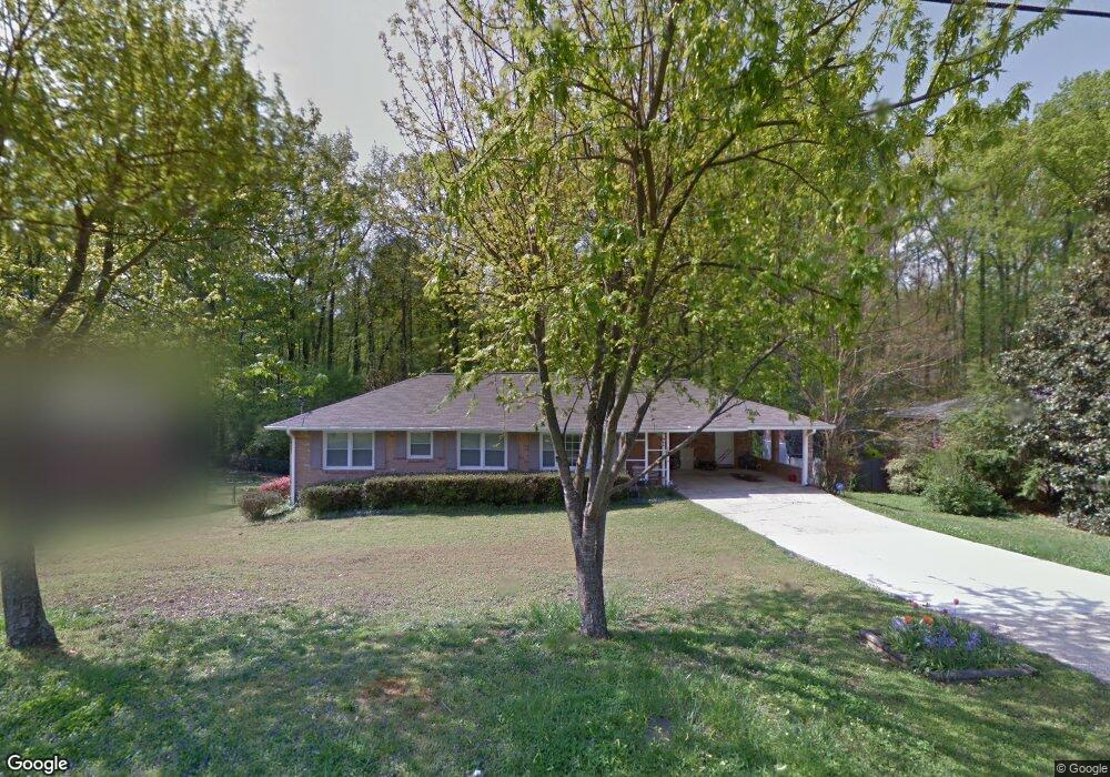
637 Carlouetta Rd SW Unit LOT 69 Mableton, GA 30126
Estimated Value: $286,000 - $307,000
3
Beds
2
Baths
1,392
Sq Ft
$216/Sq Ft
Est. Value
About This Home
This home is located at 637 Carlouetta Rd SW Unit LOT 69, Mableton, GA 30126 and is currently estimated at $300,206, approximately $215 per square foot. 637 Carlouetta Rd SW Unit LOT 69 is a home located in Cobb County with nearby schools including Russell Elementary School, Floyd Middle School, and South Cobb High School.
Ownership History
Date
Name
Owned For
Owner Type
Purchase Details
Closed on
Dec 14, 2021
Sold by
Sfr Atl Owner 10 Lp
Bought by
Star 2021-Sfr2 Borrower Lp
Current Estimated Value
Purchase Details
Closed on
Dec 10, 2020
Sold by
Carter House Properties Llc
Bought by
Sfr Atl Owner 10 Lp
Create a Home Valuation Report for This Property
The Home Valuation Report is an in-depth analysis detailing your home's value as well as a comparison with similar homes in the area
Home Values in the Area
Average Home Value in this Area
Purchase History
| Date | Buyer | Sale Price | Title Company |
|---|---|---|---|
| Star 2021-Sfr2 Borrower Lp | -- | None Listed On Document | |
| Sfr Atl Owner 10 Lp | -- | None Available | |
| Carter House Properties Llc | $170,000 | None Available |
Source: Public Records
Tax History Compared to Growth
Tax History
| Year | Tax Paid | Tax Assessment Tax Assessment Total Assessment is a certain percentage of the fair market value that is determined by local assessors to be the total taxable value of land and additions on the property. | Land | Improvement |
|---|---|---|---|---|
| 2025 | $3,495 | $116,000 | $22,800 | $93,200 |
| 2024 | $3,635 | $120,560 | $22,800 | $97,760 |
| 2023 | $2,972 | $98,572 | $16,800 | $81,772 |
| 2022 | $2,772 | $91,324 | $16,800 | $74,524 |
| 2021 | $2,064 | $68,000 | $13,560 | $54,440 |
| 2020 | $1,880 | $61,944 | $14,800 | $47,144 |
| 2019 | $1,880 | $61,944 | $14,800 | $47,144 |
| 2018 | $1,880 | $61,944 | $14,800 | $47,144 |
| 2017 | $1,727 | $60,068 | $16,000 | $44,068 |
| 2016 | $1,407 | $48,956 | $11,200 | $37,756 |
| 2015 | $1,477 | $50,152 | $11,200 | $38,952 |
| 2014 | $1,618 | $54,456 | $0 | $0 |
Source: Public Records
Map
Nearby Homes
- 681 Manor Ridge Dr SW
- 4766 Mckee Ct SW
- 639 Concord Rd SW
- 4672 Vernon Dr SW
- 680 Sundial Ln
- 684 Sundial Ln
- 450 Dorset Way SW
- 45 Concord Rd SW
- 4589 Moray Dr
- 4561 Moray Dr
- 4593 Moray Dr
- 4585 Moray Dr
- 4577 Moray Dr
- 4573 Moray Dr
- 4370 Conwhey Ct SW
- 4581 Moray Dr
- Kaufman Plan at Wilkins Walk
- Bryson Plan at Wilkins Walk
- Brooks Plan at Wilkins Walk
- 647 Shannon Green Cir SW
- 637 Carlouetta Rd SW
- 623 Carlouetta Rd SW
- 0 Carlouetta Rd SW Unit 8826536
- 645 Carlouetta Rd SW
- 5529 Oakland Terrace
- 625 Carlouetta Rd SW
- 665 Carlouetta Rd SW Unit 3
- 4614 Oakland Terrace SW Unit 3
- 630 Benson Hurst Dr SW
- 650 Carlouetta Rd SW
- 654 Carlouetta Rd SW
- 4615 Oakland Terrace SW
- 638 Benson Hurst Dr SW
- 638 Benson Hurst Dr SW
- 591 Carlouetta Rd SW
- 4604 Oakland Terrace SW
- 620 Benson Hurst Dr SW Unit 2
- 644 Benson Hurst Dr SW
- 4613 Shamrock Place SE