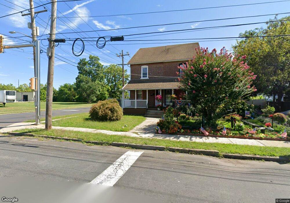
637 Maple Ave Lansdale, PA 19446
Estimated Value: $292,000 - $349,000
3
Beds
2
Baths
1,350
Sq Ft
$237/Sq Ft
Est. Value
About This Home
This home is located at 637 Maple Ave, Lansdale, PA 19446 and is currently estimated at $319,734, approximately $236 per square foot. 637 Maple Ave is a home located in Montgomery County with nearby schools including Knapp Elementary School, Penndale Middle School, and North Penn Senior High School.
Ownership History
Date
Name
Owned For
Owner Type
Purchase Details
Closed on
Dec 8, 2000
Sold by
Commonwealth Bank
Bought by
United Guaranty Residential Insurance Co
Current Estimated Value
Purchase Details
Closed on
Dec 7, 2000
Sold by
United Guaranty Residential Insurance Co
Bought by
Rafiuzzaman Kgm
Purchase Details
Closed on
May 12, 2000
Sold by
Giuliano Amy L and Schmale David R
Bought by
Commonwealth Bank
Purchase Details
Closed on
Oct 23, 1995
Sold by
Giuliano Gerald Louis and Giuliano Elizabeth Jane
Bought by
Giuliano Amy J and Schmale David R
Create a Home Valuation Report for This Property
The Home Valuation Report is an in-depth analysis detailing your home's value as well as a comparison with similar homes in the area
Home Values in the Area
Average Home Value in this Area
Purchase History
| Date | Buyer | Sale Price | Title Company |
|---|---|---|---|
| United Guaranty Residential Insurance Co | $68,625 | -- | |
| Rafiuzzaman Kgm | $92,500 | -- | |
| Commonwealth Bank | $1,600 | -- | |
| Giuliano Amy J | $93,000 | -- |
Source: Public Records
Tax History Compared to Growth
Tax History
| Year | Tax Paid | Tax Assessment Tax Assessment Total Assessment is a certain percentage of the fair market value that is determined by local assessors to be the total taxable value of land and additions on the property. | Land | Improvement |
|---|---|---|---|---|
| 2025 | $3,742 | $88,940 | $40,600 | $48,340 |
| 2024 | $3,742 | $88,940 | $40,600 | $48,340 |
| 2023 | $3,500 | $88,940 | $40,600 | $48,340 |
| 2022 | $3,389 | $88,940 | $40,600 | $48,340 |
| 2021 | $3,250 | $88,940 | $40,600 | $48,340 |
| 2020 | $3,152 | $88,940 | $40,600 | $48,340 |
| 2019 | $3,100 | $88,940 | $40,600 | $48,340 |
| 2018 | $832 | $88,940 | $40,600 | $48,340 |
| 2017 | $2,894 | $88,940 | $40,600 | $48,340 |
| 2016 | $2,859 | $88,940 | $40,600 | $48,340 |
| 2015 | $2,653 | $88,940 | $40,600 | $48,340 |
| 2014 | $2,653 | $88,940 | $40,600 | $48,340 |
Source: Public Records
Map
Nearby Homes
- 302 W 8th St Unit 21
- 129 W Fifth St
- 816 Kenilworth Ave
- 39 E 5th St
- 529 N Chestnut St
- 833 W 4th St
- 124 E 5th St
- 130 E 5th St
- 405 Derstine Ave
- 200 E 5th St
- 135 Third
- 831 W Main St
- 1028 Poplar St Unit 75
- 204 N Valley Forge Rd Unit 7B
- 235 E 2nd St
- 128 S Broad St
- 21 S Valley Forge Rd Unit 213
- 108 Allison Ct Unit 8
- 2 N Line St
- 13 W End Dr