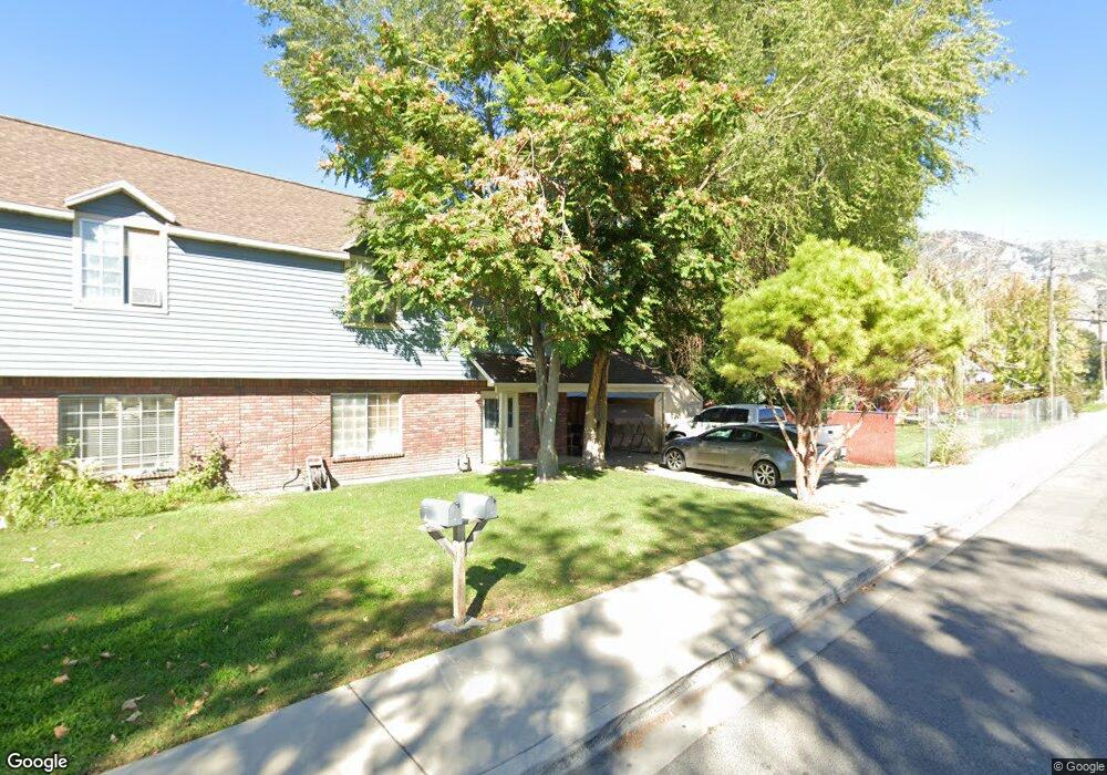
637 S 500 W Unit 10 Provo, UT 84601
Franklin NeighborhoodEstimated Value: $285,000 - $293,000
3
Beds
1
Bath
1,100
Sq Ft
$263/Sq Ft
Est. Value
About This Home
This home is located at 637 S 500 W Unit 10, Provo, UT 84601 and is currently estimated at $289,667, approximately $263 per square foot. 637 S 500 W Unit 10 is a home located in Utah County with nearby schools including Spring Creek Elementary School, Centennial Middle School, and Timpview High School.
Ownership History
Date
Name
Owned For
Owner Type
Purchase Details
Closed on
May 15, 2016
Sold by
Calle Arenal Properties Llc
Bought by
Haslam Ronald C and Haslam Naomi
Current Estimated Value
Home Financials for this Owner
Home Financials are based on the most recent Mortgage that was taken out on this home.
Original Mortgage
$113,000
Outstanding Balance
$89,721
Interest Rate
3.58%
Mortgage Type
New Conventional
Estimated Equity
$199,946
Purchase Details
Closed on
May 13, 2016
Sold by
Haslam Ronald C and Haslam Naomi
Bought by
Manning David M and Manning Alissa
Home Financials for this Owner
Home Financials are based on the most recent Mortgage that was taken out on this home.
Original Mortgage
$113,000
Outstanding Balance
$89,721
Interest Rate
3.58%
Mortgage Type
New Conventional
Estimated Equity
$199,946
Purchase Details
Closed on
Oct 20, 2011
Sold by
Haslam Linda D
Bought by
Calle Arenal Properties Llc
Purchase Details
Closed on
Jan 3, 2006
Sold by
Haslam Linda D
Bought by
Haslam Linda D and Haslam Ronald C
Home Financials for this Owner
Home Financials are based on the most recent Mortgage that was taken out on this home.
Original Mortgage
$90,250
Interest Rate
5.9%
Mortgage Type
Fannie Mae Freddie Mac
Purchase Details
Closed on
Nov 9, 2005
Sold by
Hopkinson Sally Rue
Bought by
Haslam Linda D
Home Financials for this Owner
Home Financials are based on the most recent Mortgage that was taken out on this home.
Original Mortgage
$90,250
Interest Rate
5.9%
Mortgage Type
Fannie Mae Freddie Mac
Purchase Details
Closed on
Jan 29, 2003
Sold by
Brown Stephen
Bought by
Hopkinson Sally Rue
Purchase Details
Closed on
Sep 30, 1999
Sold by
Hartman Devin R and Hartman Camille M
Bought by
Brown Stephen
Home Financials for this Owner
Home Financials are based on the most recent Mortgage that was taken out on this home.
Original Mortgage
$84,350
Interest Rate
7.97%
Purchase Details
Closed on
May 27, 1998
Sold by
Forsyth Daniel P and Forsyth Emily L
Bought by
Hartman Devin R and Hartman Camille M
Home Financials for this Owner
Home Financials are based on the most recent Mortgage that was taken out on this home.
Original Mortgage
$84,300
Interest Rate
7.13%
Mortgage Type
FHA
Create a Home Valuation Report for This Property
The Home Valuation Report is an in-depth analysis detailing your home's value as well as a comparison with similar homes in the area
Home Values in the Area
Average Home Value in this Area
Purchase History
| Date | Buyer | Sale Price | Title Company |
|---|---|---|---|
| Haslam Ronald C | -- | Eagle Point Title Insurnce | |
| Manning David M | -- | Eagle Pointe Title Inc | |
| Calle Arenal Properties Llc | -- | Eagle Pointe Title Ins | |
| Haslam Linda D | -- | Eagle Pointe Title Insurance | |
| Haslam Linda D | -- | Eagle Pointe Title Insuranc | |
| Hopkinson Sally Rue | -- | Old Republic Title Of Utah | |
| Brown Stephen | -- | Associated Title Company | |
| Hartman Devin R | -- | -- |
Source: Public Records
Mortgage History
| Date | Status | Borrower | Loan Amount |
|---|---|---|---|
| Open | Haslam Ronald C | $113,000 | |
| Closed | Manning David M | $113,000 | |
| Previous Owner | Haslam Linda D | $90,250 | |
| Previous Owner | Brown Stephen | $84,350 | |
| Previous Owner | Hartman Devin R | $84,300 |
Source: Public Records
Tax History Compared to Growth
Tax History
| Year | Tax Paid | Tax Assessment Tax Assessment Total Assessment is a certain percentage of the fair market value that is determined by local assessors to be the total taxable value of land and additions on the property. | Land | Improvement |
|---|---|---|---|---|
| 2025 | $1,405 | $146,575 | $29,600 | $236,900 |
| 2024 | $1,405 | $138,325 | $0 | $0 |
| 2023 | $1,521 | $147,620 | $0 | $0 |
| 2022 | $1,341 | $131,230 | $0 | $0 |
| 2021 | $1,127 | $192,400 | $23,100 | $169,300 |
| 2020 | $1,112 | $177,900 | $21,300 | $156,600 |
| 2019 | $968 | $161,000 | $21,000 | $140,000 |
| 2018 | $830 | $140,000 | $16,800 | $123,200 |
| 2017 | $716 | $66,385 | $0 | $0 |
| 2016 | $712 | $61,490 | $0 | $0 |
| 2015 | $677 | $59,125 | $0 | $0 |
| 2014 | $649 | $59,125 | $0 | $0 |
Source: Public Records
Map
Nearby Homes
- 608 S 500 W Unit 3
- 648 S 500 W Unit 4
- 751 S 400 W
- 330 W 600 S
- 389 W 500 S
- 3404 W 1500 N
- 590 S 600 W
- 461 S 400 W
- 151 S Meadow Dr Unit 19
- 151 S Meadow Dr
- 475 S 400 W Unit D1
- 516 S Freedom Blvd
- 761 W 600 S Unit 12
- 491 S Freedom Blvd Unit 104204
- 393 W 300 S
- 244 W 400 S
- 784 W Heather Ln
- 272 W 1020 S Unit B
- 933 S Blvd W
- 770 W 400 S
- 637 S 500 W Unit 11
- 637 S 500 W Unit 9
- 637 S 500 W Unit 12
- 637 S 500 W
- 647 S 500 W Unit 7
- 647 S 500 W Unit 6
- 647 S 500 W Unit 8
- 647 S 500 W Unit 5
- 629 S 500 W Unit 15
- 629 S 500 W Unit 14
- 629 S 500 W
- 629 S 500 W Unit 16
- 629 S 500 W Unit 13
- 645 S 500 W
- 645 S 500 W
- 645 S 500 W
- 645 S 500 W Unit 5
- 641 S 500 W Unit 12
- 623 S 500 W Unit 19
- 623 S 500 W Unit 18