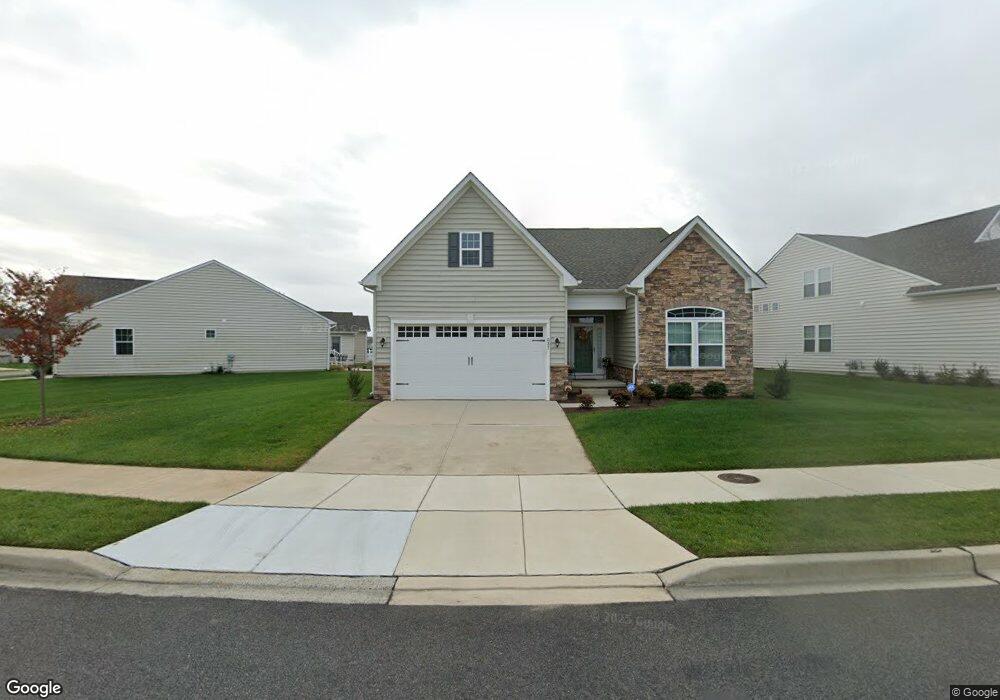
637 Swansea Dr Middletown, DE 19709
Estimated Value: $604,651 - $627,000
3
Beds
4
Baths
2,480
Sq Ft
$247/Sq Ft
Est. Value
About This Home
This home is located at 637 Swansea Dr, Middletown, DE 19709 and is currently estimated at $613,163, approximately $247 per square foot. 637 Swansea Dr is a home with nearby schools including Bunker Hill Elementary School, Everett Meredith Middle School, and Appoquinimink High School.
Ownership History
Date
Name
Owned For
Owner Type
Purchase Details
Closed on
Nov 20, 2018
Sold by
Nvr Inc
Bought by
Doyle Linda
Current Estimated Value
Home Financials for this Owner
Home Financials are based on the most recent Mortgage that was taken out on this home.
Original Mortgage
$25,000
Outstanding Balance
$22,045
Interest Rate
4.94%
Estimated Equity
$591,118
Purchase Details
Closed on
Aug 31, 2018
Sold by
Nvr Inc
Bought by
Doyle Linda R
Purchase Details
Closed on
Apr 27, 2018
Sold by
Westown Development Llc
Bought by
Nvr Inc
Create a Home Valuation Report for This Property
The Home Valuation Report is an in-depth analysis detailing your home's value as well as a comparison with similar homes in the area
Home Values in the Area
Average Home Value in this Area
Purchase History
| Date | Buyer | Sale Price | Title Company |
|---|---|---|---|
| Doyle Linda | $402,225 | -- | |
| Doyle Linda R | $402,225 | None Available | |
| Nvr Inc | -- | None Available |
Source: Public Records
Mortgage History
| Date | Status | Borrower | Loan Amount |
|---|---|---|---|
| Open | Doyle Linda | $25,000 | |
| Closed | Doyle Linda | -- |
Source: Public Records
Tax History Compared to Growth
Tax History
| Year | Tax Paid | Tax Assessment Tax Assessment Total Assessment is a certain percentage of the fair market value that is determined by local assessors to be the total taxable value of land and additions on the property. | Land | Improvement |
|---|---|---|---|---|
| 2024 | $3,611 | $111,600 | $10,800 | $100,800 |
| 2023 | $2,937 | $111,600 | $10,800 | $100,800 |
| 2022 | $2,931 | $111,600 | $10,800 | $100,800 |
| 2021 | $2,917 | $111,600 | $10,800 | $100,800 |
| 2020 | $2,917 | $111,600 | $10,800 | $100,800 |
| 2019 | $332 | $111,600 | $10,800 | $100,800 |
| 2018 | $142 | $110,700 | $10,800 | $99,900 |
| 2017 | $16 | $5,400 | $5,400 | $0 |
| 2016 | $139 | $5,400 | $5,400 | $0 |
Source: Public Records
Map
Nearby Homes
- 1611 Ellinor Ct
- 1613 Ellinor Ct
- 152 Tywyn Dr
- 527 Swansea Dr
- 414 Goodwick Dr
- 763 Wallasey Dr
- 351 Goodwick Dr
- 1032 Applecross Dr
- 911 Cadman Dr
- 1018 Applecross Dr
- 327 Braemar St
- 303 Braemar St
- 712 Wallasey Dr
- 50 Haggis Rd
- 11 Garcia Dr
- 6 Viola Cir
- 102 W Crail Ct
- 36 Deep Branch Dr
- 118 W Crail Ct
- 900 S Vernon St
- 629 Swansea Dr
- 629 Swansea Dr
- 1001 Swansea Dr
- 1000 Swansea Dr
- 639 Swansea Dr
- 1601 Goodwick Dr
- 1701 Goodwick Dr
- 492 Goodwick Dr
- 627 Swansea Dr
- 636 Swansea Dr
- 638 Swansea Dr
- 1301 Swansea Dr
- 1400 Swansea Dr
- 1100 Swansea Dr
- 636 Swansea Dr
- 625 Swansea Dr
- 490 Goodwick Dr
- 640 Swansea Dr
- 1200 Swansea Dr
- 628 Swansea Dr