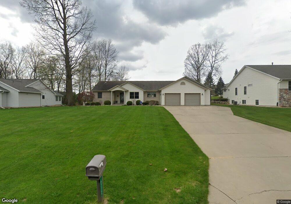
6372 Buckham Wood Dr Unit 18 Kalamazoo, MI 49009
Estimated Value: $356,000 - $459,254
4
Beds
3
Baths
1,844
Sq Ft
$220/Sq Ft
Est. Value
About This Home
This home is located at 6372 Buckham Wood Dr Unit 18, Kalamazoo, MI 49009 and is currently estimated at $406,064, approximately $220 per square foot. 6372 Buckham Wood Dr Unit 18 is a home located in Kalamazoo County with nearby schools including King-Westwood Elementary School, Linden Grove Middle School, and Kalamazoo Central High School.
Ownership History
Date
Name
Owned For
Owner Type
Purchase Details
Closed on
Dec 15, 2021
Sold by
Jefferson Stephen E and Jefferson Terry B
Bought by
Jefferson Stephen E and Jefferson Stephen E
Current Estimated Value
Purchase Details
Closed on
Sep 13, 2004
Sold by
Loher James F and Loher Carol M
Bought by
Jefferson Stephen E and Jefferson Terry B
Purchase Details
Closed on
May 15, 2003
Sold by
Bey Moure Llc
Bought by
Loher James F and Loher Carol M
Create a Home Valuation Report for This Property
The Home Valuation Report is an in-depth analysis detailing your home's value as well as a comparison with similar homes in the area
Home Values in the Area
Average Home Value in this Area
Purchase History
| Date | Buyer | Sale Price | Title Company |
|---|---|---|---|
| Jefferson Stephen E | -- | None Listed On Document | |
| Jefferson Stephen E | $36,000 | -- | |
| Loher James F | $35,000 | Trans |
Source: Public Records
Tax History Compared to Growth
Tax History
| Year | Tax Paid | Tax Assessment Tax Assessment Total Assessment is a certain percentage of the fair market value that is determined by local assessors to be the total taxable value of land and additions on the property. | Land | Improvement |
|---|---|---|---|---|
| 2025 | $5,877 | $236,400 | $0 | $0 |
| 2024 | $1,413 | $218,600 | $0 | $0 |
| 2023 | $1,347 | $202,000 | $0 | $0 |
| 2022 | $5,451 | $187,200 | $0 | $0 |
| 2021 | $5,043 | $179,800 | $0 | $0 |
| 2020 | $4,808 | $168,700 | $0 | $0 |
| 2019 | $4,557 | $158,800 | $0 | $0 |
| 2018 | $4,450 | $130,000 | $0 | $0 |
| 2017 | $0 | $130,000 | $0 | $0 |
| 2016 | -- | $119,700 | $0 | $0 |
| 2015 | -- | $102,500 | $21,700 | $80,800 |
| 2014 | -- | $102,500 | $0 | $0 |
Source: Public Records
Map
Nearby Homes
- 202 Beymoure St
- 264 Beymoure St
- 6735 Seeco Dr
- 587 Lodge Ln
- 6771 J r Dr
- 6024 W Main St
- 1398 Tanager Ln Unit 243
- 6258 Quail Run Dr
- 1090 Cadet Ln
- Elements 2390 Plan at West Ridge
- Integrity 1750 Plan at West Ridge
- Integrity 2000 Plan at West Ridge
- Integrity 1605 Plan at West Ridge
- Integrity 1910 Plan at West Ridge
- Elements 2700 Plan at West Ridge
- Integrity 1460 Plan at West Ridge
- Integrity 1880 Plan at West Ridge
- Integrity 2085 Plan at West Ridge
- Elements 2070 Plan at West Ridge
- Elements 2200 Plan at West Ridge
- 6374 Buckham Wood Dr
- 6358 Buckham Wood Dr Unit 17
- 510 Wood Hollow Dr
- 6373 Buckham Wood Dr Unit 12
- 6483 Caddam Wood Ave
- 6392 Buckham Wood Dr
- 6371 Buckham Wood Dr
- 6487 Caddam Wood Ave Unit 34
- 6472 Caddam Wood Ave
- 6460 Caddam Wood Ave
- 6462 Caddam Wood Ave
- 887 Laurel Wood St Unit 28
- 769 Laurel Wood St Unit 112
- 6493 Caddam Wood Ave Unit 33
- 6389 Buckham Wood Dr Unit 11
- 723 Laurel Wood St
- 6400 Buckham Wood Dr Unit 21
- 941 Laurel Wood St Unit 27
- 1059 Laurel Wood St Unit 26
- 6488 Caddam Wood Ave