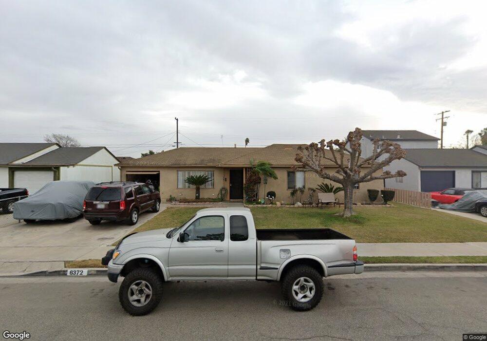
6372 Shawnee Rd Westminster, CA 92683
Estimated Value: $866,564 - $1,028,000
4
Beds
2
Baths
1,237
Sq Ft
$780/Sq Ft
Est. Value
About This Home
This home is located at 6372 Shawnee Rd, Westminster, CA 92683 and is currently estimated at $965,141, approximately $780 per square foot. 6372 Shawnee Rd is a home located in Orange County with nearby schools including Finley Elementary, Johnson Middle, and Westminster High School.
Ownership History
Date
Name
Owned For
Owner Type
Purchase Details
Closed on
Mar 17, 2021
Sold by
Collins Michael G and Collins Patricia Anne
Bought by
Collins Michael G and Collins Patricia Anne
Current Estimated Value
Home Financials for this Owner
Home Financials are based on the most recent Mortgage that was taken out on this home.
Original Mortgage
$200,000
Interest Rate
2.8%
Mortgage Type
New Conventional
Purchase Details
Closed on
Jun 14, 2013
Sold by
Collins Michael G and Collins Patricia Ann
Bought by
Collins Michael G and Collins Patricia Ann
Create a Home Valuation Report for This Property
The Home Valuation Report is an in-depth analysis detailing your home's value as well as a comparison with similar homes in the area
Home Values in the Area
Average Home Value in this Area
Purchase History
| Date | Buyer | Sale Price | Title Company |
|---|---|---|---|
| Collins Michael G | -- | Title 365 | |
| Collins Michael G | -- | Accommodation |
Source: Public Records
Mortgage History
| Date | Status | Borrower | Loan Amount |
|---|---|---|---|
| Closed | Collins Michael G | $200,000 |
Source: Public Records
Tax History
| Year | Tax Paid | Tax Assessment Tax Assessment Total Assessment is a certain percentage of the fair market value that is determined by local assessors to be the total taxable value of land and additions on the property. | Land | Improvement |
|---|---|---|---|---|
| 2025 | $2,538 | $176,083 | $101,458 | $74,625 |
| 2024 | $2,538 | $172,631 | $99,469 | $73,162 |
| 2023 | $2,452 | $169,247 | $97,519 | $71,728 |
| 2022 | $2,406 | $165,929 | $95,607 | $70,322 |
| 2021 | $2,337 | $162,676 | $93,732 | $68,944 |
| 2020 | $2,312 | $161,008 | $92,770 | $68,238 |
| 2019 | $2,290 | $157,851 | $90,951 | $66,900 |
| 2018 | $2,285 | $154,756 | $89,167 | $65,589 |
| 2017 | $2,211 | $151,722 | $87,419 | $64,303 |
| 2016 | $2,152 | $148,748 | $85,705 | $63,043 |
| 2015 | $2,118 | $146,514 | $84,417 | $62,097 |
| 2014 | $2,074 | $143,644 | $82,763 | $60,881 |
Source: Public Records
Map
Nearby Homes
- 13036 Springarden Ln
- 6282 Cheyenne Dr
- 13161 Summit Cir
- 13352 Springdale St
- 6632 Trask Ave
- 6122 Anthony Ave
- 6071 Modoc Rd
- 6751 Klondike Ave
- 6091 Navajo Rd
- 6949 Danvers Dr
- 6848 Citriadora Ct
- 6216 Hefley St Unit 3
- 12552 Fieldstone Ln Unit 101
- 6971 Knollcrest Ln Unit 47
- 6952 Brightwood Ln Unit 3
- 6181 Lenore Ave
- 13722 Hammon Place
- 5382 Laverne Cir
- 12586 George Reyburn Rd
- 5302 Clark Cir
- 6382 Shawnee Rd
- 6362 Shawnee Rd
- 6371 Iroquois Rd
- 6361 Iroquois Rd
- 6381 Iroquois Rd
- 6392 Shawnee Rd
- 6352 Shawnee Rd
- 6371 Shawnee Rd
- 6381 Shawnee Rd
- 6361 Shawnee Rd
- 6351 Iroquois Rd
- 6391 Iroquois Rd
- 6391 Shawnee Rd
- 6351 Shawnee Rd
- 6412 Shawnee Rd
- 6342 Shawnee Rd
- 6411 Iroquois Rd
- 6341 Iroquois Rd
- 6372 Bannock Rd
- 6411 Shawnee Rd
Your Personal Tour Guide
Ask me questions while you tour the home.