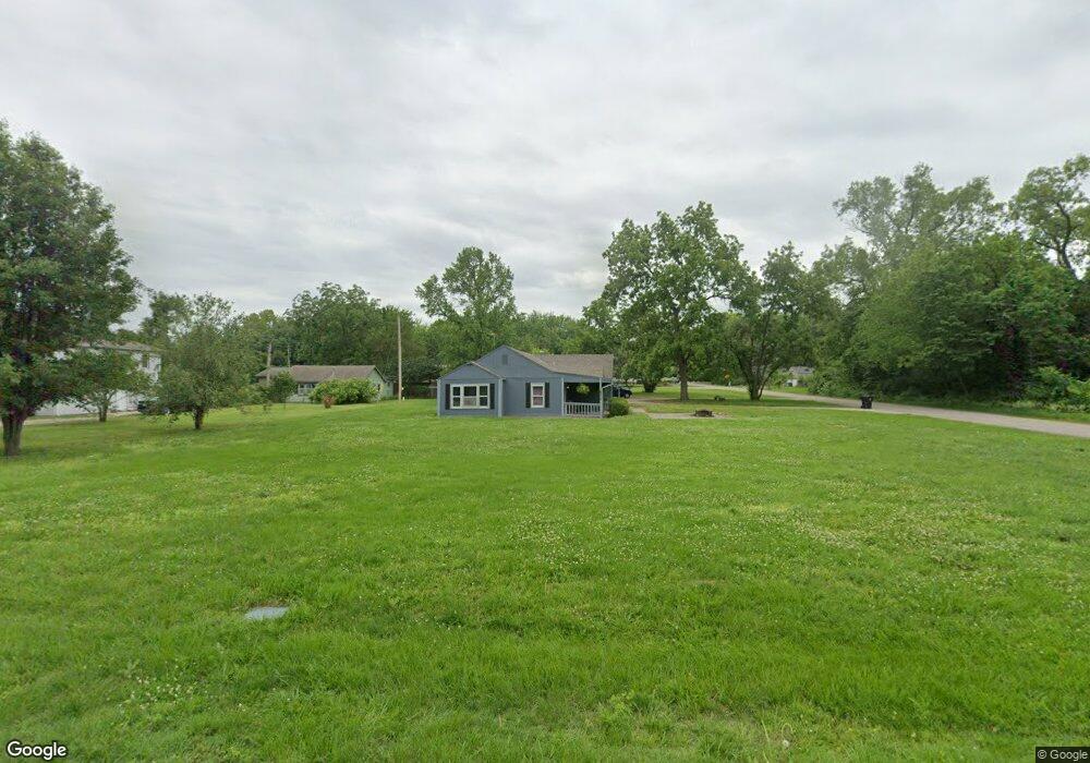
6373 SW 10th Ave Topeka, KS 66615
West Topeka NeighborhoodEstimated Value: $157,000 - $284,000
3
Beds
2
Baths
1,520
Sq Ft
$145/Sq Ft
Est. Value
About This Home
This home is located at 6373 SW 10th Ave, Topeka, KS 66615 and is currently estimated at $219,850, approximately $144 per square foot. 6373 SW 10th Ave is a home located in Shawnee County with nearby schools including Wanamaker Elementary School, Washburn Rural Middle School, and Washburn Rural High School.
Ownership History
Date
Name
Owned For
Owner Type
Purchase Details
Closed on
Jan 5, 2018
Sold by
Nichols John D
Bought by
Nichols Janet M
Current Estimated Value
Purchase Details
Closed on
Oct 11, 2006
Sold by
Noble Carl W and Noble Barbara A
Bought by
Reust Ronald W and Nichols Janet M
Home Financials for this Owner
Home Financials are based on the most recent Mortgage that was taken out on this home.
Original Mortgage
$52,000
Outstanding Balance
$30,995
Interest Rate
6.44%
Mortgage Type
Future Advance Clause Open End Mortgage
Estimated Equity
$188,855
Create a Home Valuation Report for This Property
The Home Valuation Report is an in-depth analysis detailing your home's value as well as a comparison with similar homes in the area
Home Values in the Area
Average Home Value in this Area
Purchase History
| Date | Buyer | Sale Price | Title Company |
|---|---|---|---|
| Nichols Janet M | -- | None Available | |
| Reust Ronald W | -- | Lawyers Title Of Topeka Inc |
Source: Public Records
Mortgage History
| Date | Status | Borrower | Loan Amount |
|---|---|---|---|
| Open | Reust Ronald W | $52,000 |
Source: Public Records
Tax History Compared to Growth
Tax History
| Year | Tax Paid | Tax Assessment Tax Assessment Total Assessment is a certain percentage of the fair market value that is determined by local assessors to be the total taxable value of land and additions on the property. | Land | Improvement |
|---|---|---|---|---|
| 2025 | $1,733 | $12,007 | -- | -- |
| 2023 | $1,733 | $11,541 | $0 | $0 |
| 2022 | $1,595 | $10,304 | $0 | $0 |
| 2021 | $1,178 | $7,569 | $0 | $0 |
| 2020 | $1,097 | $7,209 | $0 | $0 |
| 2019 | $1,099 | $7,209 | $0 | $0 |
| 2018 | $1,062 | $6,998 | $0 | $0 |
| 2017 | $1,054 | $6,861 | $0 | $0 |
| 2014 | $1,066 | $6,861 | $0 | $0 |
Source: Public Records
Map
Nearby Homes
- 1053 SW Harvey St
- 7027 SW 10th St
- 5639 SW West Dr
- 1306 SW Glendale Dr
- 5802 SW Sterling Ln
- 741 SW Mifflin Rd
- 5452 SW 12th Terrace Unit 3
- 5618 SW 14th St
- 5518 SW Avalon Ln
- 1717 SW Stone Crest Dr
- 1100 SW Amhurst Ct
- 1042 SW Amhurst Ct
- 1906 SW Village Dr
- 6445 SW 21st Terrace
- 613 SW Grand Ct
- 2222 SW Pondview Dr
- 1728 SW Fairlawn Rd
- Lot 4 & .5 of 3 SW Balmoral Ln
- Lot 2 SW Balmoral Ln Unit and east 1/2 of Lot
- Lot 17 SW Balmoral Ln
- 6352 SW 11th St
- 6369 SW 10th Ave
- 6350 SW 11th St
- 6403 SW 10th Ave
- 6351 SW 10th Ave
- 6362 SW 10th Ave
- 6366 SW 10th Ave
- 1101 SW Vitt Rd
- 6360 SW 10th Ave
- 1010 SW Marge Ct
- 1000 SW Marge Ct
- 1020 SW Marge Ct
- 6355 SW 11th St
- 6351 SW 11th St
- 6317 SW 10th Ave
- 6349 SW 11th St
- 1026 SW Marge Ct
- 6358 SW 10th Ave
- 6347 SW 11th St
- 1107 SW Vitt Rd