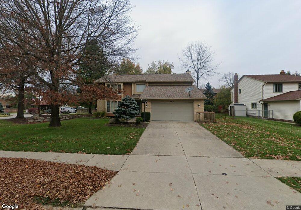
6373 Woodhawk Dr Cleveland, OH 44124
Estimated Value: $410,040 - $489,000
4
Beds
3
Baths
2,848
Sq Ft
$158/Sq Ft
Est. Value
About This Home
This home is located at 6373 Woodhawk Dr, Cleveland, OH 44124 and is currently estimated at $451,260, approximately $158 per square foot. 6373 Woodhawk Dr is a home located in Cuyahoga County with nearby schools including Mayfield High School, Gilmour Academy, and University School.
Ownership History
Date
Name
Owned For
Owner Type
Purchase Details
Closed on
Apr 7, 2016
Sold by
Shamis Aron and Shamis Frida
Bought by
Shamis Aaron and Shamis Frida
Current Estimated Value
Purchase Details
Closed on
Feb 26, 1988
Bought by
Shamis Aron
Purchase Details
Closed on
May 1, 1987
Bought by
Zaremba Properties Co
Purchase Details
Closed on
Jul 10, 1986
Bought by
Woodhawk Co
Purchase Details
Closed on
Sep 9, 1981
Bought by
Zaremba Properties East Co
Purchase Details
Closed on
Jan 1, 1980
Bought by
Paris Dev Corp
Create a Home Valuation Report for This Property
The Home Valuation Report is an in-depth analysis detailing your home's value as well as a comparison with similar homes in the area
Home Values in the Area
Average Home Value in this Area
Purchase History
| Date | Buyer | Sale Price | Title Company |
|---|---|---|---|
| Shamis Aaron | -- | Attorney | |
| Shamis Aron | $175,900 | -- | |
| Zaremba Properties Co | -- | -- | |
| Woodhawk Co | -- | -- | |
| Zaremba Properties East Co | -- | -- | |
| Paris Dev Corp | -- | -- |
Source: Public Records
Tax History Compared to Growth
Tax History
| Year | Tax Paid | Tax Assessment Tax Assessment Total Assessment is a certain percentage of the fair market value that is determined by local assessors to be the total taxable value of land and additions on the property. | Land | Improvement |
|---|---|---|---|---|
| 2024 | $7,911 | $131,250 | $21,140 | $110,110 |
| 2023 | $6,113 | $95,140 | $20,550 | $74,590 |
| 2022 | $6,304 | $95,130 | $20,550 | $74,590 |
| 2021 | $6,239 | $95,130 | $20,550 | $74,590 |
| 2020 | $6,565 | $92,370 | $19,950 | $72,420 |
| 2019 | $6,360 | $263,900 | $57,000 | $206,900 |
| 2018 | $5,839 | $92,370 | $19,950 | $72,420 |
| 2017 | $5,882 | $81,340 | $17,010 | $64,330 |
| 2016 | $5,837 | $81,340 | $17,010 | $64,330 |
| 2015 | $5,354 | $81,340 | $17,010 | $64,330 |
| 2014 | $5,393 | $81,340 | $17,010 | $64,330 |
Source: Public Records
Map
Nearby Homes
- 6344 Woodhawk Dr
- 220 Fox Hollow Dr Unit 308
- 140 Fox Hollow Dr Unit 201A
- 180 Fox Hollow Dr Unit 105
- 6419 Longridge Rd
- 200 Fox Hollow Dr Unit 100
- 200 Fox Hollow Dr Unit 104
- 6464 Woodhawk Dr
- 210 Teal Trace Unit 210
- 6132 Westerham Rd
- 6578 Gates Mills Blvd
- 1604 Fruitland Ave
- 1593 Woodhurst Ave
- VL Som Center Rd
- 46 Bridgeport Way
- 1542 Woodhurst Ave
- 43 Bridgeport Way
- 31799 Gates Mills Blvd
- 1520 Fruitland Ave
- 2565 Cedarwood Rd
- 6379 Woodhawk Dr
- 6385 Woodhawk Dr
- 100 Fox Hollow Dr Unit 201A
- 100 Fox Hollow Dr Unit 403
- 100 Fox Hollow Dr Unit 207
- 100 Fox Hollow Dr Unit 303C
- 100 Fox Hollow Dr Unit 404B
- 100 Fox Hollow Dr
- 100 Fox Hollow Dr
- 100 Fox Hollow Dr Unit 3054
- 100 Fox Hollow Dr
- 100 Fox Hollow Dr
- 100 Fox Hollow Dr
- 100 Fox Hollow Dr
- 100 Fox Hollow Dr
- 100 Fox Hollow Dr Unit 302C1
- 100 Fox Hollow Dr
- 100 Fox Hollow Dr
- 100 Fox Hollow Dr
- 100 Fox Hollow Dr