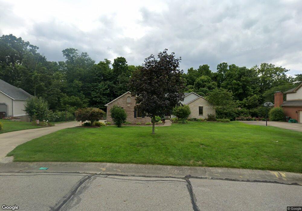
6379 Sherrybrook Dr Cincinnati, OH 45248
Estimated Value: $516,000 - $584,809
4
Beds
3
Baths
3,804
Sq Ft
$148/Sq Ft
Est. Value
About This Home
This home is located at 6379 Sherrybrook Dr, Cincinnati, OH 45248 and is currently estimated at $561,202, approximately $147 per square foot. 6379 Sherrybrook Dr is a home located in Hamilton County with nearby schools including John Foster Dulles Elementary School, Rapid Run Middle School, and Oak Hills High School.
Ownership History
Date
Name
Owned For
Owner Type
Purchase Details
Closed on
Feb 15, 2000
Sold by
Kern Linda S
Bought by
Sneed Jeffery T and Sneed Michele C
Current Estimated Value
Home Financials for this Owner
Home Financials are based on the most recent Mortgage that was taken out on this home.
Original Mortgage
$160,000
Outstanding Balance
$46,173
Interest Rate
7.25%
Estimated Equity
$515,029
Purchase Details
Closed on
Apr 13, 1998
Sold by
Kimberly Michael A and Kimberly Julie A
Bought by
Kern Linda
Purchase Details
Closed on
Sep 3, 1997
Sold by
Campbell Alexander W and Campbell Patricia A
Bought by
Kern Linda S
Create a Home Valuation Report for This Property
The Home Valuation Report is an in-depth analysis detailing your home's value as well as a comparison with similar homes in the area
Home Values in the Area
Average Home Value in this Area
Purchase History
| Date | Buyer | Sale Price | Title Company |
|---|---|---|---|
| Sneed Jeffery T | $264,500 | -- | |
| Kern Linda | $17,000 | Superior Title Agency Inc | |
| Kern Linda S | $1,000 | Superior Land Title Agency I | |
| Kern Linda S | $17,500 | Superior Land Title Agency I |
Source: Public Records
Mortgage History
| Date | Status | Borrower | Loan Amount |
|---|---|---|---|
| Open | Sneed Jeffery T | $160,000 |
Source: Public Records
Tax History
| Year | Tax Paid | Tax Assessment Tax Assessment Total Assessment is a certain percentage of the fair market value that is determined by local assessors to be the total taxable value of land and additions on the property. | Land | Improvement |
|---|---|---|---|---|
| 2025 | $9,354 | $176,373 | $32,022 | $144,351 |
| 2024 | $9,116 | $176,373 | $32,022 | $144,351 |
| 2023 | $9,115 | $176,373 | $32,022 | $144,351 |
| 2022 | $7,792 | $127,478 | $27,591 | $99,887 |
| 2021 | $7,006 | $127,478 | $27,591 | $99,887 |
| 2020 | $7,083 | $127,478 | $27,591 | $99,887 |
| 2019 | $6,937 | $113,817 | $24,633 | $89,184 |
| 2018 | $6,944 | $113,817 | $24,633 | $89,184 |
| 2017 | $6,557 | $113,817 | $24,633 | $89,184 |
| 2016 | $6,776 | $117,457 | $27,255 | $90,202 |
| 2015 | $6,823 | $117,457 | $27,255 | $90,202 |
| 2014 | $6,562 | $112,897 | $27,255 | $85,642 |
| 2013 | $6,200 | $114,037 | $27,531 | $86,506 |
Source: Public Records
Map
Nearby Homes
- 2 Ebenezer Rd
- 6214 Berauer Rd
- 6684 Powner Farm Dr
- 3905 Springoak Dr
- 3589 Eyrich Rd
- 3570 Eyrich Rd
- 3454 Eyrich Rd
- 1 Hutchinson Rd
- 4181 Hutchinson Rd
- 3311 Starhaven Trail
- 5775 Irwin Dr
- 3986 Trailside Dr
- 3994 Trailside Dr
- 3855 Ridgecombe Dr
- 4008 Trailside Dr
- 5696 Biscayne Ave
- 3105 Laurel Hill Ln
- 4017 Trailside Dr
- 5913 Countryhills Dr
- 5809 Harborpoint Dr
- 6387 Sherrybrook Dr
- 6373 Sherrybrook Dr
- 6397 Sherrybrook Dr
- 6363 Sherrybrook Dr
- 6386 Sherrybrook Dr
- 6374 Sherrybrook Dr
- 6405 Sherrybrook Dr
- 6398 Sherrybrook Dr
- 3593 Rickshire Dr
- 6355 Sherrybrook Dr
- 6415 Sherrybrook Dr
- 6408 Sherrybrook Dr
- 6369 Suehaven Ct
- 3557 Rickshire Dr
- 6375 Suehaven Ct
- 6427 Sherrybrook Dr
- 3580 Rickshire Dr
- 3611 Rickshire Dr
- 22 Grandin Woods Dr
- 19 Grandin Woods Dr
Your Personal Tour Guide
Ask me questions while you tour the home.