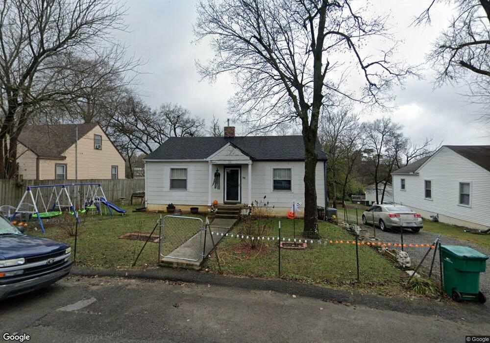
638 6th Ave N Lewisburg, TN 37091
Estimated Value: $153,438 - $208,000
--
Bed
1
Bath
1,124
Sq Ft
$161/Sq Ft
Est. Value
About This Home
This home is located at 638 6th Ave N, Lewisburg, TN 37091 and is currently estimated at $181,360, approximately $161 per square foot. 638 6th Ave N is a home located in Marshall County with nearby schools including Oak Grove Elementary School, Marshall Elementary School, and Westhills Elementary School.
Ownership History
Date
Name
Owned For
Owner Type
Purchase Details
Closed on
Jan 14, 2011
Sold by
Willoughby Michael E
Bought by
Thompson Marvin
Current Estimated Value
Purchase Details
Closed on
Dec 27, 2010
Sold by
Kekich Benjamin A
Bought by
Willoughby Michael E
Purchase Details
Closed on
Oct 10, 1997
Sold by
Kekich Benjamin A
Bought by
Richardson Rex A and Richardson Judy
Purchase Details
Closed on
Aug 29, 1991
Bought by
Kekick Benjamin A
Purchase Details
Closed on
Jun 8, 1990
Bought by
Smith Christopher Arnold and Smith Linda Mae
Purchase Details
Closed on
Aug 14, 1989
Bought by
Smith Arnold and Smith Mary
Create a Home Valuation Report for This Property
The Home Valuation Report is an in-depth analysis detailing your home's value as well as a comparison with similar homes in the area
Home Values in the Area
Average Home Value in this Area
Purchase History
| Date | Buyer | Sale Price | Title Company |
|---|---|---|---|
| Thompson Marvin | $15,000 | -- | |
| Willoughby Michael E | $11,000 | -- | |
| Richardson Rex A | $155,000 | -- | |
| Kekick Benjamin A | $28,000 | -- | |
| Smith Christopher Arnold | $24,000 | -- | |
| Smith Arnold | $22,800 | -- |
Source: Public Records
Tax History Compared to Growth
Tax History
| Year | Tax Paid | Tax Assessment Tax Assessment Total Assessment is a certain percentage of the fair market value that is determined by local assessors to be the total taxable value of land and additions on the property. | Land | Improvement |
|---|---|---|---|---|
| 2024 | -- | $20,525 | $2,500 | $18,025 |
| 2023 | $637 | $20,525 | $2,500 | $18,025 |
| 2022 | $637 | $20,525 | $2,500 | $18,025 |
| 2021 | $554 | $11,925 | $1,250 | $10,675 |
| 2020 | $543 | $11,675 | $1,250 | $10,425 |
| 2019 | $525 | $11,675 | $1,250 | $10,425 |
| 2018 | $519 | $11,675 | $1,250 | $10,425 |
| 2017 | $519 | $11,675 | $1,250 | $10,425 |
| 2016 | $261 | $5,100 | $1,250 | $3,850 |
| 2015 | $238 | $5,100 | $1,250 | $3,850 |
| 2014 | $238 | $5,100 | $1,250 | $3,850 |
Source: Public Records
Map
Nearby Homes
- 630 6th Ave N
- 627 6th Ave N
- 594 5th Ave N
- 319 Greenwood St
- 0 New Lake Rd Unit RTC3030964
- 231 Greenwood St
- 726 Thomas Ave
- 638 2nd Ave N
- 543 2nd Ave N
- 316 Haynes St
- 215 5th Ave N
- 416 1st Ave N
- 1600 Larry Dospil Dr
- 518 Maple St
- 525 Maple St
- 1144 Apple St
- 610 Forrest St
- 1025 Glenn Ave
- 319 E Hill Ave
- 1111 W End Ave N
- 646 6th Ave N
- 654 6th Ave N
- 576 Franklin Ave
- 607 Mccord St
- 570 Franklin Ave
- 564 Franklin Ave
- 602 Franklin Ave
- 612 Franklin Ave
- 617 Mccord St
- 488 Shannon Ct
- 485 Shannon Ct
- 617 7th Ave N
- 622 Franklin Ave
- 486 Shannon Ct Unit 7
- 483 Shannon Ct
- 623 Franklin Ave
- 620 Mccord St
- 557 Franklin Ave
- 484 Shannon Ct
- 481 Shannon Ct