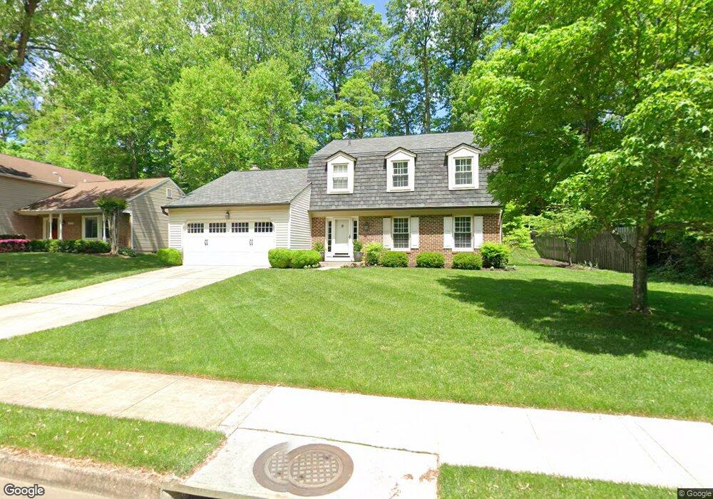
6384 Phillip Ct Springfield, VA 22152
Estimated Value: $907,898 - $1,016,000
5
Beds
4
Baths
2,009
Sq Ft
$475/Sq Ft
Est. Value
About This Home
This home is located at 6384 Phillip Ct, Springfield, VA 22152 and is currently estimated at $954,725, approximately $475 per square foot. 6384 Phillip Ct is a home located in Fairfax County with nearby schools including Rolling Valley Elementary School, Irving Middle School, and West Springfield High School.
Ownership History
Date
Name
Owned For
Owner Type
Purchase Details
Closed on
Jun 4, 2009
Sold by
Woodzell Stephen R
Bought by
Pastel Teague A
Current Estimated Value
Home Financials for this Owner
Home Financials are based on the most recent Mortgage that was taken out on this home.
Original Mortgage
$510,750
Outstanding Balance
$323,742
Interest Rate
4.83%
Mortgage Type
VA
Estimated Equity
$630,983
Create a Home Valuation Report for This Property
The Home Valuation Report is an in-depth analysis detailing your home's value as well as a comparison with similar homes in the area
Home Values in the Area
Average Home Value in this Area
Purchase History
| Date | Buyer | Sale Price | Title Company |
|---|---|---|---|
| Pastel Teague A | $500,000 | -- |
Source: Public Records
Mortgage History
| Date | Status | Borrower | Loan Amount |
|---|---|---|---|
| Open | Pastel Teague A | $510,750 |
Source: Public Records
Tax History
| Year | Tax Paid | Tax Assessment Tax Assessment Total Assessment is a certain percentage of the fair market value that is determined by local assessors to be the total taxable value of land and additions on the property. | Land | Improvement |
|---|---|---|---|---|
| 2025 | $10,238 | $904,460 | $309,000 | $595,460 |
| 2024 | $10,238 | $883,730 | $309,000 | $574,730 |
| 2023 | $8,004 | $709,220 | $259,000 | $450,220 |
| 2022 | $7,718 | $674,980 | $239,000 | $435,980 |
| 2021 | $7,241 | $617,050 | $214,000 | $403,050 |
| 2020 | $7,229 | $610,850 | $214,000 | $396,850 |
| 2019 | $6,990 | $590,590 | $209,000 | $381,590 |
| 2018 | $6,709 | $583,430 | $209,000 | $374,430 |
| 2017 | $6,533 | $562,700 | $199,000 | $363,700 |
| 2016 | $6,437 | $555,640 | $199,000 | $356,640 |
Source: Public Records
Map
Nearby Homes
- 6703 Greenview Ln
- 8347 Carrleigh Pkwy
- 6606 Huntsman Blvd
- 6102 Sherborn Ln
- 6246 Hillside Rd
- 8674 Center Rd Unit 1
- 6815 Rolling Rd
- 8600 Kentford Dr
- 6143 Green Hollow Ct
- 6020 Forrest Hollow Ln
- 6427 Old Scotts Ct
- 8905 Side Saddle Rd
- 7105 Galgate Dr
- 7116 Hadlow Ct
- 6025 Greeley Blvd
- 8100 Langbrook Rd
- 8104 Viola St
- 8218 Carrleigh Pkwy Unit 10
- 8526 Forrester Blvd Unit 890
- 8353D Dunham Ct Unit 642
- 6386 Phillip Ct
- 6382 Phillip Ct
- 6388 Phillip Ct
- 6381 English Ivy Way
- 6383 English Ivy Way
- 6379 English Ivy Way
- 6385 English Ivy Way
- 6389 Phillip Ct
- 6387 English Ivy Way
- 6389 English Ivy Way
- 6391 English Ivy Way
- 6377 Phillip Ct
- 6393 English Ivy Way
- 6391 Phillip Ct
- 6330 Millwood Ct
- 6390 Phillip Ct
- 6378 Phillip Ct
- 6395 English Ivy Way
- 6328 Millwood Ct
- 6377 English Ivy Way