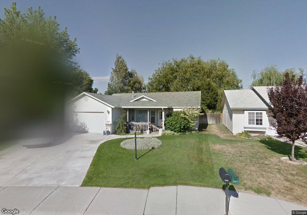
6387 N Fairfax Ave Boise, ID 83714
Northwest NeighborhoodEstimated Value: $443,581 - $485,000
3
Beds
2
Baths
1,499
Sq Ft
$308/Sq Ft
Est. Value
About This Home
This home is located at 6387 N Fairfax Ave, Boise, ID 83714 and is currently estimated at $461,645, approximately $307 per square foot. 6387 N Fairfax Ave is a home located in Ada County with nearby schools including Shadow Hills Elementary School, Riverglen Junior High School, and Capital High School.
Ownership History
Date
Name
Owned For
Owner Type
Purchase Details
Closed on
Apr 29, 2024
Sold by
Nelson Carol S
Bought by
Carol Sue Nelson Living Trust and Nelson
Current Estimated Value
Purchase Details
Closed on
Dec 16, 1999
Sold by
Belvoir Tanna T and Belvoir Rick
Bought by
Nelson Carol S
Home Financials for this Owner
Home Financials are based on the most recent Mortgage that was taken out on this home.
Original Mortgage
$82,700
Interest Rate
7.82%
Mortgage Type
Purchase Money Mortgage
Create a Home Valuation Report for This Property
The Home Valuation Report is an in-depth analysis detailing your home's value as well as a comparison with similar homes in the area
Home Values in the Area
Average Home Value in this Area
Purchase History
| Date | Buyer | Sale Price | Title Company |
|---|---|---|---|
| Carol Sue Nelson Living Trust | -- | None Listed On Document | |
| Nelson Carol S | -- | Stewart Title |
Source: Public Records
Mortgage History
| Date | Status | Borrower | Loan Amount |
|---|---|---|---|
| Previous Owner | Nelson Carol S | $82,700 |
Source: Public Records
Tax History Compared to Growth
Tax History
| Year | Tax Paid | Tax Assessment Tax Assessment Total Assessment is a certain percentage of the fair market value that is determined by local assessors to be the total taxable value of land and additions on the property. | Land | Improvement |
|---|---|---|---|---|
| 2025 | $2,214 | $410,300 | -- | -- |
| 2024 | $1,961 | $395,200 | -- | -- |
| 2023 | $2,373 | $372,200 | $0 | $0 |
| 2022 | $2,857 | $453,000 | $0 | $0 |
| 2021 | $2,467 | $349,600 | $0 | $0 |
| 2020 | $2,091 | $275,200 | $0 | $0 |
| 2019 | $2,263 | $266,000 | $0 | $0 |
| 2018 | $1,841 | $220,600 | $0 | $0 |
| 2017 | $1,353 | $168,100 | $0 | $0 |
| 2016 | $1,239 | $150,200 | $0 | $0 |
| 2015 | $1,200 | $142,100 | $0 | $0 |
| 2012 | -- | $100,900 | $0 | $0 |
Source: Public Records
Map
Nearby Homes
- 7827 W Gillis St
- 8220 W Caswell St
- 8056 W Manassas Ln
- 8028 N Manassas Ln
- 7810 W Peterson St
- 7714 N Robson Ave
- 5657 Sudley Ln
- 5651 Sudley Ln
- 7814 W Manassas
- 7100 W Limelight St
- 9351 W Sooty Grouse Ct
- 7604 N Ferris Ave
- 7652 N Ferris Ave
- 7180 W Tobi Ct
- 7195 W Rygate Dr
- 7254 W Rygate Dr
- 7260 W Rygate Dr
- 7248 W Rygate Dr
- 7242 W Rygate Dr
- 7234 W Rygate Dr
- 8049 W Gillis St
- 6439 N Fairfax Ave
- 8037 W Gillis St
- 6475 N Fairfax Ave
- 8025 W Gillis St
- 8014 W Gillis St
- 8013 W Gillis St
- 6352 Roe St
- 8015 W Whittaker St
- 7992 W Gillis St
- 7991 W Gillis St
- 8088 Pocono Ln
- 7993 W Whittaker St
- 8038 W Whittaker St
- 8024 W Pocono Ln
- 7984 W Gillis St
- 8024 Pocono Ln
- 7985 W Gillis St
- 8026 W Whittaker St