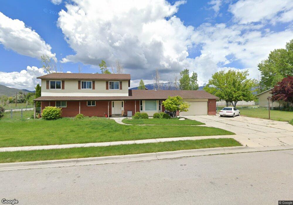
6388 W 10570 N Highland, UT 84003
Estimated Value: $863,000 - $1,166,000
8
Beds
5
Baths
4,270
Sq Ft
$234/Sq Ft
Est. Value
About This Home
This home is located at 6388 W 10570 N, Highland, UT 84003 and is currently estimated at $999,723, approximately $234 per square foot. 6388 W 10570 N is a home located in Utah County with nearby schools including Highland Elementary School, Mountain Ridge Junior High School, and Lone Peak High School.
Ownership History
Date
Name
Owned For
Owner Type
Purchase Details
Closed on
Mar 31, 2005
Sold by
Hall Bennie R and Hall Beverly L
Bought by
Allen Mark D and Allen Anita W
Current Estimated Value
Home Financials for this Owner
Home Financials are based on the most recent Mortgage that was taken out on this home.
Original Mortgage
$226,400
Outstanding Balance
$116,756
Interest Rate
5.77%
Mortgage Type
New Conventional
Estimated Equity
$882,967
Purchase Details
Closed on
May 18, 1998
Sold by
Dowden Shadric A and Dowden Ellen G
Bought by
Hall Bennie R
Create a Home Valuation Report for This Property
The Home Valuation Report is an in-depth analysis detailing your home's value as well as a comparison with similar homes in the area
Home Values in the Area
Average Home Value in this Area
Purchase History
| Date | Buyer | Sale Price | Title Company |
|---|---|---|---|
| Allen Mark D | -- | Backman Stewart Title Servic | |
| Hall Bennie R | -- | Provo Land Title |
Source: Public Records
Mortgage History
| Date | Status | Borrower | Loan Amount |
|---|---|---|---|
| Open | Allen Mark D | $226,400 | |
| Closed | Allen Mark D | $226,400 |
Source: Public Records
Tax History Compared to Growth
Tax History
| Year | Tax Paid | Tax Assessment Tax Assessment Total Assessment is a certain percentage of the fair market value that is determined by local assessors to be the total taxable value of land and additions on the property. | Land | Improvement |
|---|---|---|---|---|
| 2025 | $3,372 | $433,895 | $353,000 | $435,900 |
| 2024 | $3,372 | $416,515 | $0 | $0 |
| 2023 | $3,225 | $429,715 | $0 | $0 |
| 2022 | $3,020 | $403,920 | $0 | $0 |
| 2021 | $2,721 | $523,700 | $200,200 | $323,500 |
| 2020 | $2,571 | $485,200 | $174,100 | $311,100 |
| 2019 | $2,303 | $454,600 | $174,100 | $280,500 |
| 2018 | $2,160 | $405,300 | $161,400 | $243,900 |
| 2017 | $2,034 | $208,890 | $0 | $0 |
| 2016 | -- | $201,355 | $0 | $0 |
| 2015 | $2,003 | $177,705 | $0 | $0 |
| 2014 | $1,833 | $161,150 | $0 | $0 |
Source: Public Records
Map
Nearby Homes
- 6373 W 10500 N
- 10434 N 6400 W
- 6372 W 10400 N
- 6271 W 10830 St N
- 6399 W 10150 N
- 10818 N 6000 W
- 6190 W 10050 N
- 11337 N 5950 W Unit 7
- 1610 E Center Pointe Dr
- 1602 E Center Pointe Dr
- 1602 E Center Pointe Dr Unit 1
- 9924 N 6630 W Unit 9
- 11124 N 6000 W
- 9967 N 6670 W
- 11248 Hawkstone Way Unit 109
- 6024 Hawkstone Way Unit 108
- 11228 Hawkstone Way Unit 110
- 10197 N 5750 W
- 5973 W 9960 N
- 6692 W 9770 N
- 6368 W 10570 N
- 6379 W 10630 N
- 6389 W 10570 N
- 10585 N 6400 W
- 6369 W 10570 N
- 6349 W 10630 N
- 10565 N 6400 W
- 10555 N 6400 W
- 10550 N 6400 W
- 6349 W 10570 N
- 6384 W 10500 N
- 6328 W 10570 N
- 6362 W 10500 N
- 6327 W 10630 N
- 6377 W 10670 N
- 10582 Avery Ave
- 10582 N Avery Ave
- 10648 N 6400 St W
- 10529 N 6400 W
- 6297 W 10570 N