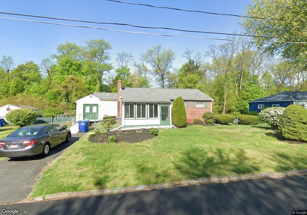
639 Devon Rd Moorestown, NJ 08057
Estimated Value: $451,958 - $497,000
Studio
--
Bath
1,504
Sq Ft
$320/Sq Ft
Est. Value
About This Home
This home is located at 639 Devon Rd, Moorestown, NJ 08057 and is currently estimated at $481,740, approximately $320 per square foot. 639 Devon Rd is a home located in Burlington County with nearby schools including George C. Baker Elementary School, Moorestown Upper Elementary School, and William Allen Middle School.
Ownership History
Date
Name
Owned For
Owner Type
Purchase Details
Closed on
Jul 11, 2024
Sold by
Fialkow Martin B
Bought by
Ginley John J and Sacalis Loreen L
Current Estimated Value
Home Financials for this Owner
Home Financials are based on the most recent Mortgage that was taken out on this home.
Original Mortgage
$413,250
Outstanding Balance
$408,314
Interest Rate
6.99%
Mortgage Type
New Conventional
Estimated Equity
$73,426
Purchase Details
Closed on
Aug 29, 1986
Bought by
Fialkow Martin B and Fialkow Joyce A
Create a Home Valuation Report for This Property
The Home Valuation Report is an in-depth analysis detailing your home's value as well as a comparison with similar homes in the area
Home Values in the Area
Average Home Value in this Area
Purchase History
| Date | Buyer | Sale Price | Title Company |
|---|---|---|---|
| Ginley John J | $435,000 | Southern United Title | |
| Fialkow Martin B | $119,000 | -- |
Source: Public Records
Mortgage History
| Date | Status | Borrower | Loan Amount |
|---|---|---|---|
| Open | Ginley John J | $413,250 |
Source: Public Records
Tax History
| Year | Tax Paid | Tax Assessment Tax Assessment Total Assessment is a certain percentage of the fair market value that is determined by local assessors to be the total taxable value of land and additions on the property. | Land | Improvement |
|---|---|---|---|---|
| 2025 | $6,807 | $238,100 | $137,300 | $100,800 |
| 2024 | $6,603 | $238,100 | $137,300 | $100,800 |
| 2023 | $6,603 | $238,100 | $137,300 | $100,800 |
| 2022 | $6,569 | $238,100 | $137,300 | $100,800 |
| 2021 | $6,034 | $238,100 | $137,300 | $100,800 |
| 2020 | $6,443 | $238,100 | $137,300 | $100,800 |
| 2019 | $6,326 | $238,100 | $137,300 | $100,800 |
| 2018 | $6,141 | $238,100 | $137,300 | $100,800 |
| 2017 | $6,181 | $238,100 | $137,300 | $100,800 |
| 2016 | $6,153 | $238,100 | $137,300 | $100,800 |
| 2015 | $6,072 | $238,100 | $137,300 | $100,800 |
| 2014 | $5,774 | $238,100 | $137,300 | $100,800 |
Source: Public Records
Map
Nearby Homes
- 206 E Camden Ave
- 149 Chalkboard Ct
- 141 Chalkboard Ct Unit 141
- 5 Vincent Way
- 27 Domenica Dr
- 21 N Lenola Rd
- 126 S Lenola Rd
- 93 Westbrook Dr
- 11 Errickson Ave
- 15 Circle Dr
- 601 Stratford Dr
- 620 N Lincoln Ave
- 106 Pine St
- 401 W 3rd St
- 307 Fairview Ave
- 444 Shady Ln
- 115 E Kings Hwy Unit 187
- 115 E Kings Hwy Unit 125
- 26 Morris Ave
- 543 Bethel Ave
- 637 Devon Rd
- 710 Bowling Green
- 635 Devon Rd
- 711 E Camden Ave
- 711 Bowling Green
- 708 Bowling Green
- 633 Devon Rd
- 709 E Camden Ave
- 709 Bowling Green
- 710 Manor Terrace
- 706 Bowling Green
- 707 E Camden Ave
- 631 Devon Rd
- 708 Manor Terrace
- 707 Bowling Green
- 708 E Camden Ave
- 704 Bowling Green
- 705 E Camden Ave
- 706 Manor Terrace
- 705 Bowling Green
Your Personal Tour Guide
Ask me questions while you tour the home.