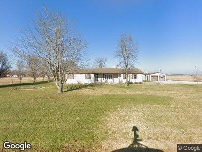
639 Red Stripe Rd Sandoval, IL 62882
Estimated Value: $153,230 - $204,000
--
Bed
--
Bath
--
Sq Ft
1.05
Acres
About This Home
This home is located at 639 Red Stripe Rd, Sandoval, IL 62882 and is currently estimated at $184,058. 639 Red Stripe Rd is a home located in Marion County with nearby schools including Sandoval Elementary School and Sandoval Jr High School.
Ownership History
Date
Name
Owned For
Owner Type
Purchase Details
Closed on
Nov 25, 2019
Sold by
Patterson Andrew George and Patterson Jaymee Lee
Bought by
Parson Chad Darren and Parson Kathy Ann
Current Estimated Value
Home Financials for this Owner
Home Financials are based on the most recent Mortgage that was taken out on this home.
Original Mortgage
$161,029
Interest Rate
4.25%
Mortgage Type
FHA
Purchase Details
Closed on
Aug 30, 2016
Sold by
Rhodes Jason M and Rhodes Stephanie M
Bought by
Patterson Andrew G
Home Financials for this Owner
Home Financials are based on the most recent Mortgage that was taken out on this home.
Original Mortgage
$137,580
Interest Rate
3.45%
Mortgage Type
VA
Create a Home Valuation Report for This Property
The Home Valuation Report is an in-depth analysis detailing your home's value as well as a comparison with similar homes in the area
Home Values in the Area
Average Home Value in this Area
Purchase History
| Date | Buyer | Sale Price | Title Company |
|---|---|---|---|
| Parson Chad Darren | $164,000 | Quad County Title | |
| Patterson Andrew G | $145,000 | -- |
Source: Public Records
Mortgage History
| Date | Status | Borrower | Loan Amount |
|---|---|---|---|
| Open | Parson Kathy Ann | $25,528 | |
| Closed | Parson Chad Darren | $16,313 | |
| Open | Parson Chad Darren | $160,434 | |
| Closed | Parson Chad Darren | $160,434 | |
| Closed | Parson Chad Darren | $161,029 | |
| Previous Owner | Patterson Andrew G | $137,580 | |
| Previous Owner | Rhodes Jason Mark | $120,000 | |
| Previous Owner | Rhodes Jason M | $50,000 |
Source: Public Records
Tax History Compared to Growth
Tax History
| Year | Tax Paid | Tax Assessment Tax Assessment Total Assessment is a certain percentage of the fair market value that is determined by local assessors to be the total taxable value of land and additions on the property. | Land | Improvement |
|---|---|---|---|---|
| 2023 | $3,082 | $45,830 | $4,280 | $41,550 |
| 2022 | $2,876 | $41,660 | $3,890 | $37,770 |
| 2021 | $2,898 | $38,940 | $3,640 | $35,300 |
| 2020 | $2,858 | $37,770 | $3,530 | $34,240 |
| 2019 | $645 | $36,390 | $3,400 | $32,990 |
| 2018 | $2,583 | $38,020 | $5,030 | $32,990 |
| 2017 | $2,754 | $37,270 | $4,930 | $32,340 |
| 2016 | $2,959 | $35,840 | $4,740 | $31,100 |
| 2015 | $29 | $35,840 | $4,740 | $31,100 |
| 2012 | $29 | $36,920 | $4,640 | $32,280 |
Source: Public Records
Map
Nearby Homes
- 507 E 12th St
- 1104 Van Buren Ave
- 000 S Mine St
- 315 S Main St
- 605 N Cedar St
- 0 N Jefferson St
- 00 N Jefferson St
- 631 Community Beach Rd
- 1503 Green Street Rd
- 223 N Broadway
- 117 N Morrison St
- 119 N Douglas St
- 2039 Shook Ln
- 224 S Broadway
- 408 W Kirkwood St
- 1541 Knight St
- 1831 Duck Ln
- 1427 N Elm St
- 102 Laury St
- 7 Phyllis Dr
- 639 Red Stripe Rd
- 695 Red Stripe Rd
- 627 Red Stripe Rd
- 3220 Old 51 Rd
- 603 Red Stripe Rd
- 3232 Old 51 Rd
- 3244 Old 51 Rd
- 3221 Old 51 Rd
- 3233 Old 51 Rd
- 3239 Old 51 Rd
- 717 Red Stripe Rd
- 3269 Old 51 Rd
- 3280 Old 51 Rd
- 3280 Old 51 Rd
- 3275 Old 51 Rd
- 3281 Old 51 Rd
- 3100 Old 51 Rd
- 3328 Old 51 Rd
- 3101 Old 51 Rd
- 3119 Old 51 Rd