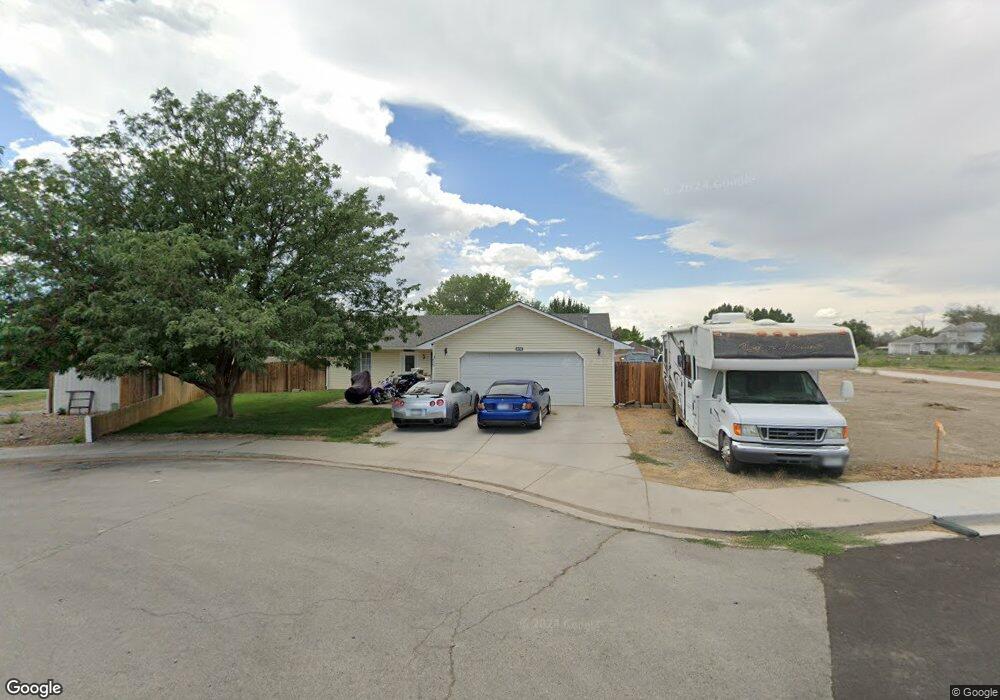
639 Round Table Rd Grand Junction, CO 81504
Estimated Value: $361,859 - $386,000
3
Beds
2
Baths
1,400
Sq Ft
$269/Sq Ft
Est. Value
About This Home
This home is located at 639 Round Table Rd, Grand Junction, CO 81504 and is currently estimated at $376,965, approximately $269 per square foot. 639 Round Table Rd is a home located in Mesa County with nearby schools including Thunder Mountain Elementary School, Grand Mesa Middle School, and Central High School.
Ownership History
Date
Name
Owned For
Owner Type
Purchase Details
Closed on
Feb 12, 2007
Sold by
Martsolf William A and Martsolf Lori A
Bought by
Martsolf Lori A
Current Estimated Value
Home Financials for this Owner
Home Financials are based on the most recent Mortgage that was taken out on this home.
Original Mortgage
$153,500
Outstanding Balance
$103,272
Interest Rate
8.5%
Mortgage Type
New Conventional
Estimated Equity
$273,693
Purchase Details
Closed on
Sep 12, 2001
Sold by
Davis John
Bought by
Martsolf William A and Martsolf Lori A
Home Financials for this Owner
Home Financials are based on the most recent Mortgage that was taken out on this home.
Original Mortgage
$122,350
Interest Rate
6.88%
Mortgage Type
VA
Purchase Details
Closed on
Oct 11, 2000
Sold by
Lee Homes Inc
Bought by
Davis John
Home Financials for this Owner
Home Financials are based on the most recent Mortgage that was taken out on this home.
Original Mortgage
$108,800
Interest Rate
7.96%
Create a Home Valuation Report for This Property
The Home Valuation Report is an in-depth analysis detailing your home's value as well as a comparison with similar homes in the area
Home Values in the Area
Average Home Value in this Area
Purchase History
| Date | Buyer | Sale Price | Title Company |
|---|---|---|---|
| Martsolf Lori A | -- | Fahtco | |
| Martsolf William A | $119,999 | Meridian Land Title Llc | |
| Davis John | -- | -- |
Source: Public Records
Mortgage History
| Date | Status | Borrower | Loan Amount |
|---|---|---|---|
| Open | Martsolf Lori A | $153,500 | |
| Closed | Martsolf William A | $122,350 | |
| Previous Owner | Davis John | $108,800 |
Source: Public Records
Tax History
| Year | Tax Paid | Tax Assessment Tax Assessment Total Assessment is a certain percentage of the fair market value that is determined by local assessors to be the total taxable value of land and additions on the property. | Land | Improvement |
|---|---|---|---|---|
| 2024 | $1,402 | $18,770 | $4,760 | $14,010 |
| 2023 | $1,402 | $18,770 | $4,760 | $14,010 |
| 2022 | $1,302 | $17,020 | $4,520 | $12,500 |
| 2021 | $1,306 | $17,510 | $4,650 | $12,860 |
| 2020 | $1,123 | $15,250 | $3,580 | $11,670 |
| 2019 | $1,066 | $15,250 | $3,580 | $11,670 |
| 2018 | $1,019 | $13,250 | $3,240 | $10,010 |
| 2016 | $896 | $13,380 | $3,180 | $10,200 |
Source: Public Records
Map
Nearby Homes
- 636 Rock Eagle Rd Unit B
- 3022 Country Rd
- 3036 Kings Ct
- 644 Avalon Ct
- 3050 Lancelot Place
- 625 Sovereign Ln
- 657 Starlight Dr
- 612 1/2 Cottage Meadows Ct
- 635 Aspenwood Ln
- 3066 Thunderhead Way
- 3068 Thunder Cloud Dr
- 635 Anvil Way
- 624 Orange Grove Way
- 639 Aspenwood Ln
- 634 Anvil Way
- 3049 F 3 4 Rd
- 623 Thunder Ridge Dr
- 590 Seranade St
- 3010 F 3 4 Rd
- 634 Thunder Ct
- 640 Round Table Rd
- 638 Monarch Ct
- 637 Round Table Rd
- 640 Monarch Ct
- 636 Monarch Ct
- 632 Monarch Ct
- 635 Round Table Rd
- 638 Round Table Rd
- 642 Monarch Ct
- 634 Monarch Ct
- 634 Round Table Rd
- 641 Monarch Ct
- 3030 Milburn Dr
- 3028 Milburn Dr
- 637 Monarch Ct
- 630 Monarch Ct
- 636 Round Table Rd
- 639 Monarch Ct
- 635 Monarch Ct
- 3032 Milburn Ct
Your Personal Tour Guide
Ask me questions while you tour the home.