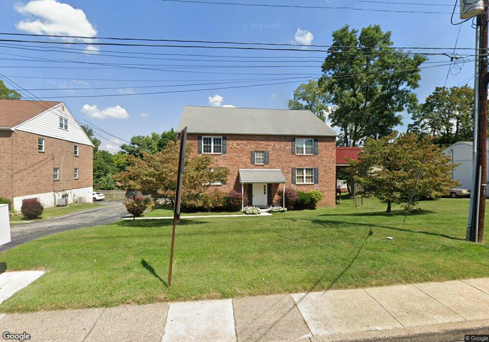
639 W Springfield Rd Unit A2 Springfield, PA 19064
Estimated Value: $304,000 - $347,000
2
Beds
2
Baths
1,434
Sq Ft
$223/Sq Ft
Est. Value
About This Home
This home is located at 639 W Springfield Rd Unit A2, Springfield, PA 19064 and is currently estimated at $320,084, approximately $223 per square foot. 639 W Springfield Rd Unit A2 is a home located in Delaware County with nearby schools including Springfield High School, St Francis Of Assisi School, and St Dorothy School.
Ownership History
Date
Name
Owned For
Owner Type
Purchase Details
Closed on
May 7, 2019
Sold by
Moon O Susan O and Moon Young O
Bought by
Moon O Susan O and Moon Young O
Current Estimated Value
Home Financials for this Owner
Home Financials are based on the most recent Mortgage that was taken out on this home.
Original Mortgage
$145,125
Outstanding Balance
$126,136
Interest Rate
3.65%
Mortgage Type
New Conventional
Estimated Equity
$193,948
Purchase Details
Closed on
Jan 25, 2007
Sold by
Elcock Claudius A R and Elcock Annie B
Bought by
Youngo Jun and Moon Susan
Home Financials for this Owner
Home Financials are based on the most recent Mortgage that was taken out on this home.
Original Mortgage
$148,000
Interest Rate
6.15%
Mortgage Type
Purchase Money Mortgage
Purchase Details
Closed on
Jul 29, 1996
Sold by
Fredrickson Edgar B and Fredrickson Kathryn V
Bought by
Elcock Claudius A R and Elcock Annie B
Create a Home Valuation Report for This Property
The Home Valuation Report is an in-depth analysis detailing your home's value as well as a comparison with similar homes in the area
Home Values in the Area
Average Home Value in this Area
Purchase History
| Date | Buyer | Sale Price | Title Company |
|---|---|---|---|
| Moon O Susan O | -- | None Available | |
| Youngo Jun | $185,000 | None Available | |
| Elcock Claudius A R | $114,000 | -- |
Source: Public Records
Mortgage History
| Date | Status | Borrower | Loan Amount |
|---|---|---|---|
| Open | Moon O Susan O | $145,125 | |
| Closed | Youngo Jun | $148,000 |
Source: Public Records
Tax History Compared to Growth
Tax History
| Year | Tax Paid | Tax Assessment Tax Assessment Total Assessment is a certain percentage of the fair market value that is determined by local assessors to be the total taxable value of land and additions on the property. | Land | Improvement |
|---|---|---|---|---|
| 2025 | $5,642 | $200,740 | $39,580 | $161,160 |
| 2024 | $5,642 | $200,740 | $39,580 | $161,160 |
| 2023 | $5,433 | $200,740 | $39,580 | $161,160 |
| 2022 | $5,315 | $200,740 | $39,580 | $161,160 |
| 2021 | $8,232 | $200,740 | $39,580 | $161,160 |
| 2020 | $4,967 | $109,620 | $34,420 | $75,200 |
| 2019 | $4,851 | $109,620 | $34,420 | $75,200 |
| 2018 | $4,781 | $109,620 | $0 | $0 |
| 2017 | $4,671 | $109,620 | $0 | $0 |
| 2016 | $602 | $109,620 | $0 | $0 |
| 2015 | $602 | $109,620 | $0 | $0 |
| 2014 | $602 | $109,620 | $0 | $0 |
Source: Public Records
Map
Nearby Homes
- 200 N State Rd
- 15 Pearson Dr
- 517 W Woodland Ave
- 232 S Highland Rd
- 201 S Highland Rd
- 165 Summit Rd
- 530 Hempstead Rd
- 341 Kennerly Rd
- 457 Kennerly Rd
- 247 Orchard Rd
- 464 Conard Dr
- 140 N Rolling Rd
- 89 Saxer Ave
- 499 Collins Dr
- 2605 Red Oak Cir
- 30 Wayne Ave
- 1300 Cable Hill Dr Unit 1300
- 224 Ballymore Rd
- 412 N Rolling Rd
- 658 W Rolling Rd
- 639 W Springfield Rd Unit A4
- 639 W Springfield Rd Unit A3
- 639 W Springfield Rd Unit A1
- 633 W Springfield Rd
- 641 W Springfield Rd Unit B4
- 641 W Springfield Rd Unit B3
- 641 W Springfield Rd Unit B2
- 641 W Springfield Rd Unit B1
- 641 W Springfield Rd
- 620 Foster Dr
- 624 Foster Dr
- 627 W Springfield Rd
- 646 W Springfield Rd
- 638 W Springfield Rd
- 616 Foster Dr
- 612 Foster Dr
- 628 Foster Dr
- 7 Curtis Rd
- 658 W Springfield Rd
- 6 Longview Dr