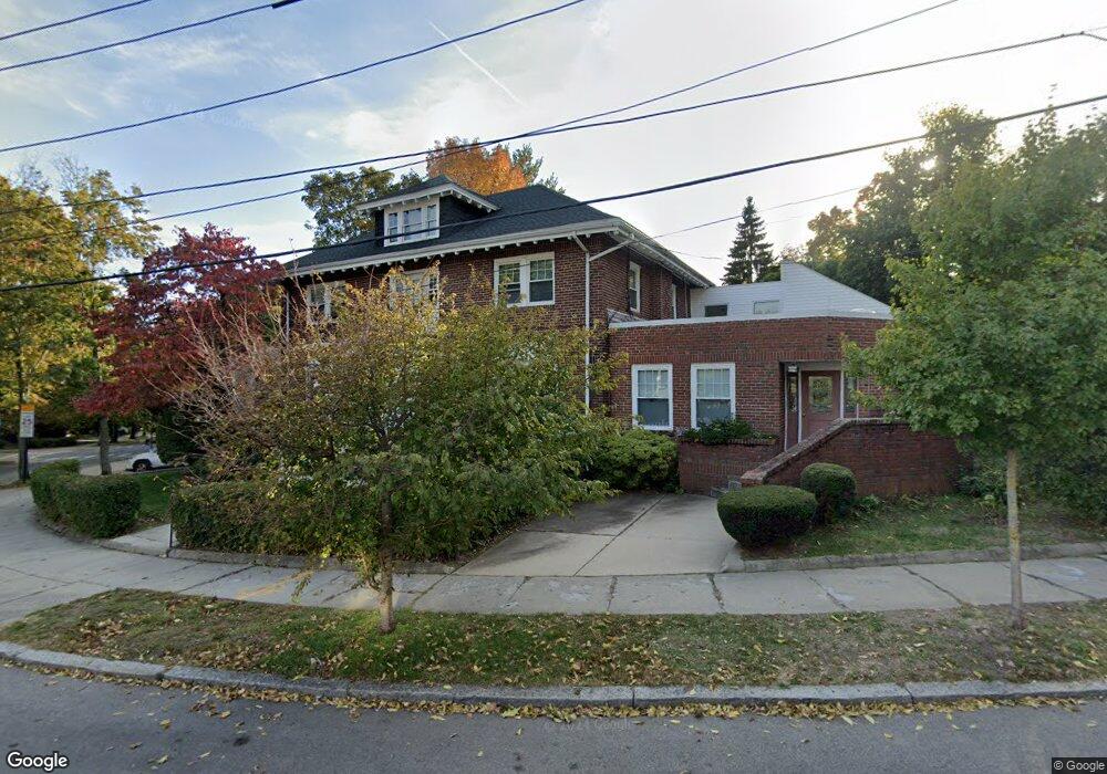
64 Corey Rd Brighton, MA 02135
Commonwealth NeighborhoodEstimated Value: $1,951,000 - $2,770,463
4
Beds
3
Baths
--
Sq Ft
10,237
Sq Ft Lot
About This Home
This home is located at 64 Corey Rd, Brighton, MA 02135 and is currently estimated at $2,321,116. 64 Corey Rd is a home located in Suffolk County with nearby schools including Boston Green Academy Horace Mann Charter School, Torah Academy, and Bais Yaakov Of Boston High School.
Ownership History
Date
Name
Owned For
Owner Type
Purchase Details
Closed on
Sep 22, 2015
Sold by
Wfe Llc
Bought by
Wu Amy F and Wu Robert H
Current Estimated Value
Purchase Details
Closed on
Dec 26, 2013
Sold by
Wu Amy F and Wu Robert H
Bought by
Wfe Llc
Purchase Details
Closed on
Jun 30, 2011
Sold by
Talner Congretion B Da
Bought by
Wu Amy F and Wu Robert Vh
Create a Home Valuation Report for This Property
The Home Valuation Report is an in-depth analysis detailing your home's value as well as a comparison with similar homes in the area
Home Values in the Area
Average Home Value in this Area
Purchase History
| Date | Buyer | Sale Price | Title Company |
|---|---|---|---|
| Wu Amy F | -- | -- | |
| Wfe Llc | -- | -- | |
| Wu Amy F | $879,000 | -- | |
| Wu Amy F | $879,000 | -- |
Source: Public Records
Tax History Compared to Growth
Tax History
| Year | Tax Paid | Tax Assessment Tax Assessment Total Assessment is a certain percentage of the fair market value that is determined by local assessors to be the total taxable value of land and additions on the property. | Land | Improvement |
|---|---|---|---|---|
| 2025 | $23,059 | $1,991,300 | $599,500 | $1,391,800 |
| 2024 | $21,057 | $1,931,800 | $601,900 | $1,329,900 |
| 2023 | $20,748 | $1,931,800 | $601,900 | $1,329,900 |
| 2022 | $20,405 | $1,875,500 | $584,400 | $1,291,100 |
| 2021 | $20,012 | $1,875,500 | $584,400 | $1,291,100 |
| 2020 | $19,237 | $1,821,700 | $499,200 | $1,322,500 |
| 2019 | $17,959 | $1,703,900 | $411,600 | $1,292,300 |
| 2018 | $17,508 | $1,670,600 | $411,600 | $1,259,000 |
| 2017 | $17,171 | $1,621,400 | $411,600 | $1,209,800 |
| 2016 | $15,928 | $1,448,000 | $411,600 | $1,036,400 |
| 2015 | $12,864 | $1,062,270 | $296,550 | $765,720 |
| 2014 | $10,832 | $861,084 | $276,780 | $584,304 |
Source: Public Records
Map
Nearby Homes
- 36 Cummings Rd Unit 1
- 1650 Commonwealth Ave Unit 304
- 85 Williston Rd
- 1666 Commonwealth Ave Unit 24
- 1778 Beacon St Unit 302
- 140 Kilsyth Rd Unit 8
- 9 Downing Rd
- 38 Ransom Rd Unit 12
- 38 Ransom Rd Unit 3
- 3 Englewood Ave Unit 9
- 1691 Commonwealth Ave Unit 31
- 12 Ransom Rd Unit 7
- 47 Englewood Ave
- 1607 Commonwealth Ave Unit 14
- 45 Bartlett Crescent Unit 402
- 45 Bartlett Crescent Unit 404
- 45 Bartlett Crescent Unit 302
- 45 Bartlett Crescent Unit 401
- 45 Bartlett Crescent Unit 101
- 45 Bartlett Crescent Unit 305
- 64 Corey Rd Unit 3
- 64 Corey Rd
- 64 Corey Rd Unit 2
- 64 Corey Rd Unit 1
- 58 Corey Rd Unit 2
- 58 Corey Rd Unit 1
- 6 Cummings Rd
- 6 Cummings Rd Unit 2
- 6 Cummings Rd Unit 1
- 6 Cummings Rd Unit 3
- 45 Windsor Rd
- 45 Windsor Rd Unit 45
- 45 Windsor Rd
- 45 Windsor Rd Unit 2
- 12 Cummings Rd
- 12 Cummings Rd Unit 2
- 12 Cummings Rd Unit 1
- 74 Corey Rd Unit 1
- 74 Corey Rd Unit 2
- 74 Corey Rd