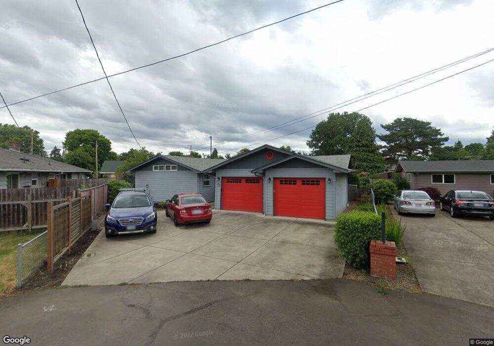
64 Harshels Ct Eugene, OR 97404
River Road NeighborhoodEstimated Value: $449,000 - $509,000
3
Beds
3
Baths
1,876
Sq Ft
$255/Sq Ft
Est. Value
About This Home
This home is located at 64 Harshels Ct, Eugene, OR 97404 and is currently estimated at $478,712, approximately $255 per square foot. 64 Harshels Ct is a home located in Lane County with nearby schools including Howard Elementary School, Kelly Middle School, and North Eugene High School.
Ownership History
Date
Name
Owned For
Owner Type
Purchase Details
Closed on
Jul 25, 2016
Sold by
Dellinger Ruth E
Bought by
Note Michael
Current Estimated Value
Home Financials for this Owner
Home Financials are based on the most recent Mortgage that was taken out on this home.
Original Mortgage
$284,075
Outstanding Balance
$225,871
Interest Rate
3.54%
Mortgage Type
VA
Estimated Equity
$252,841
Purchase Details
Closed on
Jan 10, 2001
Sold by
Uttinger Gene M
Bought by
Dellinger Ruth E
Home Financials for this Owner
Home Financials are based on the most recent Mortgage that was taken out on this home.
Original Mortgage
$96,000
Interest Rate
7.65%
Create a Home Valuation Report for This Property
The Home Valuation Report is an in-depth analysis detailing your home's value as well as a comparison with similar homes in the area
Home Values in the Area
Average Home Value in this Area
Purchase History
| Date | Buyer | Sale Price | Title Company |
|---|---|---|---|
| Note Michael | $275,000 | Western Title & Escrow Co | |
| Dellinger Ruth E | $120,000 | Western Pioneer Title Co |
Source: Public Records
Mortgage History
| Date | Status | Borrower | Loan Amount |
|---|---|---|---|
| Open | Note Michael | $284,075 | |
| Previous Owner | Dellinger Ruth E | $96,000 |
Source: Public Records
Tax History
| Year | Tax Paid | Tax Assessment Tax Assessment Total Assessment is a certain percentage of the fair market value that is determined by local assessors to be the total taxable value of land and additions on the property. | Land | Improvement |
|---|---|---|---|---|
| 2025 | $4,318 | $257,012 | -- | -- |
| 2024 | $4,271 | $249,527 | -- | -- |
| 2023 | $4,271 | $242,260 | $0 | $0 |
| 2022 | $4,017 | $235,204 | $0 | $0 |
| 2021 | $3,736 | $228,354 | $0 | $0 |
| 2020 | $3,762 | $221,703 | $0 | $0 |
| 2019 | $3,630 | $215,246 | $0 | $0 |
| 2018 | $3,385 | $202,890 | $0 | $0 |
| 2017 | $3,237 | $202,890 | $0 | $0 |
| 2016 | $3,073 | $196,981 | $0 | $0 |
| 2015 | $3,000 | $191,244 | $0 | $0 |
| 2014 | $3,005 | $185,674 | $0 | $0 |
Source: Public Records
Map
Nearby Homes
- 1420 Evergreen Dr
- 172 Norman Ave
- 1685 Evergreen Dr
- 154 Norman Ave
- 1487 Barton St
- 1483 Barton St
- 1360 Andersen Ln
- 260 Greenleaf Ave
- 389 Maxwell Rd
- 1555 Escalante St
- 1880 Manihi Dr
- 1314 Dalton Dr
- 1010 Horn Ln
- 2874 Riverwalk Loop
- 2709 Riverwalk Loop
- 32 Marion Ln
- 1566 Maywood Ave
- 1927 Lake Isle Dr
- 574 Wimbledon Ct
- 1682 Hemlock St
- 68 Harshels Ct
- 18 Howard Ave
- 101 Maynard Ave
- 85 Maynard Ave
- 76 Harshels Ct
- 125 Maynard Ave
- 80 Howard Ave
- 53 Maynard Ave
- 147 Maynard Ave
- 25 Howard Ave
- 100 Howard Ave
- 55 Howard Ave
- 27 Maynard Ave
- 1545 Evergreen Dr
- 1527 Evergreen Dr
- 104 Maynard Ave
- 90 Maynard Ave
- 95 Howard Ave
- 95 W Howard
- 122 Maynard Ave
Your Personal Tour Guide
Ask me questions while you tour the home.