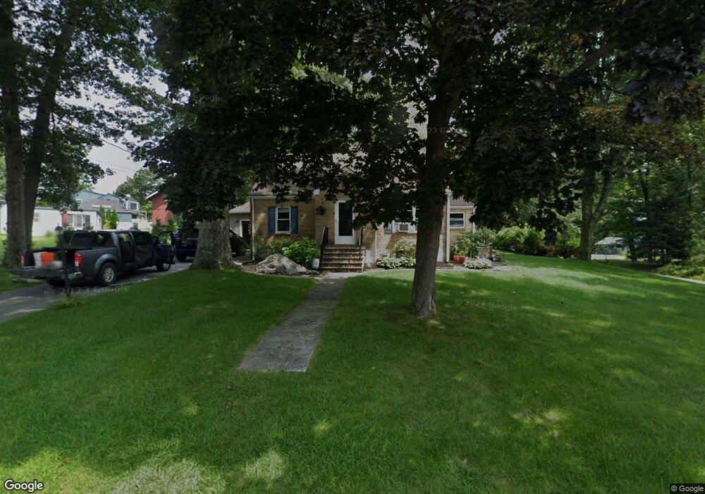
64 Homestead Rd Holden, MA 01520
Estimated Value: $496,054 - $517,000
3
Beds
2
Baths
1,652
Sq Ft
$306/Sq Ft
Est. Value
About This Home
This home is located at 64 Homestead Rd, Holden, MA 01520 and is currently estimated at $506,264, approximately $306 per square foot. 64 Homestead Rd is a home located in Worcester County with nearby schools including Wachusett Regional High School and Bancroft School.
Ownership History
Date
Name
Owned For
Owner Type
Purchase Details
Closed on
May 26, 2006
Sold by
Ware Philip L
Bought by
Kamataris Lauria K and Kamataris Thomas P
Current Estimated Value
Home Financials for this Owner
Home Financials are based on the most recent Mortgage that was taken out on this home.
Original Mortgage
$208,000
Outstanding Balance
$122,013
Interest Rate
6.53%
Mortgage Type
Purchase Money Mortgage
Estimated Equity
$384,251
Purchase Details
Closed on
Aug 1, 1991
Sold by
Ware Humphrey H
Bought by
Ware Philip L
Create a Home Valuation Report for This Property
The Home Valuation Report is an in-depth analysis detailing your home's value as well as a comparison with similar homes in the area
Home Values in the Area
Average Home Value in this Area
Purchase History
| Date | Buyer | Sale Price | Title Company |
|---|---|---|---|
| Kamataris Lauria K | $260,000 | -- | |
| Ware Philip L | $90,000 | -- |
Source: Public Records
Mortgage History
| Date | Status | Borrower | Loan Amount |
|---|---|---|---|
| Open | Kamataris Lauria K | $208,000 | |
| Previous Owner | Ware Philip L | $174,750 | |
| Previous Owner | Ware Philip L | $87,000 | |
| Previous Owner | Ware Philip L | $25,000 |
Source: Public Records
Tax History Compared to Growth
Tax History
| Year | Tax Paid | Tax Assessment Tax Assessment Total Assessment is a certain percentage of the fair market value that is determined by local assessors to be the total taxable value of land and additions on the property. | Land | Improvement |
|---|---|---|---|---|
| 2025 | $5,816 | $419,600 | $141,300 | $278,300 |
| 2024 | $5,444 | $384,700 | $137,100 | $247,600 |
| 2023 | $5,127 | $342,000 | $119,200 | $222,800 |
| 2022 | $4,923 | $297,300 | $93,100 | $204,200 |
| 2021 | $224 | $274,300 | $88,700 | $185,600 |
| 2020 | $4,565 | $268,500 | $84,500 | $184,000 |
| 2019 | $225 | $251,400 | $84,500 | $166,900 |
| 2018 | $4,295 | $243,900 | $80,500 | $163,400 |
| 2017 | $3,986 | $226,600 | $80,500 | $146,100 |
| 2016 | $3,705 | $214,800 | $76,600 | $138,200 |
| 2015 | $3,778 | $208,500 | $76,600 | $131,900 |
| 2014 | $3,701 | $208,500 | $76,600 | $131,900 |
Source: Public Records
Map
Nearby Homes
- 160 Shrewsbury St
- 23 Gail Dr
- 250 Shrewsbury St
- 9 Birchwood Dr
- 81 Mount View Dr
- 156 Newell Rd
- 27 Tea Party Cir Unit 27
- 24 John Alden St
- 48 Lexington Cir
- 206 Wachusett St
- 8 (Lot 1) Holmes Dr
- 15 Lowell Ave
- 8 Dawson Cir
- 527 Salisbury St
- 168 Twinbrooke Dr
- 83 Stoneleigh Rd
- 9 Emily St
- 9 Holmes Dr
- 7 Holmes Dr
- 29 Glenwood St
- 50 Homestead Rd
- 25 Cumberland Cir
- 72 Homestead Rd
- 44 Homestead Rd
- 63 Homestead Rd
- 19 Cumberland Cir
- 78 Homestead Rd
- 69 Homestead Rd
- 1 Cumberland Cir
- 57 Homestead Rd
- 55 Homestead Rd
- 75 Homestead Rd
- 13 Cumberland Cir
- 38 Homestead Rd
- 7 Cumberland Cir
- 84 Homestead Rd
- 84 Homestead Rd Unit 1
- 43 Homestead Rd
- 81 Homestead Rd
- 17 Chaffins Ln