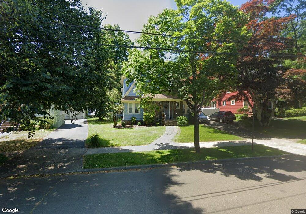
64 Roger Rd New Haven, CT 06515
Westville NeighborhoodEstimated Value: $546,000 - $633,591
3
Beds
2
Baths
2,605
Sq Ft
$224/Sq Ft
Est. Value
About This Home
This home is located at 64 Roger Rd, New Haven, CT 06515 and is currently estimated at $583,398, approximately $223 per square foot. 64 Roger Rd is a home located in New Haven County with nearby schools including Edgewood Creative Thinking through STEAM Magnet School and Hopkins School.
Ownership History
Date
Name
Owned For
Owner Type
Purchase Details
Closed on
Nov 8, 2004
Sold by
Rubinsky Susan M
Bought by
Liucci Stefanic
Current Estimated Value
Purchase Details
Closed on
Jun 28, 1995
Sold by
Matousek Diane M
Bought by
Mongillo Paul R and Rubinsky Susan M
Purchase Details
Closed on
Jul 30, 1993
Sold by
Claudio Toni
Bought by
Matousek Diane M
Create a Home Valuation Report for This Property
The Home Valuation Report is an in-depth analysis detailing your home's value as well as a comparison with similar homes in the area
Home Values in the Area
Average Home Value in this Area
Purchase History
| Date | Buyer | Sale Price | Title Company |
|---|---|---|---|
| Liucci Stefanic | $287,000 | -- | |
| Mongillo Paul R | $139,500 | -- | |
| Matousek Diane M | $125,000 | -- |
Source: Public Records
Mortgage History
| Date | Status | Borrower | Loan Amount |
|---|---|---|---|
| Open | Matousek Diane M | $319,844 | |
| Closed | Matousek Diane M | $320,000 | |
| Closed | Matousek Diane M | $50,000 |
Source: Public Records
Tax History
| Year | Tax Paid | Tax Assessment Tax Assessment Total Assessment is a certain percentage of the fair market value that is determined by local assessors to be the total taxable value of land and additions on the property. | Land | Improvement |
|---|---|---|---|---|
| 2025 | $11,575 | $293,790 | $73,080 | $220,710 |
| 2024 | $11,311 | $293,790 | $73,080 | $220,710 |
| 2023 | $10,929 | $293,790 | $73,080 | $220,710 |
| 2022 | $11,678 | $293,790 | $73,080 | $220,710 |
| 2021 | $9,350 | $213,080 | $56,980 | $156,100 |
| 2020 | $9,350 | $213,080 | $56,980 | $156,100 |
| 2019 | $9,158 | $213,080 | $56,980 | $156,100 |
| 2018 | $9,158 | $213,080 | $56,980 | $156,100 |
| 2017 | $8,242 | $213,080 | $56,980 | $156,100 |
| 2016 | $9,080 | $218,540 | $67,480 | $151,060 |
| 2015 | $9,080 | $218,540 | $67,480 | $151,060 |
| 2014 | $9,080 | $218,540 | $67,480 | $151,060 |
Source: Public Records
Map
Nearby Homes
- 690 Forest Rd Unit 702
- 690 Forest Rd Unit 761
- 690 Forest Rd Unit 501
- 690 Forest Rd Unit 651
- 119 Westwood Rd
- 55 Marvel Rd
- 21 Richmond Ave
- 252 Alden Ave
- 50 Morris Ave
- 224 Ray Rd
- 595 Central Ave
- 143 Fountain St Unit A11
- 55 Irving St
- 907 Elm St
- 1016 Whalley Ave Unit 6
- 1599 Chapel St
- 110 Fenwick St
- 50 Maltby Ave
- 122 Derby Ave
- 34 Maltby Ave
- 72 Roger Rd
- 56 Roger Rd
- 52 Roger Rd
- 35 Roger Rd
- 801 Forest Rd
- 75 Roger Rd
- 809 Forest Rd
- 95 Roger Rd
- 785 Forest Rd
- 9 Roger Rd
- 107 Roger Rd
- 152 Cleveland Rd
- 162 Cleveland Rd
- 793 Tummell Ln Aka 690 Forest Rd #793 Unit 793
- 117 Roger Rd
- 170 Cleveland Rd
- 120 Cleveland Rd
- 127 Roger Rd
- 149 Cleveland Rd
- 145 Cleveland Rd
Your Personal Tour Guide
Ask me questions while you tour the home.