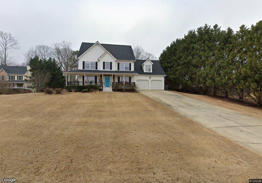
64 Roland Way Douglasville, GA 30134
Estimated Value: $372,000 - $455,000
3
Beds
3
Baths
2,712
Sq Ft
$151/Sq Ft
Est. Value
About This Home
This home is located at 64 Roland Way, Douglasville, GA 30134 and is currently estimated at $409,797, approximately $151 per square foot. 64 Roland Way is a home located in Paulding County with nearby schools including Connie Dugan Elementary School, Irma C. Austin Middle School, and South Paulding High School.
Ownership History
Date
Name
Owned For
Owner Type
Purchase Details
Closed on
Apr 4, 2005
Sold by
Earl Coran Homes Inc
Bought by
Akins Matthew B
Current Estimated Value
Home Financials for this Owner
Home Financials are based on the most recent Mortgage that was taken out on this home.
Original Mortgage
$179,050
Outstanding Balance
$91,496
Interest Rate
5.63%
Mortgage Type
New Conventional
Estimated Equity
$318,301
Create a Home Valuation Report for This Property
The Home Valuation Report is an in-depth analysis detailing your home's value as well as a comparison with similar homes in the area
Home Values in the Area
Average Home Value in this Area
Purchase History
| Date | Buyer | Sale Price | Title Company |
|---|---|---|---|
| Akins Matthew B | $223,900 | -- |
Source: Public Records
Mortgage History
| Date | Status | Borrower | Loan Amount |
|---|---|---|---|
| Open | Akins Matthew B | $179,050 |
Source: Public Records
Tax History Compared to Growth
Tax History
| Year | Tax Paid | Tax Assessment Tax Assessment Total Assessment is a certain percentage of the fair market value that is determined by local assessors to be the total taxable value of land and additions on the property. | Land | Improvement |
|---|---|---|---|---|
| 2024 | $3,595 | $147,760 | $12,000 | $135,760 |
| 2023 | $3,805 | $148,480 | $12,000 | $136,480 |
| 2022 | $3,994 | $134,480 | $12,000 | $122,480 |
| 2021 | $3,230 | $108,768 | $12,000 | $96,768 |
| 2020 | $2,934 | $98,772 | $12,000 | $86,772 |
| 2019 | $2,797 | $92,832 | $12,000 | $80,832 |
| 2018 | $2,669 | $90,452 | $12,000 | $78,452 |
| 2017 | $2,438 | $81,684 | $12,000 | $69,684 |
| 2016 | $2,561 | $86,576 | $12,000 | $74,576 |
| 2015 | $2,587 | $85,908 | $12,000 | $73,908 |
| 2014 | $2,313 | $75,132 | $12,000 | $63,132 |
| 2013 | -- | $63,440 | $12,000 | $51,440 |
Source: Public Records
Map
Nearby Homes
- 269 Shelby Ln
- 263 Chandler Ridge Dr
- 289 Ridge Run Dr
- 239 Clear Brook Trail
- 23 Bomar Ln
- 42 Crystal Springs Dr
- 3061 Dallas Nebo Rd
- 88 Lambeth Dr
- 55 Hayes Trace
- 280 Glenn Eagles Way
- 554 Oak Landing Cir
- 1267 Austin Bridge Rd
- 59 Creekside Bluff
- 43 Oak Landing Cir
- 210 Creekside Overlook
- 976 Bakers Bridge Rd
- 56 Creekside Point
- 496 Hughes Rd
- 80 Roland Way
- 0 Roland Way
- 173 Jamestowne Dr
- 153 Jamestowne Dr
- 0 Jamestowne Dr Unit 7056346
- 0 Jamestowne Dr Unit 3242646
- 0 Jamestowne Dr Unit 8824948
- 0 Jamestowne Dr Unit 8673429
- 0 Jamestowne Dr Unit 8435585
- 0 Jamestowne Dr Unit 8384104
- 0 Jamestowne Dr Unit 8379215
- 0 Jamestowne Dr Unit 8210158
- 0 Jamestowne Dr Unit 8022486
- 0 Jamestowne Dr Unit 7616004
- 0 Jamestowne Dr Unit 7596052
- 0 Jamestowne Dr
- 86 Roland Way
- 197 Jamestowne Dr
- 77 Roland Way
- 63 Roland Way