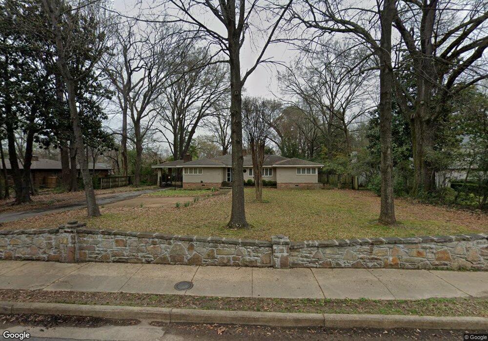
64 S Mendenhall Rd Memphis, TN 38117
Audubon Park NeighborhoodEstimated Value: $451,000 - $483,247
2
Beds
3
Baths
2,930
Sq Ft
$159/Sq Ft
Est. Value
About This Home
This home is located at 64 S Mendenhall Rd, Memphis, TN 38117 and is currently estimated at $466,812, approximately $159 per square foot. 64 S Mendenhall Rd is a home located in Shelby County with nearby schools including White Station Elementary School, White Station High, and White Station Middle.
Ownership History
Date
Name
Owned For
Owner Type
Purchase Details
Closed on
Dec 17, 2008
Sold by
Dubowik Erich I
Bought by
Holt James L
Current Estimated Value
Home Financials for this Owner
Home Financials are based on the most recent Mortgage that was taken out on this home.
Original Mortgage
$212,850
Interest Rate
5.96%
Mortgage Type
Purchase Money Mortgage
Purchase Details
Closed on
May 18, 2001
Sold by
Dubowik Donna K
Bought by
Dubowik Erich I
Home Financials for this Owner
Home Financials are based on the most recent Mortgage that was taken out on this home.
Original Mortgage
$130,000
Interest Rate
7.11%
Create a Home Valuation Report for This Property
The Home Valuation Report is an in-depth analysis detailing your home's value as well as a comparison with similar homes in the area
Home Values in the Area
Average Home Value in this Area
Purchase History
| Date | Buyer | Sale Price | Title Company |
|---|---|---|---|
| Holt James L | $236,500 | Chicago Title Ins Co | |
| Dubowik Erich I | -- | -- |
Source: Public Records
Mortgage History
| Date | Status | Borrower | Loan Amount |
|---|---|---|---|
| Closed | Holt James L | $212,850 | |
| Previous Owner | Dubowik Erich I | $130,000 |
Source: Public Records
Tax History Compared to Growth
Tax History
| Year | Tax Paid | Tax Assessment Tax Assessment Total Assessment is a certain percentage of the fair market value that is determined by local assessors to be the total taxable value of land and additions on the property. | Land | Improvement |
|---|---|---|---|---|
| 2025 | $3,268 | $113,925 | $28,625 | $85,300 |
| 2024 | $3,268 | $96,400 | $25,975 | $70,425 |
| 2023 | $5,872 | $96,400 | $25,975 | $70,425 |
| 2022 | $5,872 | $96,400 | $25,975 | $70,425 |
| 2021 | $5,941 | $96,400 | $25,975 | $70,425 |
| 2020 | $6,040 | $83,350 | $25,975 | $57,375 |
| 2019 | $6,040 | $83,350 | $25,975 | $57,375 |
| 2018 | $6,040 | $83,350 | $25,975 | $57,375 |
| 2017 | $3,426 | $83,350 | $25,975 | $57,375 |
| 2016 | $2,945 | $67,400 | $0 | $0 |
| 2014 | $2,945 | $67,400 | $0 | $0 |
Source: Public Records
Map
Nearby Homes
- 4975 Brookwood Cove
- 5068 Walnut Grove Rd
- 4859 Gwynne Rd
- 50 Grove Creek Place
- 131 N Mendenhall Rd
- 5071 Anchor Cove
- 4956 Robindale Ln
- 65 Laverne Ln
- 4772 Gwynne Rd
- 4798 Normandy Ln
- 4723 Normandy Ln
- 5157 S Angela Rd
- 5103 Norich Ave
- 5188 Gwynne Rd
- 4980 Barfield Rd
- 5081 Rich Rd
- 41 W Bendel Cir
- 4679 Walnut Grove Rd
- 209 Leonora Dr
- 267 Barry Rd
- 68 S Mendenhall Rd
- 50 S Mendenhall Rd
- 4949 Walnut Grove Rd
- 4955 Walnut Grove Rd
- 74 S Mendenhall Rd
- 4943 Walnut Grove Rd
- 4971 Walnut Grove Rd
- 78 S Mendenhall Rd
- 47 S Mendenhall Rd
- 4933 Walnut Grove Rd
- 4981 Walnut Grove Rd
- 61 S Mendenhall Rd
- 37 S Mendenhall Rd
- 69 S Mendenhall Rd
- 31 S Mendenhall Rd
- 80 N Mendenhall Rd
- 80 S Mendenhall Rd
- 4991 Walnut Grove Rd
- 73 S Mendenhall Rd
- 75 S Mendenhall Rd