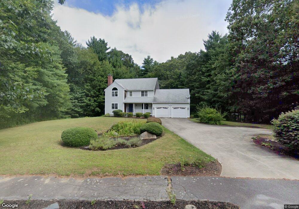
64 Woodbrook Ln Hanson, MA 02341
Estimated Value: $677,000 - $780,000
3
Beds
3
Baths
2,040
Sq Ft
$356/Sq Ft
Est. Value
About This Home
This home is located at 64 Woodbrook Ln, Hanson, MA 02341 and is currently estimated at $727,230, approximately $356 per square foot. 64 Woodbrook Ln is a home located in Plymouth County.
Ownership History
Date
Name
Owned For
Owner Type
Purchase Details
Closed on
Nov 6, 1996
Sold by
Commons Hsg T and Walsh John A
Bought by
Cantin William A and Cantin Maureen J
Current Estimated Value
Home Financials for this Owner
Home Financials are based on the most recent Mortgage that was taken out on this home.
Original Mortgage
$160,000
Outstanding Balance
$15,782
Interest Rate
8.1%
Mortgage Type
Purchase Money Mortgage
Estimated Equity
$711,448
Create a Home Valuation Report for This Property
The Home Valuation Report is an in-depth analysis detailing your home's value as well as a comparison with similar homes in the area
Home Values in the Area
Average Home Value in this Area
Purchase History
| Date | Buyer | Sale Price | Title Company |
|---|---|---|---|
| Cantin William A | $65,000 | -- |
Source: Public Records
Mortgage History
| Date | Status | Borrower | Loan Amount |
|---|---|---|---|
| Open | Cantin William A | $39,000 | |
| Closed | Cantin William A | $43,000 | |
| Open | Cantin William A | $160,000 |
Source: Public Records
Tax History Compared to Growth
Tax History
| Year | Tax Paid | Tax Assessment Tax Assessment Total Assessment is a certain percentage of the fair market value that is determined by local assessors to be the total taxable value of land and additions on the property. | Land | Improvement |
|---|---|---|---|---|
| 2025 | $8,230 | $615,100 | $201,300 | $413,800 |
| 2024 | $7,992 | $597,300 | $195,400 | $401,900 |
| 2023 | $7,670 | $540,900 | $195,400 | $345,500 |
| 2022 | $7,486 | $496,100 | $177,600 | $318,500 |
| 2021 | $6,653 | $440,600 | $170,900 | $269,700 |
| 2020 | $6,552 | $429,100 | $165,000 | $264,100 |
| 2019 | $6,526 | $420,200 | $176,600 | $243,600 |
| 2018 | $6,446 | $407,200 | $169,900 | $237,300 |
| 2017 | $6,245 | $390,800 | $161,800 | $229,000 |
| 2016 | $6,350 | $383,700 | $161,800 | $221,900 |
| 2015 | $6,018 | $378,000 | $161,800 | $216,200 |
Source: Public Records
Map
Nearby Homes
- 418 E Washington St
- 13 Hayford Trail Unit 15
- 168 Spring St
- 12 Hayford Trail Unit 17
- 5 Hayford Trail Unit 11
- 7 Hayford Trail Unit 12
- 22 Howland Trail Unit 34
- 248 E Washington St
- 33 Tavern Way
- Lot 5 Princeton Way
- 842 Whitman St
- 57 Liberty St
- 417 Birchbark Dr
- 1057 Whitman St
- 37 Brook St
- 842 E Washington St
- 55 Plymouth St Unit A5
- 154 Winter St
- 131 Holly Ridge Dr
- 41 Gail Rd
- 52 Woodbrook Ln
- 76 Woodbrook Ln
- 55 Woodbrook Ln
- 67 Woodbrook Ln
- 88 Woodbrook Ln
- 40 Woodbrook Ln
- 47 Woodbrook Ln
- 95 Woodbrook Ln
- 100 Woodbrook Ln
- 9 Woodbrook Ln
- 31 Woodbrook Ln
- 28 Woodbrook Ln
- 136 Woodbrook Ln
- 7 Commons Ln
- 112 Woodbrook Ln
- 124 Woodbrook Ln
- 253 King St
- 12 Commons Ln
- 11 Commons Ln
- 281 King St