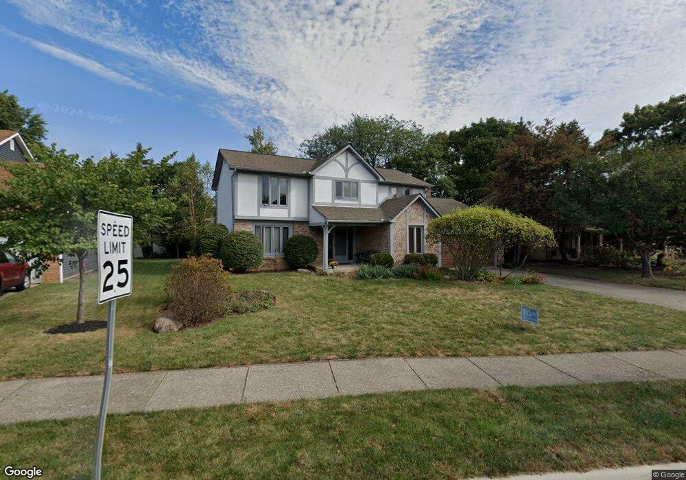
640 Ipswich St Westerville, OH 43081
Estimated Value: $469,000 - $499,414
4
Beds
3
Baths
2,488
Sq Ft
$196/Sq Ft
Est. Value
About This Home
This home is located at 640 Ipswich St, Westerville, OH 43081 and is currently estimated at $487,604, approximately $195 per square foot. 640 Ipswich St is a home located in Franklin County with nearby schools including Mcvay Elementary School, Walnut Springs Middle School, and Westerville-North High School.
Ownership History
Date
Name
Owned For
Owner Type
Purchase Details
Closed on
May 17, 1999
Sold by
Squires Jerry E and Squires Karen
Bought by
Pate Alan D and Brackney Laura E
Current Estimated Value
Home Financials for this Owner
Home Financials are based on the most recent Mortgage that was taken out on this home.
Original Mortgage
$145,000
Interest Rate
6.99%
Purchase Details
Closed on
Mar 2, 1990
Bought by
Squires Jerry E and Squires Karen
Purchase Details
Closed on
Aug 24, 1988
Purchase Details
Closed on
Aug 10, 1988
Create a Home Valuation Report for This Property
The Home Valuation Report is an in-depth analysis detailing your home's value as well as a comparison with similar homes in the area
Home Values in the Area
Average Home Value in this Area
Purchase History
| Date | Buyer | Sale Price | Title Company |
|---|---|---|---|
| Pate Alan D | $195,000 | Connor Title Co | |
| Squires Jerry E | $142,900 | -- | |
| -- | $143,000 | -- | |
| -- | $126,000 | -- |
Source: Public Records
Mortgage History
| Date | Status | Borrower | Loan Amount |
|---|---|---|---|
| Closed | Pate Alan D | $145,000 |
Source: Public Records
Tax History Compared to Growth
Tax History
| Year | Tax Paid | Tax Assessment Tax Assessment Total Assessment is a certain percentage of the fair market value that is determined by local assessors to be the total taxable value of land and additions on the property. | Land | Improvement |
|---|---|---|---|---|
| 2024 | $8,090 | $142,350 | $33,250 | $109,100 |
| 2023 | $7,918 | $142,345 | $33,250 | $109,095 |
| 2022 | $7,334 | $100,670 | $24,470 | $76,200 |
| 2021 | $7,396 | $100,670 | $24,470 | $76,200 |
| 2020 | $7,375 | $100,670 | $24,470 | $76,200 |
| 2019 | $6,432 | $82,880 | $20,370 | $62,510 |
| 2018 | $6,229 | $82,880 | $20,370 | $62,510 |
| 2017 | $6,325 | $82,880 | $20,370 | $62,510 |
| 2016 | $6,353 | $75,780 | $22,750 | $53,030 |
| 2015 | $6,153 | $75,780 | $22,750 | $53,030 |
| 2014 | $6,158 | $75,780 | $22,750 | $53,030 |
| 2013 | $2,929 | $72,170 | $21,665 | $50,505 |
Source: Public Records
Map
Nearby Homes
- 1209 Chatham Ridge Rd
- 1146 Forest Rise Dr
- 1368 Nutmeg Ct
- 750 Autumn Branch Rd
- 737 Autumn Branch Rd
- 613 Valley Wood Ct
- 1003 Autumn Meadows Dr
- 994 Autumn Lake Ct
- 969 Farrington Dr
- 1201 Wallean Dr
- 640 Brook Run Dr
- 800 S Spring Rd
- 90 Spring Creek Dr
- 5769 Burntwood Way
- 806 Watten Ln
- 4540 Central College Rd
- 371 Delaware Dr
- 810 Applewood Ln
- 461 Delaware Ct
- 6452 Rockhold Dr
- 1262 Scituate Ct
- 632 Ipswich St
- 1195 Clapham Ct
- 1270 Scituate Ct
- 624 Ipswich St
- 637 Ipswich St
- 1191 Clapham Ct
- 650 Glastonbury Ct
- 1199 Clapham Ct
- 1278 Scituate Ct
- 649 Ipswich St
- 616 Ipswich St
- 1265 Scituate Ct
- 1267 Smoke Burr Dr
- 1187 Laurel Dr
- 1261 Smoke Burr Dr
- 1275 Scituate Ct
- 658 Glastonbury Ct
- 611 Ipswich St
- 661 Ipswich St