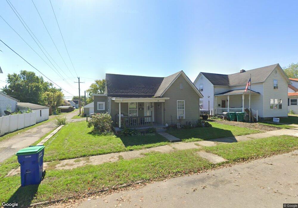
640 Lyndon Ave Greenfield, OH 45123
Estimated Value: $69,000 - $122,000
2
Beds
1
Bath
840
Sq Ft
$112/Sq Ft
Est. Value
About This Home
This home is located at 640 Lyndon Ave, Greenfield, OH 45123 and is currently estimated at $94,314, approximately $112 per square foot. 640 Lyndon Ave is a home located in Highland County with nearby schools including McClain High School.
Ownership History
Date
Name
Owned For
Owner Type
Purchase Details
Closed on
Dec 28, 2005
Sold by
Fannie Mae
Bought by
Greene Kenneth D and Greene Janey L
Current Estimated Value
Home Financials for this Owner
Home Financials are based on the most recent Mortgage that was taken out on this home.
Original Mortgage
$28,800
Outstanding Balance
$897
Interest Rate
7.25%
Mortgage Type
Purchase Money Mortgage
Estimated Equity
$93,417
Purchase Details
Closed on
May 11, 2005
Sold by
Howland Thomas P and Howland Thomas F
Bought by
Ohio Savings Bank
Purchase Details
Closed on
Jan 1, 1990
Bought by
Howland Thomas P
Create a Home Valuation Report for This Property
The Home Valuation Report is an in-depth analysis detailing your home's value as well as a comparison with similar homes in the area
Home Values in the Area
Average Home Value in this Area
Purchase History
| Date | Buyer | Sale Price | Title Company |
|---|---|---|---|
| Greene Kenneth D | $26,000 | Title First Agency Inc | |
| Ohio Savings Bank | $24,000 | -- | |
| Howland Thomas P | -- | -- |
Source: Public Records
Mortgage History
| Date | Status | Borrower | Loan Amount |
|---|---|---|---|
| Open | Greene Kenneth D | $28,800 |
Source: Public Records
Tax History
| Year | Tax Paid | Tax Assessment Tax Assessment Total Assessment is a certain percentage of the fair market value that is determined by local assessors to be the total taxable value of land and additions on the property. | Land | Improvement |
|---|---|---|---|---|
| 2024 | $792 | $25,030 | $3,750 | $21,280 |
| 2023 | $797 | $12,290 | $3,120 | $9,170 |
| 2022 | $432 | $12,290 | $3,120 | $9,170 |
| 2021 | $412 | $12,290 | $3,120 | $9,170 |
| 2020 | $368 | $10,680 | $2,700 | $7,980 |
| 2019 | $374 | $10,680 | $2,700 | $7,980 |
| 2018 | $376 | $10,680 | $2,700 | $7,980 |
| 2017 | $416 | $11,730 | $2,490 | $9,240 |
| 2016 | $417 | $11,730 | $2,490 | $9,240 |
| 2015 | $3,344 | $11,730 | $2,490 | $9,240 |
| 2014 | $477 | $11,730 | $2,490 | $9,240 |
| 2013 | $1,777 | $11,730 | $2,490 | $9,240 |
Source: Public Records
Map
Nearby Homes
- 534 Waddell St
- 814 South St
- 906 South St
- 910 South St
- 358 Mirabeau St
- 228 Lafayette St
- 0 Lafayette St
- 739 Lafayette St
- 433 Jefferson St
- 127 Paint St
- 126 Smith St
- 235 S 2nd St
- 111 South St
- 321 Mcclain Ave
- 13455 State Route 28 W
- 518 N Washington St
- 965 Grandview Ave
- 13528 Hillcrest Dr
- 14505 State Route 41 S
- 12835 Bennett Rd
- 646 Lyndon Ave
- 634 Lyndon Ave
- 652 Lyndon Ave
- 630 Lyndon Ave
- 658 Lyndon Ave
- 639 Dickey Ave
- 633 Dickey Ave
- 645 Lyndon Ave
- 627 Dickey Ave
- 647 Lyndon Ave
- 635 Lyndon Ave
- 670 Lyndon Ave
- 653 Lyndon Ave
- 657 Dickey Ave
- 657 Dickey Ave
- 614 Lyndon Ave
- 614 Lyndon Ave
- 627 Lyndon Ave
- 623 Dickey Ave
- 9772 N St Rt 41
Your Personal Tour Guide
Ask me questions while you tour the home.