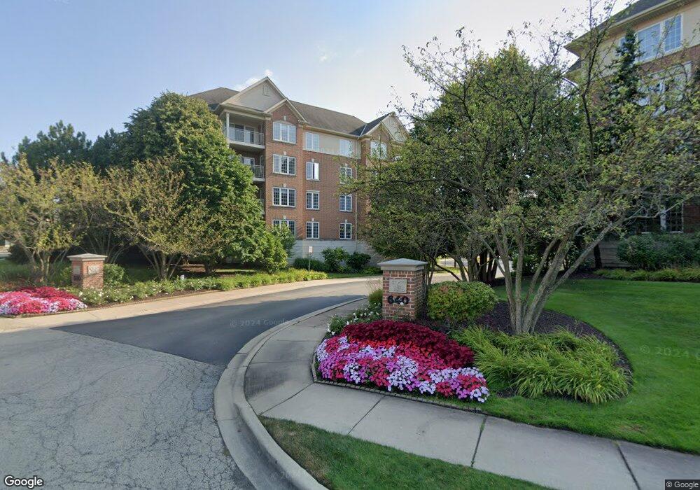
640 Robert York Ave Unit 501310 Deerfield, IL 60015
Estimated Value: $332,000 - $410,000
2
Beds
2
Baths
1,178
Sq Ft
$321/Sq Ft
Est. Value
About This Home
This home is located at 640 Robert York Ave Unit 501310, Deerfield, IL 60015 and is currently estimated at $378,625, approximately $321 per square foot. 640 Robert York Ave Unit 501310 is a home located in Lake County with nearby schools including Kipling Elementary School, Alan B Shepard Middle School, and Deerfield High School.
Ownership History
Date
Name
Owned For
Owner Type
Purchase Details
Closed on
Jan 2, 2012
Sold by
Pepper Ruth A
Bought by
Pepper Michael
Current Estimated Value
Purchase Details
Closed on
Sep 26, 2001
Sold by
South Commons Venture
Bought by
Pepper Ruth A
Home Financials for this Owner
Home Financials are based on the most recent Mortgage that was taken out on this home.
Original Mortgage
$150,000
Outstanding Balance
$64,510
Interest Rate
8.25%
Estimated Equity
$314,115
Create a Home Valuation Report for This Property
The Home Valuation Report is an in-depth analysis detailing your home's value as well as a comparison with similar homes in the area
Home Values in the Area
Average Home Value in this Area
Purchase History
| Date | Buyer | Sale Price | Title Company |
|---|---|---|---|
| Pepper Michael | -- | Chicago Title Insurance Co | |
| Pepper Ruth A | $220,500 | -- |
Source: Public Records
Mortgage History
| Date | Status | Borrower | Loan Amount |
|---|---|---|---|
| Open | Pepper Ruth A | $150,000 |
Source: Public Records
Tax History Compared to Growth
Tax History
| Year | Tax Paid | Tax Assessment Tax Assessment Total Assessment is a certain percentage of the fair market value that is determined by local assessors to be the total taxable value of land and additions on the property. | Land | Improvement |
|---|---|---|---|---|
| 2024 | $7,152 | $87,538 | $21,149 | $66,389 |
| 2023 | $7,222 | $84,010 | $20,297 | $63,713 |
| 2022 | $7,222 | $82,242 | $15,817 | $66,425 |
| 2021 | $6,802 | $79,293 | $15,250 | $64,043 |
| 2020 | $6,542 | $79,460 | $15,282 | $64,178 |
| 2019 | $6,396 | $79,325 | $15,256 | $64,069 |
| 2018 | $6,026 | $78,026 | $16,171 | $61,855 |
| 2017 | $5,977 | $77,777 | $16,119 | $61,658 |
| 2016 | $5,801 | $74,835 | $15,509 | $59,326 |
| 2015 | $5,665 | $70,314 | $14,572 | $55,742 |
| 2014 | $5,951 | $72,621 | $14,675 | $57,946 |
| 2012 | $5,818 | $71,981 | $14,546 | $57,435 |
Source: Public Records
Map
Nearby Homes
- 610 Robert York Ave Unit 104
- 679 Central Ave
- 441 Elm St Unit 3A
- 956 Brookside Ln
- 630 Hermitage Dr
- 1009 Central Ave
- 1038 Brookside Ln
- 372 Kelburn Rd Unit 313
- 382 Kelburn Rd Unit 122
- 745 Price Ln
- 904 Forest Ave
- 757 Kipling Place
- 860 Kenton Rd
- 505 Margate Terrace
- 1103 Hazel Ave
- 312 Pine St
- 934 Wayne Ave
- 677 Timber Hill Rd
- 1045 Fairoaks Ave
- 1127 Kenton Rd
- 640 Robert York Ave Unit 105
- 640 Robert York Ave Unit 409
- 640 Robert York Ave Unit 204
- 640 Robert York Ave Unit 501410
- 640 Robert York Ave Unit 501409
- 640 Robert York Ave Unit 501408
- 640 Robert York Ave Unit 501407
- 640 Robert York Ave Unit 501406
- 640 Robert York Ave Unit 501405
- 640 Robert York Ave Unit 501404
- 640 Robert York Ave Unit 501403
- 640 Robert York Ave Unit 501402
- 640 Robert York Ave Unit 501401
- 640 Robert York Ave Unit 501309
- 640 Robert York Ave Unit 501308
- 640 Robert York Ave Unit 501307
- 640 Robert York Ave Unit 501306
- 640 Robert York Ave Unit 501305
- 640 Robert York Ave Unit 501304
- 640 Robert York Ave Unit 501303