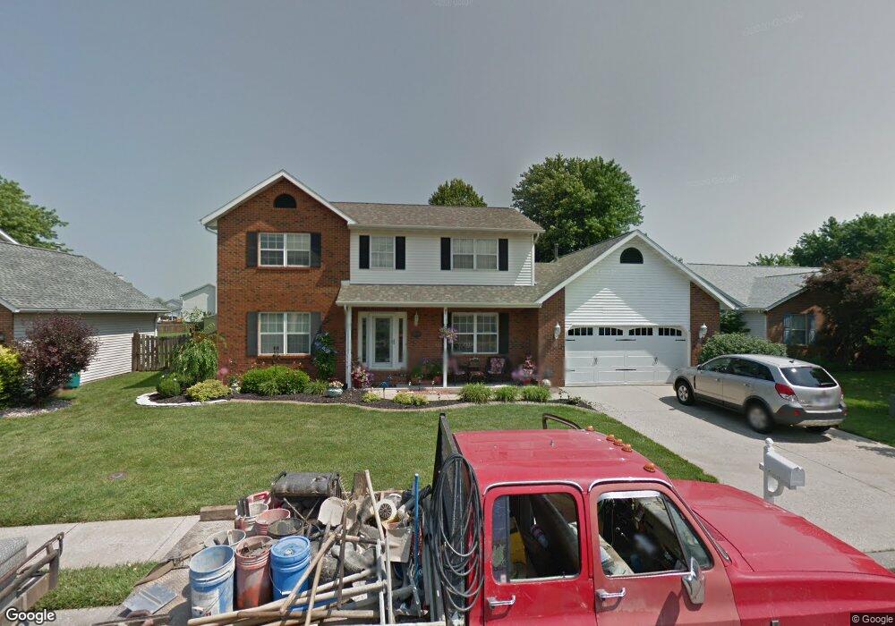
640 Shamrock Dr O Fallon, IL 62269
Estimated Value: $285,449 - $333,000
--
Bed
--
Bath
1,134
Sq Ft
$279/Sq Ft
Est. Value
About This Home
This home is located at 640 Shamrock Dr, O Fallon, IL 62269 and is currently estimated at $316,362, approximately $278 per square foot. 640 Shamrock Dr is a home located in St. Clair County with nearby schools including Evans Elementary School, Carriel Junior High School, and O'Fallon Township High School.
Ownership History
Date
Name
Owned For
Owner Type
Purchase Details
Closed on
Aug 12, 2002
Sold by
Batchelor Danny J
Bought by
Batchelor Margaret A
Current Estimated Value
Purchase Details
Closed on
Dec 11, 2001
Sold by
Parlow Michael L and Parlow Brigit M
Bought by
Batchelor Danny J and Batchelor Margaret A
Home Financials for this Owner
Home Financials are based on the most recent Mortgage that was taken out on this home.
Original Mortgage
$155,040
Outstanding Balance
$60,403
Interest Rate
6.53%
Mortgage Type
VA
Estimated Equity
$255,959
Create a Home Valuation Report for This Property
The Home Valuation Report is an in-depth analysis detailing your home's value as well as a comparison with similar homes in the area
Home Values in the Area
Average Home Value in this Area
Purchase History
| Date | Buyer | Sale Price | Title Company |
|---|---|---|---|
| Batchelor Margaret A | -- | -- | |
| Batchelor Danny J | $152,000 | -- |
Source: Public Records
Mortgage History
| Date | Status | Borrower | Loan Amount |
|---|---|---|---|
| Open | Batchelor Danny J | $155,040 |
Source: Public Records
Tax History Compared to Growth
Tax History
| Year | Tax Paid | Tax Assessment Tax Assessment Total Assessment is a certain percentage of the fair market value that is determined by local assessors to be the total taxable value of land and additions on the property. | Land | Improvement |
|---|---|---|---|---|
| 2024 | -- | $87,353 | $11,045 | $76,308 |
| 2023 | $462 | $77,530 | $9,803 | $67,727 |
| 2022 | $5,100 | $71,279 | $9,013 | $62,266 |
| 2021 | $5,214 | $71,510 | $9,042 | $62,468 |
| 2020 | $5,169 | $67,690 | $8,559 | $59,131 |
| 2019 | $5,041 | $67,690 | $8,559 | $59,131 |
| 2018 | $4,898 | $65,725 | $8,311 | $57,414 |
| 2017 | $4,615 | $60,196 | $10,071 | $50,125 |
| 2016 | $4,597 | $58,791 | $9,836 | $48,955 |
| 2014 | $4,241 | $58,111 | $9,722 | $48,389 |
| 2013 | $4,864 | $59,348 | $9,720 | $49,628 |
Source: Public Records
Map
Nearby Homes
- 749 Michael St Unit 65
- 406 Colleen Dr
- 334 Aladar Dr
- 312 Nancy Dr
- 121 S Lawn Ave
- 435 Ponderosa Ave Unit 2
- 215 Eagle Ridge Unit 215
- 121 Douglas St
- 422 W 4th St
- 421 Eagle Terrace Dr
- 894 Misty Valley Rd
- 430 S Hickory St
- 104 Ruth Dr
- 302 W 3rd St
- 702 W Washington St
- 706 S Vine St
- 511 S Vine St
- 204 W State St
- 1303 Princeton Dr
- 704 W Madison St
- 644 Shamrock Dr
- 636 Shamrock Dr
- 941 Brookdale Ct
- 632 Shamrock Dr
- 639 Shamrock Dr
- 745 Carol Ann Dr
- 643 Shamrock Dr
- 635 Shamrock Dr
- 940 Brookdale Ct
- 935 Brookdale Ct
- 647 Shamrock Dr
- 631 Shamrock Dr
- 739 Carol Ann Dr
- 739 Carol Ann Dr
- 628 Shamrock Dr
- 652 Shamrock Dr
- 934 Brookdale Ct
- 651 Shamrock Dr
- 1112 Northern Dancer Dr
- 627 Shamrock Dr