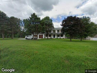
640 State Rd West Grove, PA 19390
Estimated Value: $509,000 - $555,000
4
Beds
3
Baths
2,240
Sq Ft
$238/Sq Ft
Est. Value
About This Home
This home is located at 640 State Rd, West Grove, PA 19390 and is currently estimated at $532,373, approximately $237 per square foot. 640 State Rd is a home located in Chester County with nearby schools including Penn London Elementary School, Avon Grove Intermediate School, and Fred S Engle Middle School.
Ownership History
Date
Name
Owned For
Owner Type
Purchase Details
Closed on
Aug 31, 2021
Sold by
Bp Real Estate Investment Group Lp
Bought by
Arhontakis Christos and Arhontakis Alexia
Current Estimated Value
Home Financials for this Owner
Home Financials are based on the most recent Mortgage that was taken out on this home.
Original Mortgage
$432,250
Outstanding Balance
$398,761
Interest Rate
2.7%
Mortgage Type
New Conventional
Estimated Equity
$152,881
Purchase Details
Closed on
Aug 24, 2020
Sold by
Mckee Marie Calvert and Mckee Walter
Bought by
Bp Real Estate Investment Group Lp
Purchase Details
Closed on
Oct 1, 1986
Bought by
Mckee Walter R and Marie Calvert
Create a Home Valuation Report for This Property
The Home Valuation Report is an in-depth analysis detailing your home's value as well as a comparison with similar homes in the area
Home Values in the Area
Average Home Value in this Area
Purchase History
| Date | Buyer | Sale Price | Title Company |
|---|---|---|---|
| Arhontakis Christos | $455,000 | None Available | |
| Bp Real Estate Investment Group Lp | $177,000 | None Available | |
| Mckee Walter R | $99,900 | -- |
Source: Public Records
Mortgage History
| Date | Status | Borrower | Loan Amount |
|---|---|---|---|
| Open | Arhontakis Christos | $432,250 | |
| Previous Owner | Mckee Walter R | $18,204 | |
| Previous Owner | Mckee Marie Calvert | $188,000 |
Source: Public Records
Tax History Compared to Growth
Tax History
| Year | Tax Paid | Tax Assessment Tax Assessment Total Assessment is a certain percentage of the fair market value that is determined by local assessors to be the total taxable value of land and additions on the property. | Land | Improvement |
|---|---|---|---|---|
| 2024 | $6,921 | $172,890 | $24,130 | $148,760 |
| 2023 | $6,774 | $172,890 | $24,130 | $148,760 |
| 2022 | $6,674 | $172,890 | $24,130 | $148,760 |
| 2021 | $5,969 | $157,960 | $24,130 | $133,830 |
| 2020 | $5,767 | $157,960 | $24,130 | $133,830 |
| 2019 | $5,622 | $157,960 | $24,130 | $133,830 |
| 2018 | $5,476 | $157,960 | $24,130 | $133,830 |
| 2017 | $5,361 | $157,960 | $24,130 | $133,830 |
| 2016 | $4,762 | $157,960 | $24,130 | $133,830 |
| 2015 | $4,762 | $157,960 | $24,130 | $133,830 |
| 2014 | $4,762 | $157,960 | $24,130 | $133,830 |
Source: Public Records
Map
Nearby Homes
- 131 Marthas Way
- 781 W Glenview Dr
- 797 W Glenview Dr
- 154 Hillside Ave
- 17 Nottingham Dr
- 65 Kent Farm Ln
- 400 N Guernsey Rd
- 6 White Clay Ln
- 136 Janine Way
- 460 Pennocks Bridge Rd
- 85 Janine Way Unit HAWTHORNE
- 85 Janine Way Unit NOTTINGHAM
- 85 Janine Way Unit AUGUSTA
- 85 Janine Way Unit ANDREWS
- 85 Janine Way Unit DEVONSHIRE
- 230 N Jennersville Rd
- 225 State Rd
- 330 School Rd
- 103 Dylan Cir
- 607 Martin Dr