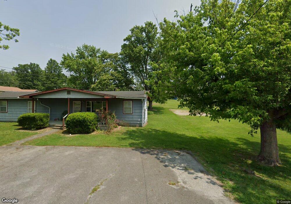
640 State St Newport, TN 37821
Estimated Value: $136,389 - $149,000
--
Bed
1
Bath
864
Sq Ft
$166/Sq Ft
Est. Value
About This Home
This home is located at 640 State St, Newport, TN 37821 and is currently estimated at $143,847, approximately $166 per square foot. 640 State St is a home located in Cocke County with nearby schools including Newport Grammar School, Grace Christian School, and Calvary Baptist Tabernacle School.
Ownership History
Date
Name
Owned For
Owner Type
Purchase Details
Closed on
Sep 10, 2021
Sold by
Clark Loretta Fine and Clark John
Bought by
Fine Nathan Lee
Current Estimated Value
Purchase Details
Closed on
Feb 20, 2007
Sold by
Ramsey D C
Bought by
Clark John A
Home Financials for this Owner
Home Financials are based on the most recent Mortgage that was taken out on this home.
Original Mortgage
$33,915
Interest Rate
6.19%
Mortgage Type
Cash
Purchase Details
Closed on
Oct 14, 2003
Sold by
Ramsey D C
Bought by
Ramsey Mark W
Purchase Details
Closed on
Jan 1, 1983
Bought by
John Ramsey D and John Dale Ramsey
Create a Home Valuation Report for This Property
The Home Valuation Report is an in-depth analysis detailing your home's value as well as a comparison with similar homes in the area
Home Values in the Area
Average Home Value in this Area
Purchase History
| Date | Buyer | Sale Price | Title Company |
|---|---|---|---|
| Fine Nathan Lee | -- | None Available | |
| Clark John A | $39,900 | -- | |
| Ramsey Mark W | $7,100 | -- | |
| John Ramsey D | $12,000 | -- |
Source: Public Records
Mortgage History
| Date | Status | Borrower | Loan Amount |
|---|---|---|---|
| Closed | John Ramsey D | $33,915 |
Source: Public Records
Tax History Compared to Growth
Tax History
| Year | Tax Paid | Tax Assessment Tax Assessment Total Assessment is a certain percentage of the fair market value that is determined by local assessors to be the total taxable value of land and additions on the property. | Land | Improvement |
|---|---|---|---|---|
| 2024 | $936 | $18,825 | $5,750 | $13,075 |
| 2023 | $936 | $18,825 | $5,750 | $13,075 |
| 2022 | $937 | $18,825 | $5,750 | $13,075 |
| 2021 | $937 | $18,825 | $5,750 | $13,075 |
| 2020 | $937 | $18,825 | $5,750 | $13,075 |
| 2019 | $719 | $13,150 | $3,250 | $9,900 |
| 2018 | $719 | $13,150 | $3,250 | $9,900 |
| 2017 | $679 | $13,150 | $3,250 | $9,900 |
| 2016 | $642 | $11,725 | $3,250 | $8,475 |
| 2015 | $381 | $11,725 | $3,250 | $8,475 |
| 2014 | $381 | $11,725 | $3,250 | $8,475 |
| 2013 | $381 | $9,200 | $3,100 | $6,100 |
Source: Public Records
Map
Nearby Homes
- 141 Hiola St
- 640 N Cecil St
- 278 Harvest St
- 613 North St
- 300 Harvest St
- 000 Cindy jo Rd
- 380 Clifton Heights Rd
- 582 Cindy jo Rd
- 0 Alpine Rd
- 294 Clifton Heights Rd
- 401 North St
- 240 Clifton Heights Rd
- 499 Long Ave Unit LOT 16
- 0 Long Ave
- 580 Jessica Way
- 228 Washington Ave
- 208 Mims Ave
- 573 Banjo Way
- 286 Belton Ave
- 000 E Highway 25 70
- 651 State St
- 658 State St
- 630 State St
- 683 Musterfield Rd
- 675 Musterfield Rd
- 687 Musterfield Rd
- 655 State St
- 680 Musterfield Rd
- 688 Musterfield Rd
- 672 Musterfield Rd
- 248 Gregg Ln
- 668 Musterfield Rd
- 214 Front St
- 679 Sanford St
- 274 Gregg Ln
- 725 Thompson St
- 0 Melrose Way Unit 711
- 213 Front St
- 704 Melrose Way Unit 706
- 689 Sanford St