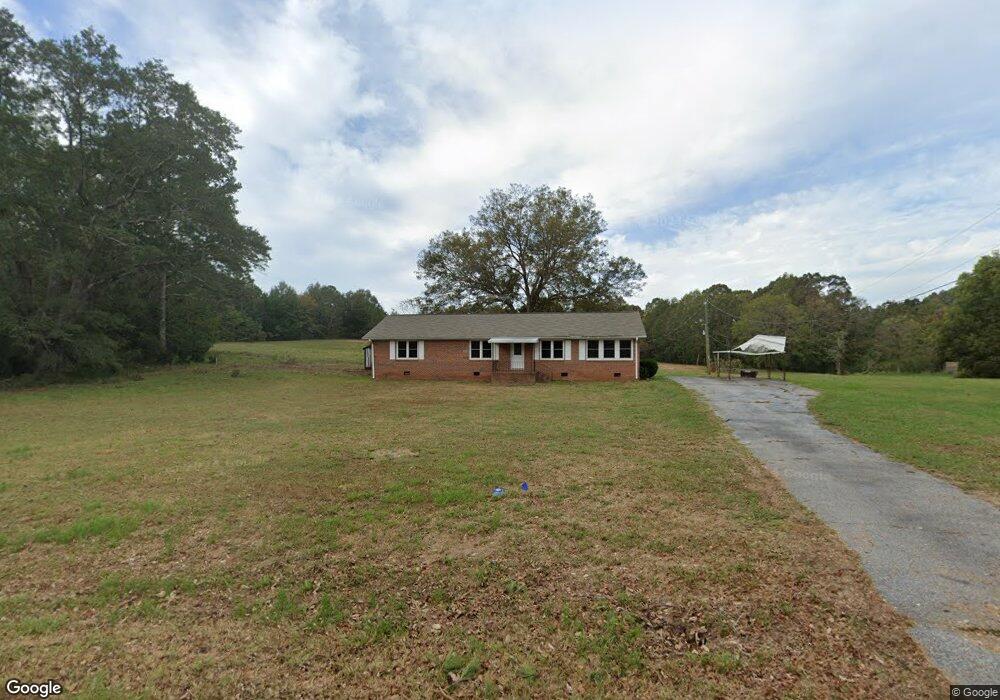
640 Walnut Grove Rd Roebuck, SC 29376
Estimated Value: $245,000 - $268,000
3
Beds
2
Baths
1,640
Sq Ft
$158/Sq Ft
Est. Value
About This Home
This home is located at 640 Walnut Grove Rd, Roebuck, SC 29376 and is currently estimated at $259,083, approximately $157 per square foot. 640 Walnut Grove Rd is a home located in Spartanburg County with nearby schools including Dorman High School Freshman Campus and Dorman High School.
Ownership History
Date
Name
Owned For
Owner Type
Purchase Details
Closed on
Oct 7, 2024
Sold by
Family Pettit Llc
Bought by
Raines Ronald G and Raines Susan R
Current Estimated Value
Home Financials for this Owner
Home Financials are based on the most recent Mortgage that was taken out on this home.
Original Mortgage
$183,750
Outstanding Balance
$181,818
Interest Rate
6.35%
Mortgage Type
New Conventional
Estimated Equity
$77,265
Purchase Details
Closed on
Jul 14, 2004
Sold by
Willis Shirley J
Bought by
Family Pettit Llc
Create a Home Valuation Report for This Property
The Home Valuation Report is an in-depth analysis detailing your home's value as well as a comparison with similar homes in the area
Purchase History
| Date | Buyer | Sale Price | Title Company |
|---|---|---|---|
| Raines Ronald G | $245,000 | None Listed On Document | |
| Raines Ronald G | $245,000 | None Listed On Document | |
| Family Pettit Llc | $138,000 | -- |
Source: Public Records
Mortgage History
| Date | Status | Borrower | Loan Amount |
|---|---|---|---|
| Open | Raines Ronald G | $183,750 | |
| Closed | Raines Ronald G | $183,750 |
Source: Public Records
Tax History
| Year | Tax Paid | Tax Assessment Tax Assessment Total Assessment is a certain percentage of the fair market value that is determined by local assessors to be the total taxable value of land and additions on the property. | Land | Improvement |
|---|---|---|---|---|
| 2025 | $2,917 | $14,700 | $1,476 | $13,224 |
| 2024 | $2,917 | $7,923 | $1,279 | $6,644 |
| 2023 | $2,917 | $7,923 | $2,244 | $5,679 |
Source: Public Records
Map
Nearby Homes
- Harrison Rd
- 603 Charles Moore Ct
- Harrison Rd
- 0 Cavalier Conection Dr Unit 298383
- 245 Thorncrest Dr
- 310 Templeton Dr
- 305 Lawtonwood Ln
- 149 Davy Crockett Trail
- 100 Caroline Dr
- 115 Otts Shoals Rd
- 0 Cavalier Connection Way Unit 1549706
- 220 Fincher Rd
- 409 Balfour Rd
- 811 S Edisto River Dr
- 339 Sara Ann Ln
- 0 Independence Ct
- 350 W River Grove Cir
- 2882 Highway 56
- 160 Blake Garrison Dr
- 212 Reedy River Ct
- 630 Walnut Grove Rd
- 709 Walnut Grove Rd
- 620 Walnut Grove Rd
- 629 Walnut Grove Rd
- 601 Walnut Grove Rd
- 000 Harrison Grove Rd
- 0 Harrison Grove Rd
- 599 Walnut Grove Rd
- 120 Harrison Rd
- 598 Walnut Grove Rd
- 800 Walnut Grove Rd
- 280 Harrison Rd
- 500 Walnut Grove Rd
- 719 Harrison Grove Rd
- 0 (lot 1a & 1b) Harrison Grove Rd
- 360 Harrison Rd
- 712 Harrison Grove Rd
- 340 Harrison Rd
- 700 Harrison Grove Rd
- 330 Harrison Rd
Your Personal Tour Guide
Ask me questions while you tour the home.