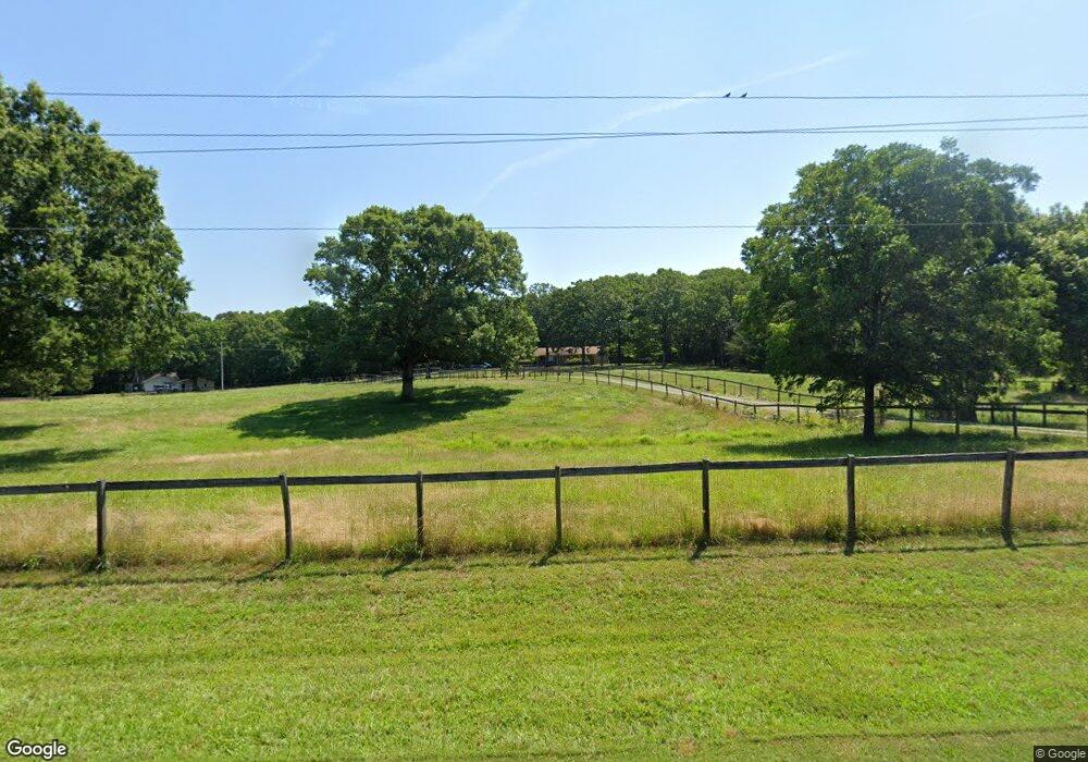
6403 Nesbit Rd Waxhaw, NC 28173
Estimated Value: $630,544 - $1,225,000
3
Beds
2
Baths
2,784
Sq Ft
$341/Sq Ft
Est. Value
About This Home
This home is located at 6403 Nesbit Rd, Waxhaw, NC 28173 and is currently estimated at $949,886, approximately $341 per square foot. 6403 Nesbit Rd is a home located in Union County with nearby schools including Prospect Elementary School, Parkwood Middle School, and Parkwood High School.
Ownership History
Date
Name
Owned For
Owner Type
Purchase Details
Closed on
Jun 6, 2023
Sold by
Zeigler Virginia Jeanne and Petaccia Anna P
Bought by
Zeigler Petaccia Living Trust and Zeigler
Current Estimated Value
Purchase Details
Closed on
Feb 22, 2013
Sold by
Dimmette James F and Dimmette Karla Y
Bought by
Zeigler Virginia Jeanne and Petaccia Anna P
Home Financials for this Owner
Home Financials are based on the most recent Mortgage that was taken out on this home.
Original Mortgage
$346,400
Interest Rate
3.56%
Mortgage Type
New Conventional
Create a Home Valuation Report for This Property
The Home Valuation Report is an in-depth analysis detailing your home's value as well as a comparison with similar homes in the area
Home Values in the Area
Average Home Value in this Area
Purchase History
| Date | Buyer | Sale Price | Title Company |
|---|---|---|---|
| Zeigler Petaccia Living Trust | -- | None Listed On Document | |
| Zeigler Virginia Jeanne | $433,000 | None Available |
Source: Public Records
Mortgage History
| Date | Status | Borrower | Loan Amount |
|---|---|---|---|
| Previous Owner | Zeigler Virginia Jeanne | $346,400 |
Source: Public Records
Tax History Compared to Growth
Tax History
| Year | Tax Paid | Tax Assessment Tax Assessment Total Assessment is a certain percentage of the fair market value that is determined by local assessors to be the total taxable value of land and additions on the property. | Land | Improvement |
|---|---|---|---|---|
| 2024 | $2,297 | $359,900 | $132,200 | $227,700 |
| 2023 | $2,260 | $359,900 | $132,200 | $227,700 |
| 2022 | $2,260 | $359,900 | $132,200 | $227,700 |
| 2021 | $2,270 | $368,100 | $132,200 | $235,900 |
| 2020 | $2,211 | $286,560 | $123,960 | $162,600 |
| 2019 | $2,225 | $286,560 | $123,960 | $162,600 |
| 2018 | $0 | $286,560 | $123,960 | $162,600 |
| 2017 | $2,368 | $286,600 | $124,000 | $162,600 |
| 2016 | $2,277 | $286,560 | $123,960 | $162,600 |
| 2015 | $2,308 | $286,560 | $123,960 | $162,600 |
| 2014 | $2,365 | $343,430 | $169,230 | $174,200 |
Source: Public Records
Map
Nearby Homes
- 5904 Nesbit Rd
- 7006 Nesbit Rd
- 8121 Cane Pointe Ln
- 8109 Cane Pointe Ln
- 6402 S Rocky River Rd
- 3315 Tom Starnes Rd
- 6118 S Rocky River Rd
- 6819 Prospect Pointe Dr
- 5624 Tipton Rd
- 5630 Tipton Rd
- 5714 Tipton Rd
- 5105 Tom Starnes Rd
- 5313 Old Highway Rd
- 5606 S Rocky River Rd
- 106 Serenity Creek Dr
- 7517 Lancaster Hwy Unit 5
- 7517 Lancaster Hwy
- 110 Serenity Creek Dr
- 7513 Lancaster Hwy Unit 6
- 7513 Lancaster Hwy
- 6403 Nesbit Rd
- 6315 Nesbit Rd
- 6419 Nesbit Rd Unit 4
- 6303 Nesbit Rd
- 6423 Nesbit Rd Unit 3
- 3922 Tom Starnes Rd Unit 2
- 3920 Tom Starnes Rd Unit 1
- 6314 Nesbit Rd
- 6222 Nesbit Rd
- 4022 Tom Starnes Rd
- 3515 Tom Starnes Rd
- 3908 Tom Starnes Rd
- 3918 Tom Starnes Rd
- 4108 Tom Starnes Rd
- 6218 Nesbit Rd
- 3902 Tom Starnes Rd
- 3901 Tom Starnes Rd
- 4114 Tom Starnes Rd
- 6216 Nesbit Rd
- 4111 Tom Starnes Rd
