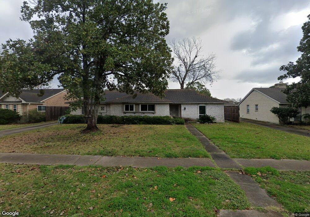
6403 Redding Rd Houston, TX 77036
Sharpstown NeighborhoodEstimated Value: $293,000 - $328,484
3
Beds
4
Baths
2,043
Sq Ft
$152/Sq Ft
Est. Value
About This Home
This home is located at 6403 Redding Rd, Houston, TX 77036 and is currently estimated at $309,621, approximately $151 per square foot. 6403 Redding Rd is a home located in Harris County with nearby schools including Neff Elementary School, Sugar Grove Academy, and Sharpstown High School.
Ownership History
Date
Name
Owned For
Owner Type
Purchase Details
Closed on
Jul 1, 2002
Sold by
Edmundson Jesse W and Edmundson Nan
Bought by
Scarborough Ramey
Current Estimated Value
Home Financials for this Owner
Home Financials are based on the most recent Mortgage that was taken out on this home.
Original Mortgage
$138,150
Outstanding Balance
$58,772
Interest Rate
6.76%
Estimated Equity
$250,849
Create a Home Valuation Report for This Property
The Home Valuation Report is an in-depth analysis detailing your home's value as well as a comparison with similar homes in the area
Home Values in the Area
Average Home Value in this Area
Purchase History
| Date | Buyer | Sale Price | Title Company |
|---|---|---|---|
| Scarborough Ramey | -- | American Title Co |
Source: Public Records
Mortgage History
| Date | Status | Borrower | Loan Amount |
|---|---|---|---|
| Open | Scarborough Ramey | $138,150 |
Source: Public Records
Tax History Compared to Growth
Tax History
| Year | Tax Paid | Tax Assessment Tax Assessment Total Assessment is a certain percentage of the fair market value that is determined by local assessors to be the total taxable value of land and additions on the property. | Land | Improvement |
|---|---|---|---|---|
| 2025 | $3,535 | $255,279 | $71,959 | $183,320 |
| 2024 | $3,535 | $262,633 | $71,959 | $190,674 |
| 2023 | $3,535 | $296,151 | $71,959 | $224,192 |
| 2022 | $5,929 | $272,061 | $71,959 | $200,102 |
| 2021 | $5,505 | $244,591 | $64,249 | $180,342 |
| 2020 | $5,372 | $214,733 | $53,969 | $160,764 |
| 2019 | $5,605 | $214,733 | $53,969 | $160,764 |
| 2018 | $3,958 | $212,802 | $53,969 | $158,833 |
| 2017 | $4,965 | $212,802 | $53,969 | $158,833 |
| 2016 | $4,514 | $180,600 | $53,969 | $126,631 |
| 2015 | $2,777 | $195,256 | $53,969 | $141,287 |
| 2014 | $2,777 | $160,000 | $53,969 | $106,031 |
Source: Public Records
Map
Nearby Homes
- 6411 Redding Rd
- 8579 Sands Point Dr Unit 102
- 8555 Sands Point Dr Unit 90
- 8543 Sands Point Dr
- 8435 Sands Point Dr
- 8411 Sands Point Dr Unit 18
- 8359 Sands Point Dr Unit 218
- 8275 Sands Point Dr Unit 176
- 6602 Harbor Town Dr Unit 1207
- 6602 Harbor Town Dr Unit 1202
- 8267 Sands Point Dr Unit 172
- 8257 Sands Point Dr Unit 167
- 6500 Harbor Town Dr Unit 3208
- 6500 Harbor Town Dr Unit 2808
- 6500 Harbor Town Dr Unit 3204
- 6500 Harbor Town Dr Unit 3408
- 6500 Harbor Town Dr Unit 2902
- 8231 Sands Point Dr Unit 154
- 6201 Ranchester Dr Unit 19
- 6201 Ranchester Dr Unit 29
- 6407 Redding Rd
- 6311 Redding Rd
- 6402 Burning Tree Dr
- 6307 Redding Rd
- 6406 Burning Tree Dr
- 6310 Burning Tree Dr
- 6410 Burning Tree Dr
- 6402 Redding Rd
- 6306 Burning Tree Dr
- 6310 Redding Rd
- 6406 Redding Rd
- 6503 Redding Rd
- 6303 Redding Rd
- 6306 Redding Rd
- 6410 Redding Rd
- 6502 Burning Tree Dr
- 6302 Burning Tree Dr
- 6507 Redding Rd
- 6302 Redding Rd
- 6502 Redding Rd