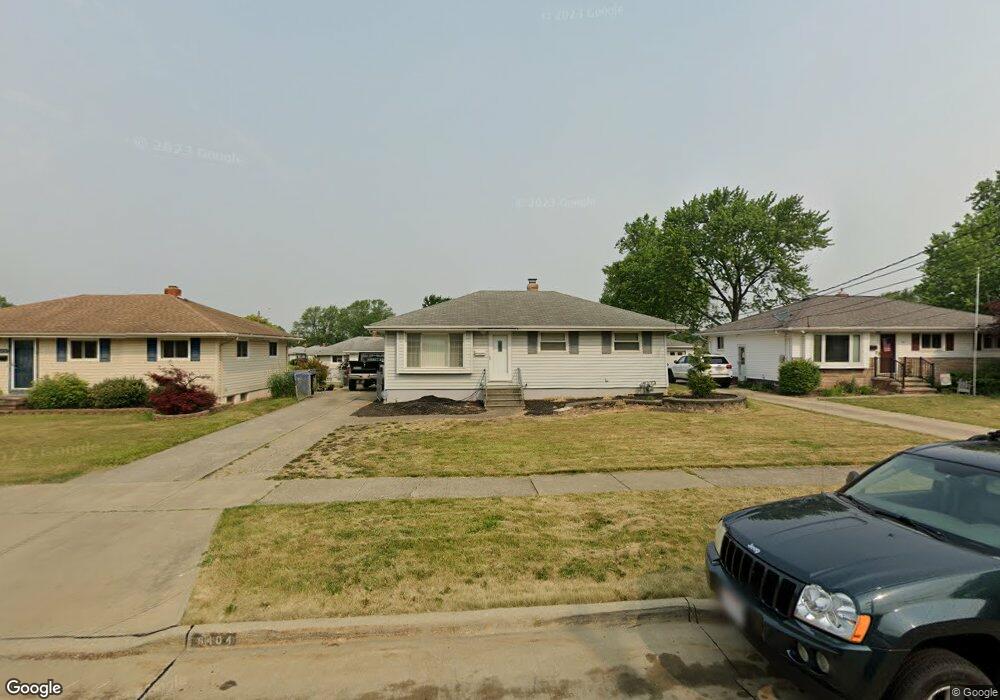
6404 Michael Dr Brookpark, OH 44142
Estimated Value: $189,834 - $211,000
3
Beds
1
Bath
988
Sq Ft
$199/Sq Ft
Est. Value
About This Home
This home is located at 6404 Michael Dr, Brookpark, OH 44142 and is currently estimated at $196,459, approximately $198 per square foot. 6404 Michael Dr is a home located in Cuyahoga County with nearby schools including Berea-Midpark Middle School, Berea-Midpark High School, and Huber Heights Preparatory Academy Parma Academy.
Ownership History
Date
Name
Owned For
Owner Type
Purchase Details
Closed on
Feb 18, 2010
Sold by
Parente Gaspare and Parente Giuseppina
Bought by
Parente Rino
Current Estimated Value
Purchase Details
Closed on
Jun 22, 2000
Sold by
Mirandilla Rolando G and Lambert Mary E
Bought by
Parente Rino and Parente Gaspare
Home Financials for this Owner
Home Financials are based on the most recent Mortgage that was taken out on this home.
Original Mortgage
$99,400
Outstanding Balance
$33,528
Interest Rate
8.66%
Mortgage Type
Purchase Money Mortgage
Estimated Equity
$162,931
Purchase Details
Closed on
May 10, 1994
Sold by
Jerome S Slovick
Bought by
Mirandilla Rolando G
Purchase Details
Closed on
Aug 29, 1979
Sold by
Slovick Jerome S and Slovick Clara M
Bought by
Jerome S Slovick
Purchase Details
Closed on
Jan 1, 1975
Bought by
Slovick Jerome S and Slovick Clara M
Create a Home Valuation Report for This Property
The Home Valuation Report is an in-depth analysis detailing your home's value as well as a comparison with similar homes in the area
Home Values in the Area
Average Home Value in this Area
Purchase History
| Date | Buyer | Sale Price | Title Company |
|---|---|---|---|
| Parente Rino | -- | City Title Company | |
| Parente Rino | $117,000 | -- | |
| Mirandilla Rolando G | $96,000 | -- | |
| Jerome S Slovick | -- | -- | |
| Slovick Jerome S | -- | -- |
Source: Public Records
Mortgage History
| Date | Status | Borrower | Loan Amount |
|---|---|---|---|
| Open | Parente Rino | $99,400 |
Source: Public Records
Tax History
| Year | Tax Paid | Tax Assessment Tax Assessment Total Assessment is a certain percentage of the fair market value that is determined by local assessors to be the total taxable value of land and additions on the property. | Land | Improvement |
|---|---|---|---|---|
| 2025 | $2,967 | $59,185 | $13,580 | $45,605 |
| 2024 | $2,985 | $59,185 | $13,580 | $45,605 |
| 2023 | $2,908 | $47,740 | $10,220 | $37,520 |
| 2022 | $2,887 | $47,740 | $10,220 | $37,520 |
| 2021 | $2,870 | $47,740 | $10,220 | $37,520 |
| 2020 | $2,590 | $37,910 | $8,120 | $29,790 |
| 2019 | $2,512 | $108,300 | $23,200 | $85,100 |
| 2018 | $2,502 | $37,910 | $8,120 | $29,790 |
| 2017 | $2,484 | $34,760 | $7,210 | $27,550 |
| 2016 | $2,463 | $34,760 | $7,210 | $27,550 |
| 2015 | $2,312 | $34,760 | $7,210 | $27,550 |
| 2014 | $2,312 | $34,760 | $7,210 | $27,550 |
Source: Public Records
Map
Nearby Homes
- 14396 Park Dr
- 14801 Larkfield Dr
- 6386 Sandfield Dr
- 14761 Larkfield Dr
- 6330 Sandfield Dr
- 6377 Ledgebrook Dr
- 6330 Ledgebrook Dr
- 6448 Delores Blvd
- 6095 Stark Dr
- 6065 Mercer Dr
- 6757 Smith Rd
- 15496 Shaleside Ct
- 6707 Woodruff Ct
- 6103 Westbrook Dr
- 6759 Quarrystone Ln
- 14024 Donald Dr
- 6188 Barbara Ln
- 6771 Wood Creek Dr
- 15995 Paulding Blvd
- 6014 Westbrook Dr
- 6400 Michael Dr
- 6408 Michael Dr
- 15036 Montvale Dr
- 6396 Michael Dr
- 15048 Montvale Dr
- 6392 Michael Dr
- 6422 Michael Dr
- 14973 Lindmont Dr
- 6405 Michael Dr
- 6401 Michael Dr
- 15060 Montvale Dr
- 6409 Michael Dr
- 14995 Lindmont Dr
- 6388 Michael Dr
- 6430 Michael Dr
- 6397 Michael Dr
- 15043 Montvale Dr
- 15017 Lindmont Dr
- 6417 Michael Dr
- 6393 Michael Dr
Your Personal Tour Guide
Ask me questions while you tour the home.