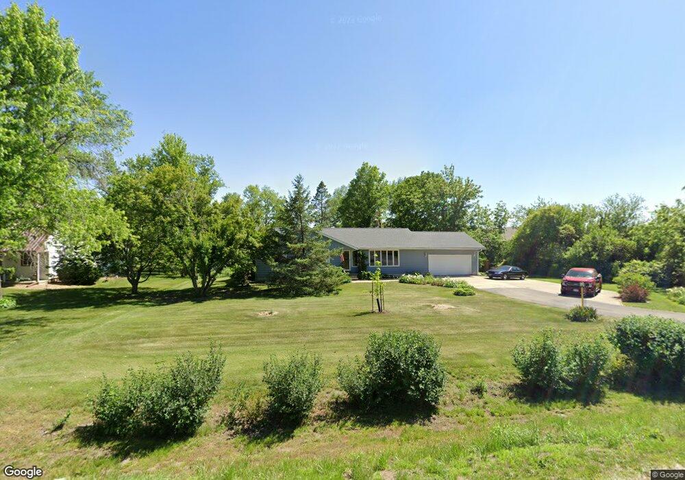
6409 Beverly Rd SW Cedar Rapids, IA 52404
Estimated Value: $352,000 - $390,000
3
Beds
2
Baths
1,590
Sq Ft
$235/Sq Ft
Est. Value
About This Home
This home is located at 6409 Beverly Rd SW, Cedar Rapids, IA 52404 and is currently estimated at $372,957, approximately $234 per square foot. 6409 Beverly Rd SW is a home located in Linn County with nearby schools including Prairie Crest Elementary School, Prairie View Elementary School, and Prairie Ridge Elementary School.
Ownership History
Date
Name
Owned For
Owner Type
Purchase Details
Closed on
Jan 3, 2006
Sold by
Iowa Department Of Transportation
Bought by
County Of Linn
Current Estimated Value
Purchase Details
Closed on
Aug 7, 2003
Sold by
Cunningham Gerald L and Cunningham June M
Bought by
Suthers Duncan B and Reinert Beverley A
Home Financials for this Owner
Home Financials are based on the most recent Mortgage that was taken out on this home.
Original Mortgage
$100,000
Interest Rate
5.47%
Mortgage Type
Purchase Money Mortgage
Purchase Details
Closed on
Jul 10, 2000
Sold by
Dollmeyer Roland W and Dollmeyer Swanie M
Bought by
Cunningham Gerald L and Cunningham June M
Home Financials for this Owner
Home Financials are based on the most recent Mortgage that was taken out on this home.
Original Mortgage
$87,500
Interest Rate
8.55%
Mortgage Type
Purchase Money Mortgage
Create a Home Valuation Report for This Property
The Home Valuation Report is an in-depth analysis detailing your home's value as well as a comparison with similar homes in the area
Home Values in the Area
Average Home Value in this Area
Purchase History
| Date | Buyer | Sale Price | Title Company |
|---|---|---|---|
| County Of Linn | $3,889 | None Available | |
| Suthers Duncan B | $182,500 | -- | |
| Cunningham Gerald L | $157,000 | -- |
Source: Public Records
Mortgage History
| Date | Status | Borrower | Loan Amount |
|---|---|---|---|
| Previous Owner | Suthers Duncan B | $100,000 | |
| Previous Owner | Cunningham Gerald L | $87,500 | |
| Closed | Suthers Duncan B | $64,700 |
Source: Public Records
Tax History Compared to Growth
Tax History
| Year | Tax Paid | Tax Assessment Tax Assessment Total Assessment is a certain percentage of the fair market value that is determined by local assessors to be the total taxable value of land and additions on the property. | Land | Improvement |
|---|---|---|---|---|
| 2025 | -- | $392,200 | $71,500 | $320,700 |
| 2024 | -- | $373,500 | $71,500 | $302,000 |
| 2023 | -- | $373,500 | $71,500 | $302,000 |
| 2022 | $0 | $275,300 | $71,500 | $203,800 |
| 2021 | $3,165 | $268,100 | $71,500 | $196,600 |
| 2020 | $3,165 | $237,800 | $52,400 | $185,400 |
| 2019 | $3,165 | $224,300 | $52,400 | $171,900 |
| 2018 | $0 | $224,300 | $52,400 | $171,900 |
| 2017 | $0 | $210,400 | $52,400 | $158,000 |
| 2016 | $3,165 | $213,700 | $52,400 | $161,300 |
| 2015 | $3,054 | $207,300 | $52,400 | $154,900 |
| 2014 | $2,924 | $207,300 | $52,400 | $154,900 |
| 2013 | $2,742 | $207,300 | $52,400 | $154,900 |
Source: Public Records
Map
Nearby Homes
- 6807 Waterview Dr SW
- 6514 Fox Run Dr SW
- 3810 Waterview Ct SW
- 7032 Waterview Dr SW Unit 7032
- 3638 Stoneview Cir SW Unit 3638
- 7106 Water View Dr SW
- 7104 Waterview Dr SW
- 3516 Stoneview Cir SW Unit 3516
- 7080 Waterview Dr SW
- 7110 Waterview Dr SW
- 7112 Water View Dr SW
- 3734 Stoneview Cir SW Unit 3734
- 5705 Beverly Rd SW
- 4124 Lakeview Dr SW Unit 4124
- 5901 Williams Blvd SW
- 3402 Falcon View Rd SW
- 3355 & 3445 Stone Creek Cir SW
- 3445 Stone Creek Cir SW
- 341 Highland Ct
- 247 Kelso Ln Unit 247
- 6405 Beverly Rd SW
- 500 Meadow Oak Cir
- 502 Meadow Oak Cir
- 6401 Beverly Rd SW
- 504 Meadow Oak Cir
- 506 Meadow Oak Cir
- 6500 Beverly Rd SW
- 558 Meadow Oak Cir
- 556 Meadow Oak Cir
- 6311 Beverly Rd SW
- 508 Meadow Oak Cir
- 554 Meadow Oak Cir
- 6400 Beverly Rd SW
- 510 Meadow Oak Cir
- 552 Meadow Oak Cir
- 566 Meadow Oak Cir
- 5240 Meadow Oak Cir
- 548 Meadow Oak Cir
- 516 Meadow Oak Cir
- 6439 Williams Blvd