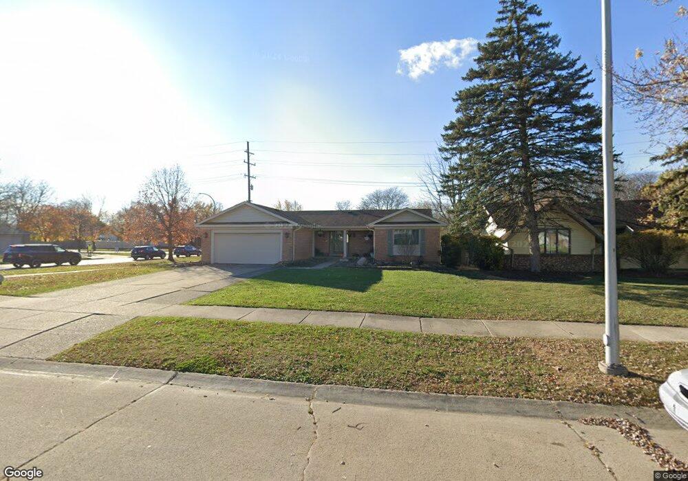
6409 Durham Dr Unit Bldg-Unit Canton, MI 48187
Estimated Value: $354,000 - $395,101
Studio
2
Baths
1,471
Sq Ft
$260/Sq Ft
Est. Value
About This Home
This home is located at 6409 Durham Dr Unit Bldg-Unit, Canton, MI 48187 and is currently estimated at $382,025, approximately $259 per square foot. 6409 Durham Dr Unit Bldg-Unit is a home located in Wayne County with nearby schools including Canton High School, Discovery Middle School, and Salem High School.
Ownership History
Date
Name
Owned For
Owner Type
Purchase Details
Closed on
Jan 5, 2024
Sold by
Colleen M Anderson Trust
Bought by
Afshari Gholamreza
Current Estimated Value
Purchase Details
Closed on
Apr 21, 2022
Sold by
Anderson Colleen M
Bought by
Colleen M Anderson Trust
Purchase Details
Closed on
Jun 12, 2018
Sold by
Armstrong Jeffrey N
Bought by
Anderson Coleen
Create a Home Valuation Report for This Property
The Home Valuation Report is an in-depth analysis detailing your home's value as well as a comparison with similar homes in the area
Home Values in the Area
Average Home Value in this Area
Purchase History
We collect this data history from publicly available records. To have your information removed, we recommend requesting removal directly through your county’s website.
| Date | Buyer | Sale Price | Title Company |
|---|---|---|---|
| Afshari Gholamreza | $335,500 | Premier Title | |
| Afshari Gholamreza | $335,500 | Premier Title | |
| Colleen M Anderson Trust | -- | Kiley Kellen C | |
| Anderson Coleen | $210,000 | Michigan Title Ins Agcy Inc |
Source: Public Records
Tax History
| Year | Tax Paid | Tax Assessment Tax Assessment Total Assessment is a certain percentage of the fair market value that is determined by local assessors to be the total taxable value of land and additions on the property. | Land | Improvement |
|---|---|---|---|---|
| 2025 | $6,608 | $182,600 | $0 | $0 |
| 2024 | $2,445 | $169,300 | $0 | $0 |
| 2023 | $2,331 | $141,400 | $0 | $0 |
| 2022 | $5,167 | $130,900 | $0 | $0 |
| 2021 | $5,009 | $127,300 | $0 | $0 |
| 2020 | $4,937 | $120,300 | $0 | $0 |
| 2019 | $4,849 | $115,190 | $0 | $0 |
| 2018 | $1,421 | $104,070 | $0 | $0 |
| 2017 | $3,742 | $102,900 | $0 | $0 |
| 2016 | $3,248 | $99,400 | $0 | $0 |
| 2015 | $7,808 | $90,740 | $0 | $0 |
| 2013 | $7,564 | $80,760 | $0 | $0 |
| 2010 | -- | $75,550 | $37,989 | $37,561 |
Source: Public Records
Map
Nearby Homes
- 44088 Yorkshire Dr
- 835 Coldrose Way
- 44150 S Umberland Cir
- 6565 Bostonhill Ln
- 6907 Harvard Ln
- 44242 N Umberland Cir
- 43737 Westminister Way
- 44432 Newburyport Dr
- 48590 Ford Rd
- 50782 Ross St
- 43715 Simsbury St
- 6873 Carriage Hills Dr
- 5903 Beaufort Dr
- 45193 Quaker Hill Dr
- 2041 W Franklin Dr Unit 48
- 2057 W Franklin Dr Unit 41
- 44500 Meadowcreek Ln
- 58560 Stuart Dr
- 5855 Wedgewood Rd
- 45440 Holmes Dr
- 6409 Durham Dr
- 6425 Durham Dr
- 47559 Ellery Ln
- 49551 Shoreline
- 7050 Shelley Ln
- 49525 Shoreline
- 49991 Ocean Dr
- 47514 Ellery Ln
- 47479 Ellery Ln
- 49416 Shoreline Dr
- 49499 Shoreline
- 49917 Ocean Dr Unit Bldg-Unit
- 50015 Ocean Dr Unit Bldg-Unit
- 49499 Shoreline Unit Bldg-Unit
- 990 Backshore Dr Unit Bldg-Unit
- 47527 Ellery Ln Unit Bldg-Unit
- 47463 Ellery Ln Unit Bldg-Unit
- 47415 Ellery Ln Unit Bldg-Unit
- 47431 Ellery Ln Unit Bldg-Unit
- 47627 Ellery Ln Unit Bldg-Unit
Your Personal Tour Guide
Ask me questions while you tour the home.