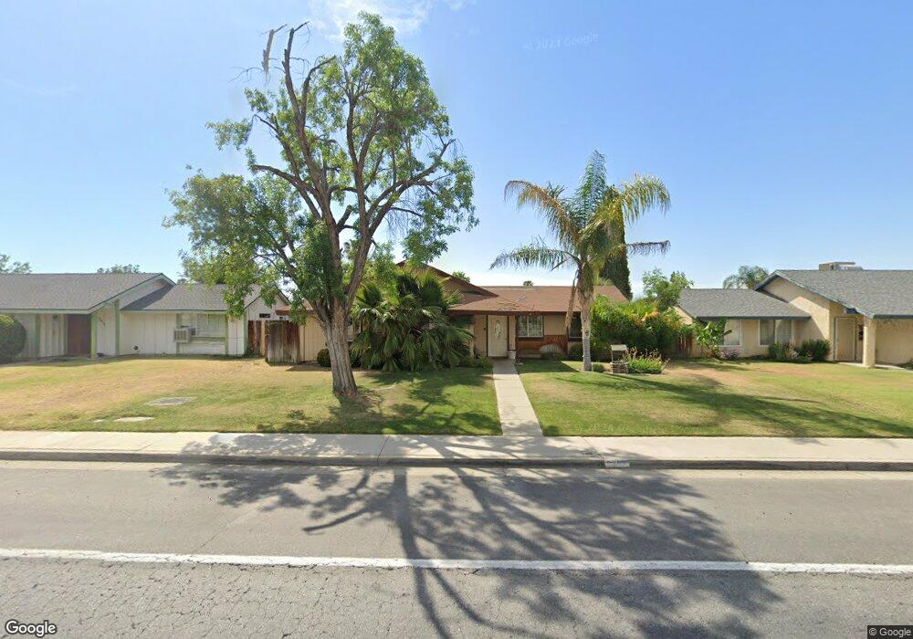
6409 Wilson Rd Bakersfield, CA 93309
Spice NeighborhoodEstimated Value: $316,390 - $347,000
3
Beds
2
Baths
1,345
Sq Ft
$245/Sq Ft
Est. Value
About This Home
This home is located at 6409 Wilson Rd, Bakersfield, CA 93309 and is currently estimated at $330,098, approximately $245 per square foot. 6409 Wilson Rd is a home located in Kern County with nearby schools including Leo B. Hart Elementary School, O.J. Actis Junior High School, and West High School.
Ownership History
Date
Name
Owned For
Owner Type
Purchase Details
Closed on
Jan 10, 2014
Sold by
Singh Jasbir and Kaur Gurpreet
Bought by
Jandu Rentals Llc
Current Estimated Value
Purchase Details
Closed on
Jun 1, 1998
Sold by
Johnson Charles A and Johnson Marian
Bought by
Singh Joseph and Kaur Gurpreet
Home Financials for this Owner
Home Financials are based on the most recent Mortgage that was taken out on this home.
Original Mortgage
$64,102
Interest Rate
7.17%
Mortgage Type
FHA
Create a Home Valuation Report for This Property
The Home Valuation Report is an in-depth analysis detailing your home's value as well as a comparison with similar homes in the area
Home Values in the Area
Average Home Value in this Area
Purchase History
| Date | Buyer | Sale Price | Title Company |
|---|---|---|---|
| Jandu Rentals Llc | -- | None Available | |
| Singh Joseph | $75,000 | Chicago Title Insurance Co |
Source: Public Records
Mortgage History
| Date | Status | Borrower | Loan Amount |
|---|---|---|---|
| Previous Owner | Singh Joseph | $64,102 |
Source: Public Records
Tax History Compared to Growth
Tax History
| Year | Tax Paid | Tax Assessment Tax Assessment Total Assessment is a certain percentage of the fair market value that is determined by local assessors to be the total taxable value of land and additions on the property. | Land | Improvement |
|---|---|---|---|---|
| 2025 | $2,126 | $119,729 | $35,114 | $84,615 |
| 2024 | $2,126 | $117,382 | $34,426 | $82,956 |
| 2023 | $2,088 | $115,081 | $33,751 | $81,330 |
| 2022 | $2,000 | $112,826 | $33,090 | $79,736 |
| 2021 | $1,896 | $110,615 | $32,442 | $78,173 |
| 2020 | $1,852 | $109,482 | $32,110 | $77,372 |
| 2019 | $1,827 | $109,482 | $32,110 | $77,372 |
| 2018 | $1,754 | $105,232 | $30,864 | $74,368 |
| 2017 | $1,728 | $103,169 | $30,259 | $72,910 |
| 2016 | $1,631 | $101,147 | $29,666 | $71,481 |
| 2015 | $1,614 | $99,629 | $29,221 | $70,408 |
| 2014 | $1,574 | $97,678 | $28,649 | $69,029 |
Source: Public Records
Map
Nearby Homes
- 3516 Sesame St
- 6610 Wilson Rd
- 5309 Sage Dr
- 3812 Curry Ct
- 5812 Appletree Ln
- 3816 Cinnamon Ct
- 5605 Arbor Ct
- 5908 Chicory Dr
- 5409 Peppertree Ln
- 5508 New Grove Ave
- 5209 Hartford Ave
- 5512 Appletree Ln
- 5709 Wonder Ln
- 3400 Waldport Ln
- 3535 Stine Rd Unit 159
- 3535 Stine Rd Unit 69
- 3535 Stine Rd Unit 149
- 3535 Stine Rd Unit 104
- 3535 Stine Rd Unit 177
- 3535 Stine Rd Unit 14
- 6411 Wilson Rd
- 6405 Wilson Rd
- 6501 Wilson Rd
- 6401 Wilson Rd
- 3408 Sesame St
- 3404 Sesame St
- 3412 Sesame St
- 6505 Wilson Rd
- 3400 Sesame St
- 3416 Sesame St
- 3517 Rosemary Ct
- 3513 Rosemary Ct
- 3521 Rosemary Ct
- 3509 Rosemary Ct
- 3525 Rosemary Ct
- 6509 Wilson Rd
- 3601 Rosemary Ct
- 3500 Sesame St
- 6317 Wilson Rd
- 3605 Rosemary Ct