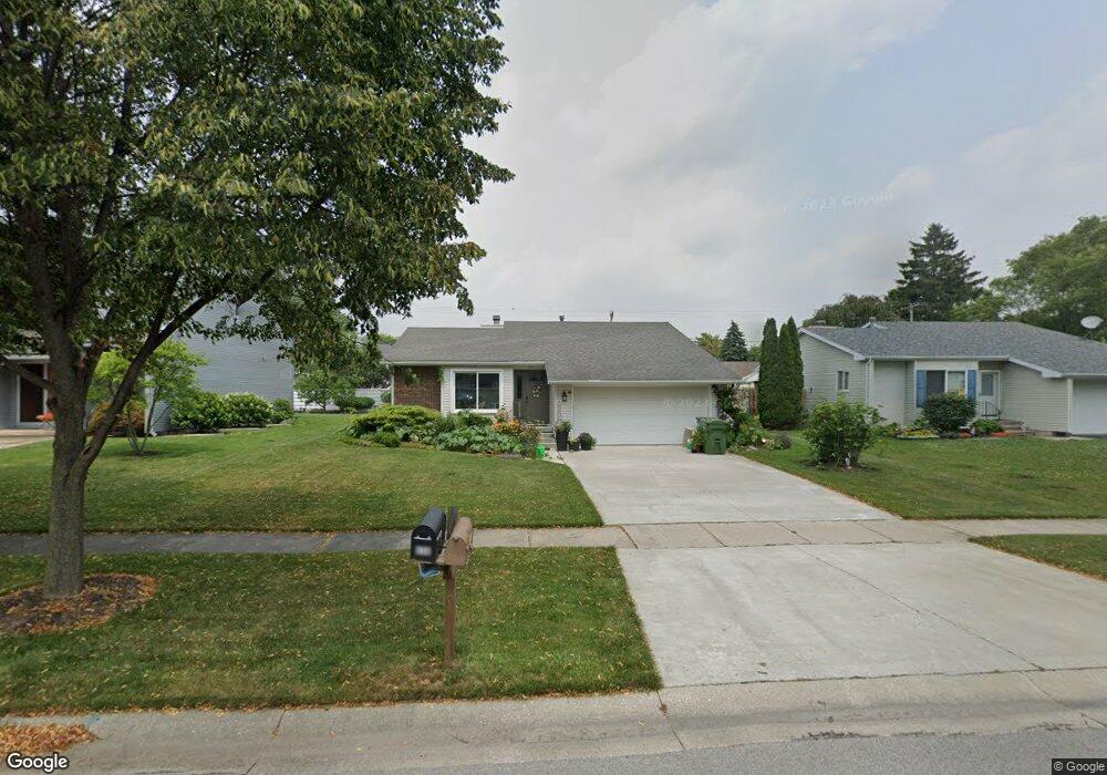
641 Centerfield Dr Maumee, OH 43537
Estimated Value: $217,493 - $277,000
3
Beds
1
Bath
1,243
Sq Ft
$199/Sq Ft
Est. Value
About This Home
This home is located at 641 Centerfield Dr, Maumee, OH 43537 and is currently estimated at $247,873, approximately $199 per square foot. 641 Centerfield Dr is a home located in Lucas County with nearby schools including Fairfield Elementary School, Maumee Intermediate School, and Maumee Middle School.
Ownership History
Date
Name
Owned For
Owner Type
Purchase Details
Closed on
Oct 7, 2003
Sold by
Rectenwald Jason M and Rectenwald Kristen T
Bought by
Reese Mary
Current Estimated Value
Home Financials for this Owner
Home Financials are based on the most recent Mortgage that was taken out on this home.
Original Mortgage
$53,450
Interest Rate
6.23%
Mortgage Type
Purchase Money Mortgage
Purchase Details
Closed on
Jun 5, 1996
Sold by
Gregory George P
Bought by
Rectenwald Jason M
Home Financials for this Owner
Home Financials are based on the most recent Mortgage that was taken out on this home.
Original Mortgage
$90,950
Interest Rate
7.97%
Mortgage Type
Balloon
Purchase Details
Closed on
Feb 28, 1994
Sold by
Levine Nicholas W
Purchase Details
Closed on
May 12, 1989
Sold by
Wyraz Karen M
Create a Home Valuation Report for This Property
The Home Valuation Report is an in-depth analysis detailing your home's value as well as a comparison with similar homes in the area
Home Values in the Area
Average Home Value in this Area
Purchase History
| Date | Buyer | Sale Price | Title Company |
|---|---|---|---|
| Reese Mary | $149,000 | Mta | |
| Rectenwald Jason M | $107,000 | -- | |
| -- | $95,000 | -- | |
| -- | $80,100 | -- |
Source: Public Records
Mortgage History
| Date | Status | Borrower | Loan Amount |
|---|---|---|---|
| Previous Owner | Reese Mary | $53,450 | |
| Previous Owner | Rectenwald Jason M | $90,950 |
Source: Public Records
Tax History Compared to Growth
Tax History
| Year | Tax Paid | Tax Assessment Tax Assessment Total Assessment is a certain percentage of the fair market value that is determined by local assessors to be the total taxable value of land and additions on the property. | Land | Improvement |
|---|---|---|---|---|
| 2025 | -- | $68,075 | $14,420 | $53,655 |
| 2024 | $2,222 | $68,075 | $14,420 | $53,655 |
| 2023 | $4,092 | $53,480 | $11,480 | $42,000 |
| 2022 | $3,636 | $53,480 | $11,480 | $42,000 |
| 2021 | $3,835 | $53,480 | $11,480 | $42,000 |
| 2020 | $3,765 | $47,005 | $9,870 | $37,135 |
| 2019 | $3,672 | $47,005 | $9,870 | $37,135 |
| 2018 | $3,518 | $47,005 | $9,870 | $37,135 |
| 2017 | $3,431 | $43,540 | $7,980 | $35,560 |
| 2016 | $3,393 | $124,400 | $22,800 | $101,600 |
| 2015 | $3,377 | $124,400 | $22,800 | $101,600 |
| 2014 | $3,129 | $42,700 | $7,840 | $34,860 |
| 2013 | $3,129 | $42,700 | $7,840 | $34,860 |
Source: Public Records
Map
Nearby Homes
- 632 Brahier Ln
- 504 Fairfield Park Dr
- 1206 Fort St
- 706 Waite Ave
- 1057 Keeler St
- 1036 River Rd
- 402 E Indiana Ave
- 408 Clinton St
- 1220 Birch Ave
- 213 E Indiana Ave
- 306 Clinton St
- 4237 Brogan Dr
- 1004 Birch Ave
- 326 E Dudley St
- 4035 Greencrest Ln
- 5125 Stengel Ave
- 1038 River Rd
- 1034 River Rd
- 629 Pierce St
- 1110 Rosedale St
- 635 Centerfield Dr
- 645 Centerfield Dr
- 651 Centerfield Dr
- 631 Centerfield Dr
- 640 Midfield Dr
- 636 Midfield Dr
- 644 Midfield Dr
- 632 Midfield Dr
- 648 Midfield Dr
- 655 Centerfield Dr
- 625 Centerfield Dr
- 638 Centerfield Dr
- 644 Centerfield Dr
- 628 Midfield Dr
- 652 Midfield Dr
- 632 Centerfield Dr
- 626 Centerfield Dr
- 624 Midfield Dr
- 656 Midfield Dr
- 661 Centerfield Dr