Estimated Value: $638,807 - $669,000
5
Beds
4
Baths
3,127
Sq Ft
$210/Sq Ft
Est. Value
About This Home
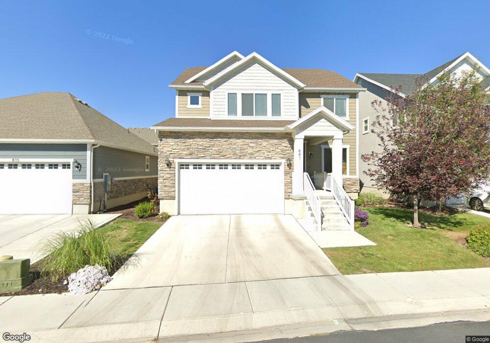
This home is located at 641 E 420 S, Lehi, UT 84043 and is currently estimated at $655,269, approximately $209 per square foot. 641 E 420 S is a home located in Utah County with nearby schools including Meadow Elementary School, Lehi Junior High School, and Lehi High School.
Ownership History
Date
Name
Owned For
Owner Type
Purchase Details
Closed on
Dec 1, 2014
Sold by
Edge Land 12 Llc
Bought by
Czarnocki Steve and Czarnocki Megan
Current Estimated Value
Home Financials for this Owner
Home Financials are based on the most recent Mortgage that was taken out on this home.
Original Mortgage
$219,900
Outstanding Balance
$168,938
Interest Rate
4%
Mortgage Type
New Conventional
Estimated Equity
$486,331
Create a Home Valuation Report for This Property
The Home Valuation Report is an in-depth analysis detailing your home's value as well as a comparison with similar homes in the area
Home Values in the Area
Average Home Value in this Area
Purchase History
| Date | Buyer | Sale Price | Title Company |
|---|---|---|---|
| Czarnocki Steve | -- | Provo Land Title Co |
Source: Public Records
Mortgage History
| Date | Status | Borrower | Loan Amount |
|---|---|---|---|
| Open | Czarnocki Steve | $219,900 |
Source: Public Records
Tax History
| Year | Tax Paid | Tax Assessment Tax Assessment Total Assessment is a certain percentage of the fair market value that is determined by local assessors to be the total taxable value of land and additions on the property. | Land | Improvement |
|---|---|---|---|---|
| 2025 | $2,642 | $342,045 | -- | -- |
| 2024 | $2,642 | $309,210 | $0 | $0 |
| 2023 | $2,459 | $312,400 | $0 | $0 |
| 2022 | $2,641 | $325,380 | $0 | $0 |
| 2021 | $2,378 | $442,800 | $129,500 | $313,300 |
| 2020 | $2,242 | $412,700 | $119,900 | $292,800 |
| 2019 | $2,022 | $387,000 | $119,900 | $267,100 |
| 2018 | $1,951 | $353,000 | $110,900 | $242,100 |
| 2017 | $1,763 | $169,565 | $0 | $0 |
| 2016 | $1,789 | $159,665 | $0 | $0 |
| 2015 | $1,901 | $161,040 | $0 | $0 |
| 2014 | $634 | $53,400 | $0 | $0 |
Source: Public Records
Map
Nearby Homes
- 641 E 420 S Unit 16
- 647 E 420 S Unit 17
- 635 E 420 S Unit 15
- 640 E 380 S Unit 13
- 640 E 380 S
- 661 E 420 S Unit 42
- 648 E 380 S Unit 12
- 634 E 380 S
- 634 E 380 S Unit 14
- 668 E 380 S Unit 56
- 668 E 380 S
- 642 E 420 S
- 642 E 420 S Unit 18
- 638 E 420 S Unit 19
- 679 E 420 S Unit 43
- 658 E 420 S Unit 41
- 658 E 420 S
- 632 E 420 S Unit 20
- 408 S 630 E Unit 23
- 408 S 630 E
Your Personal Tour Guide
Ask me questions while you tour the home.