Estimated Value: $2,045,000 - $3,475,000
5
Beds
4
Baths
7,540
Sq Ft
$360/Sq Ft
Est. Value
About This Home
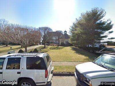
This home is located at 641 Point Ave, Brick, NJ 08724 and is currently estimated at $2,711,546, approximately $359 per square foot. 641 Point Ave is a home located in Ocean County with nearby schools including Midstreams Elementary School, Veterans Memorial Middle School, and Brick Township Memorial High School.
Ownership History
Date
Name
Owned For
Owner Type
Purchase Details
Closed on
Sep 24, 2012
Sold by
Alldian David Philip
Bought by
Alldian Jennifer Connolly
Current Estimated Value
Create a Home Valuation Report for This Property
The Home Valuation Report is an in-depth analysis detailing your home's value as well as a comparison with similar homes in the area
Home Values in the Area
Average Home Value in this Area
Purchase History
| Date | Buyer | Sale Price | Title Company |
|---|---|---|---|
| Alldian Jennifer Connolly | -- | None Available | |
| Alldian David Phillip | -- | None Available | |
| Alldian Jennifer Connolly | -- | None Available |
Source: Public Records
Mortgage History
| Date | Status | Borrower | Loan Amount |
|---|---|---|---|
| Closed | Jca 2012 Family Trust And Dpa 2012 Famil | $500,000 | |
| Closed | Alldian David | $350,000 | |
| Closed | Alldian David | $350,000 |
Source: Public Records
Tax History Compared to Growth
Tax History
| Year | Tax Paid | Tax Assessment Tax Assessment Total Assessment is a certain percentage of the fair market value that is determined by local assessors to be the total taxable value of land and additions on the property. | Land | Improvement |
|---|---|---|---|---|
| 2024 | $38,698 | $1,562,300 | $967,100 | $595,200 |
| 2023 | $38,136 | $1,562,300 | $967,100 | $595,200 |
| 2022 | $38,136 | $1,562,300 | $967,100 | $595,200 |
| 2021 | $37,339 | $1,562,300 | $967,100 | $595,200 |
| 2020 | $36,855 | $1,562,300 | $967,100 | $595,200 |
| 2019 | $36,198 | $1,562,300 | $967,100 | $595,200 |
| 2018 | $35,370 | $1,562,300 | $967,100 | $595,200 |
| 2017 | $34,417 | $1,562,300 | $967,100 | $595,200 |
| 2016 | $34,230 | $1,562,300 | $967,100 | $595,200 |
| 2015 | $33,339 | $1,562,300 | $967,100 | $595,200 |
| 2014 | $33,058 | $1,562,300 | $967,100 | $595,200 |
Source: Public Records
Map
Nearby Homes
- 627 Princeton Ave
- 650 Princeton Ave
- 599 Point Ave
- 678 Princeton Ave
- 687 Princeton Ave
- 665 Bancroft Rd
- 553 Parker Ave
- 565 Princeton Ave
- 724 Bay Ave
- 640 Thoroughfare Rd
- 531 Parker Ave
- 612 Harbor Rd
- 773 Princeton Ave
- 14 Sea Point Dr
- 6 Hidden Harbor Dr Unit 6F
- 560 Midwood Dr
- 9 Scheiber Dr
- 106 Northeast Dr
- 776 South Dr
- 1616 Beaver Dam Rd
- 641 Point Ave
- 637 Point Ave
- 645 Point Ave
- 631 Point Ave
- 649 Point Ave
- 635 Princeton Ave
- 648 Point Ave
- 627 Point Ave
- 653 Point Ave
- 634 Point Ave
- 631 Princeton Ave
- 652 Point Ave
- 625 Point Ave
- 657 Point Ave
- 627 Princeton Ave Unit Upper Level
- 656 Point Ave
- 628 Point Ave
- 636 Princeton Ave
- 623 Point Ave
- 660 Point Ave